Star.pngStar.pngStar.pngStar grey.pngStar grey.png

Watford

From Roader's Digest: The SABRE Wiki
Jump to navigation Jump to search
Watford
Location Map ( geo)
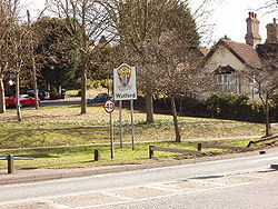
Entering Watford - town sign and speed limit - Geograph - 131625.jpg
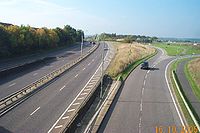
Entering Watford from Hunton Bridge roundabout
Cameraicon.png View gallery (25)
County
Hertfordshire
Highway Authority
Hertfordshire
Forward Destination on
M1, M25, A41, A405
Next Primary Destinations
Central London • Harrow • Heathrow Airport • Hemel Hempstead • Luton • St Albans • Stansted Airport
Other Nearby Primary Destinations
Amersham
Places related to the M1
Places related to the M25
Places related to the A41
Places related to the A405

Watford is a town north west of London, just inside the M25, and a significant Primary Destination.

Routes

Route To Notes

M1

The NORTH, Luton

M1

Central London, Brent Cross, Harrow

M25

The NORTH (M1), (A1(M)), Stansted Airport (M11), Dartford Crossing

M25

Heathrow Airport, (M4), Gatwick Airport (M23)

A41

Aylesbury, Hemel Hempstead, (M25)

A41

(M1), Central London, Harrow, Brent Cross

A405

The NORTH, (M1), St Albans, (M25 East) primary only north of the M1 junction

A411

Hemel H'std (A41), St Albans (A405), (M25), The Langleys

A411

Bushey

A412

St Albans, North Watford, Garston

A412

Rickmansworth

A4008

(M1), (M25), St Albans (A405), Hemel H'std, Aylesbury (A41) M1 link road

A4008

Harrow Via A404

A4125

Northwood, Oxhey

A4145

Rickmansworth, West Watford

A4178

Northwood, Oxhey, A4125

A4251

Kings Langley Old A41

A41(M)

Aylesbury

A405

Amersham, Rickmansworth, Chorleywood Rickmansworth bypass: now M25

Named Junctions

Image Name Classified Road(s) Grid Reference More Info Map
Photo-required.png Berrygrove M1 / A41 / A4008 TQ127982
SABRE • Google • geo
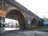
Bushey Arches - Geograph - 505347.jpg Bushey Arches A411 / A4008 / A4125 / B462 TQ119954 Complex one-way system and a roundabout. Named after the railway viaduct that bisects the area.
SABRE • Google • geo
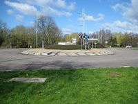
Watford- The Croxley roundabout - Geograph - 732317.jpg The Croxley Roundabout TQ089959
SABRE • Google • geo
Photo-required.png The Dome A41 / A412 TQ111993
SABRE • Google • geo
Photo-required.png Hartspring A41 / B462 TQ133976
SABRE • Google • geo
Photo-required.png Hunton Bridge M25 / A41 / A411 TQ085995 Originally planned to be the end of the M25, now the end of a spur. A41(M) was to have flown over.
SABRE • Google • geo
Leavesden Green- A41 North Western Avenue - Geograph - 66236.jpg Leavesden Green A41 / A405 TQ097996
SABRE • Google • geo
Photo-required.png Waterdale M1 / A405 TL118020
SABRE • Google • geo
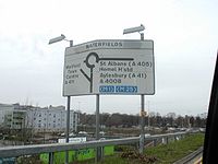
M1 J5 to 10 - 1 - Advance signage to M1 - Watford - Coppermine - 695.jpg Waterfields A411 / A4008 TQ115963
SABRE • Google • geo


Watford
Sections
Junctions
Roads
Related Pictures
View gallery (25)
A411 Watford in 1996 - Coppermine - 16682.jpgNorth Western Avenue, looking east - Geograph - 1834140.jpgWatford- The Croxley roundabout - Geograph - 732317.jpgWatford- Vicarage Road Precinct - Geograph - 1322283.jpgHagden Lane at the junction of Tolpits Lane - Geograph - 3117760.jpg
Places in the East of England
Major CitiesCambridge • Felixstowe • Ipswich • Norwich • Peterborough
Primary DestinationsBasildon • Beccles • Bedford • Bishops Stortford • Bury St Edmunds • Chelmsford • Clacton • Colchester • Cromer • Dartford Crossing • Diss • Downham Market • Dunstable • Ely • Great Yarmouth • Harlow • Harwich • Hemel Hempstead • Hertford • Huntingdon • King's Lynn • Lowestoft • Luton • Luton Airport • Newmarket • Port of Tilbury • Southend • St Albans • Stansted Airport • Stevenage • Sudbury • Swaffham • Thetford • Watford • Wisbech
Other PlacesBaldock • Braintree • Brentwood • Bungay • Cheshunt • Dereham • Fakenham • Grays • Hatfield • Haverhill • Hitchin • Leighton Buzzard • Letchworth • London Gateway Port • Maldon • Maplin Airport • Marks Tey • Potters Bar • Puckeridge • Rickmansworth • Royston • Saffron Walden • Southend Airport • St Neots • Tilbury • Tring • Welwyn Garden City


SABRE - The Society for All British and Irish Road Enthusiasts
Discuss - Digest - Discover - Help