Wild Atlantic Way
| Wild Atlantic Way | |||
| Location Map ( geo) | |||
| |||
| From: | Derry (C462181) | ||
| To: | Kinsale (W639505) | ||
| Via: | Letterkenny, Donegal, Sligo, Ballina, Galway, Kilrush, Tralee, Kenmare, Bantry, Clonakilty | ||
| Distance: | 2492.6 km (1548.9 miles) | ||
| Meets: | (Causeway Coastal Route) • Inis Eoghain 100 • Atlantic Drive • Sky Road • Loop Head Drive • Slea Head Drive • Ring of Kerry • Skellig Ring • Ring of Beara • Sheeps Head Drive • Mizen Head Drive | ||
| Primary Destinations | |||
| Highway Authorities | |||
Transport Infrastructure Ireland • DfI Roads • Clare County • Cork County • Donegal County • Galway County • Kerry County • Leitrim County • Limerick City and County • Mayo County • Sligo County | |||
| Traditional Counties | |||
Clare • Cork • Donegal • Galway • Kerry • Leitrim • Limerick • Londonderry • Mayo • Sligo | |||
The Wild Atlantic Way (Slí an Atlantaigh Fhiáin) is a tourist route, established to encourage visitors to explore the north-western, west, and south-western seaboard of Ireland.
Beginning at the border at Muff, near Derry, the route closely follows the Atlantic shore, with many spurs and loops that probe deeper into the rugged coastline, on its roughly 2,500 km journey to Kinsale.
Signage
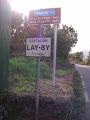
The route is explicitly signed using the symbol of a white wavy line on a blue background, together with (N)/(S) compass directions. This signage is supplemented by metal marker posts at key locations.
Wild Atlantic Way route confirmation sign at Adrigole, Co. Cork
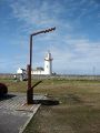
Metal marker post at Loop Head lighthouse, Co. Clare


Links
- Official Website
- Belfast Telegraph - Ireland's Wild Atlantic Way aims to rival California's Pacific Coast Highway (22 February 2014)
- Minister Ring officially launches Wild Atlantic Way (27 February 2014)


,_Achill_Island_-_Geograph_-_5220491.jpg)