Pre-Worboys preservation campaign
Moderator: Site Management Team
-
Chris Bertram

- Member
- Posts: 15777
- Joined: Tue Nov 13, 2001 12:30
- Location: Birmingham, England
Re: Pre-Worboys preservation campaign
Yes, if the background is yellow, as I think it is, that's a pre-WB sign. It was superseded by the blue circle with red border and diagonal stroke.Reading wrote:What is this - https://goo.gl/maps/WgFjLoRqFv12
“The quality of any advice anybody has to offer has to be judged against the quality of life they actually lead.” - Douglas Adams.
Did you know there's more to SABRE than just the Forums?
Add your roads knowledge to the SABRE Wiki today!
Have you browsed SABRE Maps recently? Try getting involved!
Did you know there's more to SABRE than just the Forums?
Add your roads knowledge to the SABRE Wiki today!
Have you browsed SABRE Maps recently? Try getting involved!
Re: Pre-Worboys preservation campaign
Found it when looking at where eagle has landed was filmed in Mapledurham just north of the Thames by Reading - very much a dead end kind of road. More obviously yellow on the 2011 streetview

Re: Pre-Worboys preservation campaign
It must be, someone put some pictures up on Flickr of one being renovated in their workshop. They've clearly got an official arrangement to keep them, I wish more places would while there's still a chance to.

Re: Pre-Worboys preservation campaign
taken on a 500 mile motorcycle ride in a day through mid Wales summer 2016
Re: Pre-Worboys preservation campaign
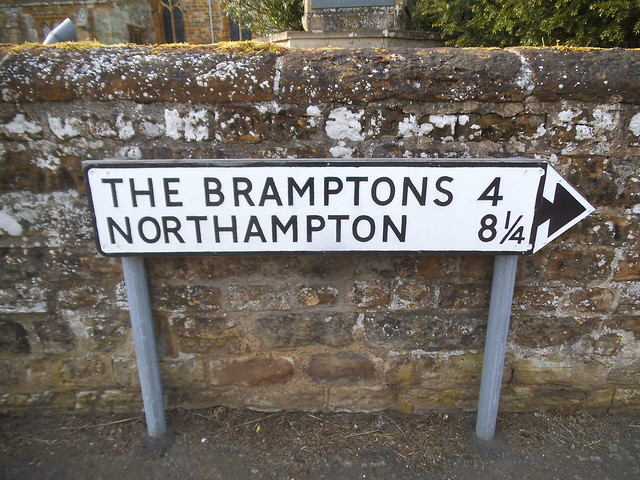
A local spotter found this for me, my nearest crossroads sign which was in Frinton.
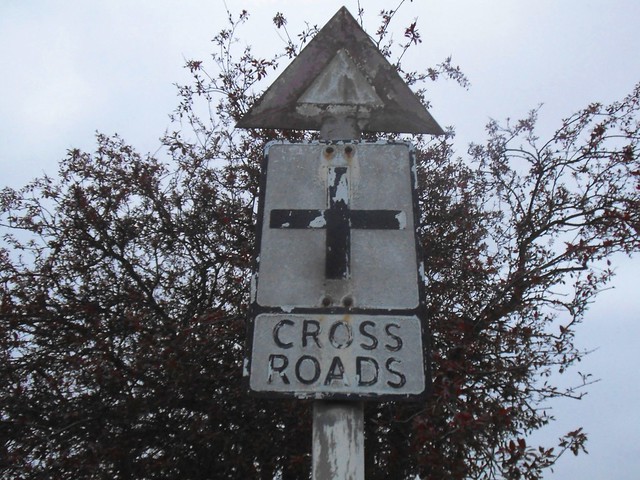
and on the way I almost missed this as it was so faded I had to stop to see what it was.
The colouring should mean a B road, and has the arrow at the side rather than the top, and has M after miles which is also unusual except for route confirmations.
and on the way I almost missed this as it was so faded I had to stop to see what it was.
The colouring should mean a B road, and has the arrow at the side rather than the top, and has M after miles which is also unusual except for route confirmations.
Re: Pre-Worboys preservation campaign
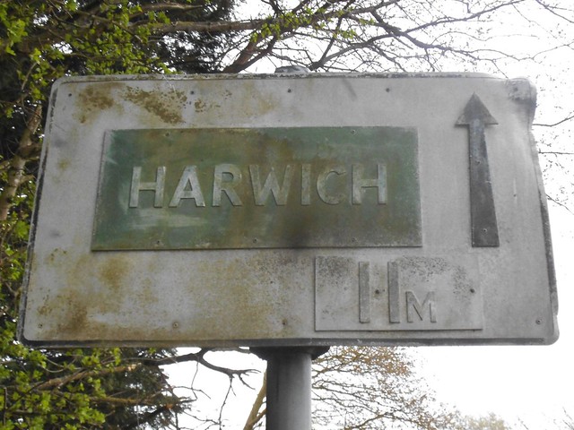
There were a number of these unusual signs on the approaches to Harwich at one time.
When they were there, I didn't really realise quite how unusual they were.
Then they built the new road and my great aunt died so I never saw them again.
When they were there, I didn't really realise quite how unusual they were.
Then they built the new road and my great aunt died so I never saw them again.
Re: Pre-Worboys preservation campaign
The Harwich sign (in my backyard, almost), has always looked green to me, and on Streetview it looks like it is green. I have meant to stop and get a photo sometime and upload to this threa, but I have never had time to.DavidNW9 wrote:
The colouring should mean a B road, and has the arrow at the side rather than the top, and has M after miles which is also unusual except for route confirmations.
Re: Pre-Worboys preservation campaign
I was extremely lucky as I was simply following the signs and hadn't planned an exact route, and as the signs didn't point to Frinton I just used the map and went via the Harwich Road and Tendring and bingo, there it was. It must have been the lorry route to the port which had these made specially for the drivers to follow. There were similar yellow ones to the Woolwich Ferry someone managed to catch although without the mileage. I'll have to Streetview now in case any others are left although it took half the day to get there.

Re: Pre-Worboys preservation campaign
Good lord, who'd have thought any of those survived!DavidNW9 wrote:
The colouring should mean a B road, and has the arrow at the side rather than the top, and has M after miles which is also unusual except for route confirmations.
The colouring doesn't mean a B-road. It's part of a series of white-on-green signs erected to give long-distance directions between London and Dover, Southampton and Harwich during the 1950s. I can't believe something so rare still exists. They were fast-tracked for replacement when Worboys came in for fear that they would be confused for primary route signs.
Chris
Roads.org.uk
Roads.org.uk
Re: Pre-Worboys preservation campaign
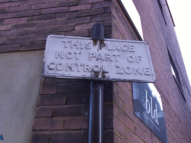
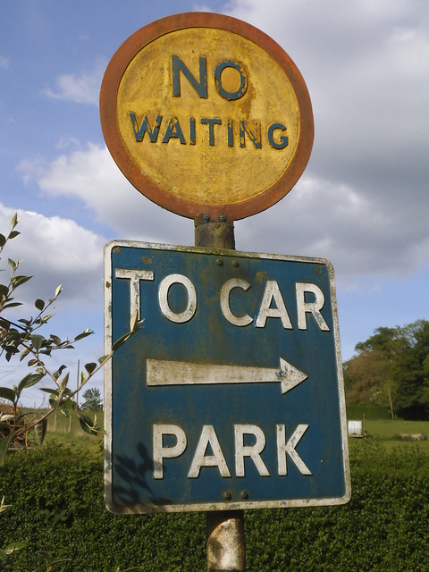
An absolute gem spotted in the West End by one of my scouts.
 sign use
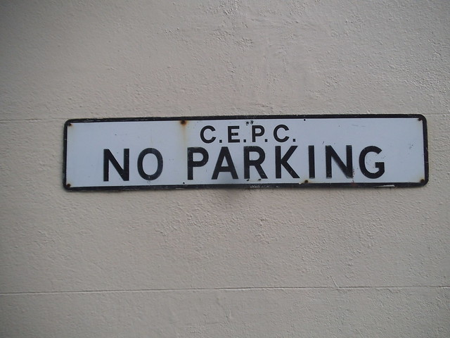
They clearly had controlled parking zones long before the 70s.
I spotted this in Regents Park on the way back. The initials were stuck on later.
sign use They clearly had controlled parking zones long before the 70s.
I spotted this in Regents Park on the way back. The initials were stuck on later.
Re: Pre-Worboys preservation campaign
That's terrific. Yes, the first parking control zones were introduced in central London from the late 1950s under Ernest Marples, a programme that is usually only remembered for the introduction of the first parking meters. It actually involved restrictions on parking, new meters to ration available space and reduce parking times, and the introduction of new off-street parking areas in some places.DavidNW9 wrote:They clearly had controlled parking zones long before the 70s.
Chris
Roads.org.uk
Roads.org.uk

Re: Pre-Worboys preservation campaign
Make poetry history.
Did you know there's more to SABRE than just the Forums?
Help with maps using the new online calibrator.
Add your roads knowledge to the SABRE Wiki.
Did you know there's more to SABRE than just the Forums?
Help with maps using the new online calibrator.
Add your roads knowledge to the SABRE Wiki.
Re: Pre-Worboys preservation campaign
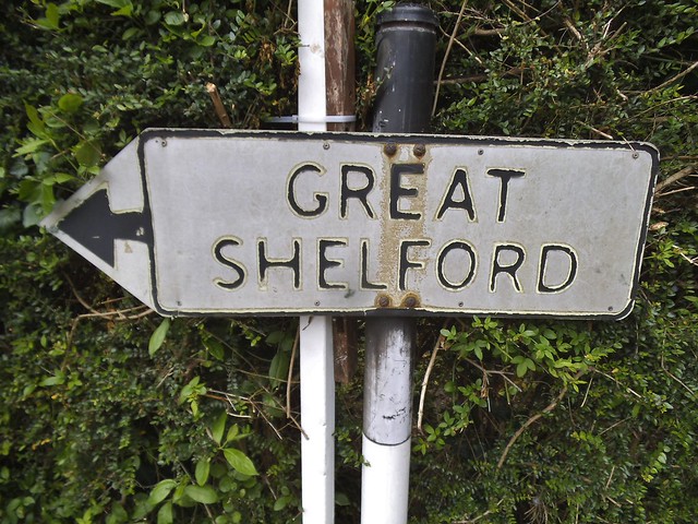
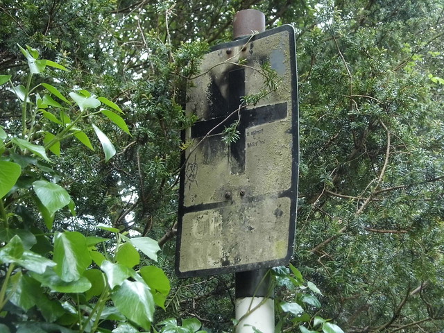
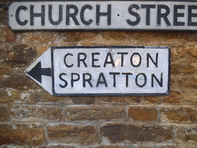
I have just mopped up the west part of Northants. Only one was gone, the big yellow one in Kilsby where I was going anyway for photos.
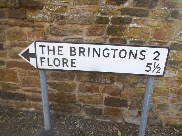 Pre-Worboys Northants by David Howard, on Flickr
 Pre-Worboys Northants by David Howard, on Flickr
 Pre-Worboys Northants by David Howard, on Flickr
 Pre-Worboys Northants by David Howard, on Flickr
 Pre-Worboys Northants by David Howard, on Flickr
The two freestanding arrows have just been painted.
Pre-Worboys Northants by David Howard, on FlickrPre-Worboys Northants by David Howard, on FlickrPre-Worboys Northants by David Howard, on FlickrPre-Worboys Northants by David Howard, on FlickrPre-Worboys Northants by David Howard, on FlickrThe two freestanding arrows have just been painted.
-
crazyknightsfan
- Member
- Posts: 473
- Joined: Tue Feb 19, 2008 22:32
- Location: Sydney, Australia
- Contact:
Re: Pre-Worboys preservation campaign
This is fantastic - what a find.Chris5156 wrote:Good lord, who'd have thought any of those survived!DavidNW9 wrote:
The colouring should mean a B road, and has the arrow at the side rather than the top, and has M after miles which is also unusual except for route confirmations.
The colouring doesn't mean a B-road. It's part of a series of white-on-green signs erected to give long-distance directions between London and Dover, Southampton and Harwich during the 1950s. I can't believe something so rare still exists. They were fast-tracked for replacement when Worboys came in for fear that they would be confused for primary route signs.
Thanks for capturing David and for the info Chris.
Re: Pre-Worboys preservation campaign
Funnily enough the final sign on my list which was gone had another green boxed place on a normal yellow map sign, which was the A361 (to Daventry which wasn't in green). Don't know how it qualified but now I know what it means. Here's the memory.
https://www.google.co.uk/maps/@52.33396 ... 6656?hl=en
https://www.google.co.uk/maps/@52.33396 ... 6656?hl=en
-
RichardA35

- Elected Committee Member
- Posts: 5719
- Joined: Thu Jul 11, 2002 18:58
- Location: Dorset
Re: Pre-Worboys preservation campaign
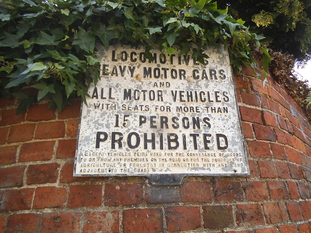
Saw this in Lostwithiel last night which looked like it had been there some time and once internally illuminated.
Re: Pre-Worboys preservation campaign
That's in Gill Sans, so not necessarily pre-Worboys. Not really clear what it is - or even whether it's publicly or privately owned!RichardA35 wrote:Saw this in Lostwithiel last night which looked like it had been there some time and once internally illuminated.
IMG_20170524_210337_625.jpg
Chris
Roads.org.uk
Roads.org.uk