
Just remembered that I saw an item last week, on whatever today's equivalent of Ceefax is called, about a proposed link road at Grantham being approved. It was said it would connect the A1 to the eastward A52.
Report and video here (the video includes a map):
http://www.bbc.co.uk/news/uk-england-li ... e-25023270
Grantham southern link road
Moderator: Site Management Team
Re: Grantham southern link road
It's being sold as an A52 southern bypass but the reality is that it's a housing/commercial development first with the road as a sweetener to get through planning.
Re: Grantham southern link road
It would still be a good thing, even if it's S2 with a bunch of roundabouts.
Re: Grantham southern link road
Grantham southern bypass - the sooner the better, queued thru' south Grantham a few years ago. It might even help long distance drivers during the fairly frequent A1 closures (roadworks) between Grantham & Stamford. The current diversion goes via Melton Mowbray & adds 40 minutes to a journey.
It's surprising in 2013 that there are still a few towns (rather than villages)that still await full or partial bypassing that. I find a few on my Plan B routes ie when Motorways or duals are closed.
Grantham, Royston A10,Studley A435 (M5 bypass from M42), then there's Whitehaven & Boston, Market Rasen, even Knutsford & Macc (east to west) and once the so called Dunstable bypass is built (more the penultimate link in the Oxford-Cambridge trunk road) we can add Aylesbury to the list.
Re: Grantham southern link road
One small step for the Grantham southern link road (surely needs an acronym using lots of RRR's)
http://www.bbc.co.uk/news/uk-england-li ... e-33817470
http://www.bbc.co.uk/news/uk-england-li ... e-33817470
Re: Grantham southern link road
You can add at least one city - Lincoln - to that list: no way to A15 or A607 south without going through the city centre.85CF380 wrote:It's surprising that there are still a few towns (rather than villages)that still await full or partial bypassing that.
Of course, the Romans had the foresight to build an eastern bypass for Grantham over 1,000 years before the town existed.
-
ForestChav

- SABRE Developer
- Posts: 11115
- Joined: Sat Sep 24, 2005 00:00
- Location: Nottingham (Bronx of the Midlands)
- Contact:
Re: Grantham southern link road
Nottingham still doesn't really have a ring road which isn't G-shaped...
C, E flat and G go into a bar. The barman says "sorry, we don't serve minors". So E flat walks off, leaving C and G to share an open fifth between them.
Never argue with an idiot. They will bring you down to their level and beat you with experience.
Never argue with an idiot. They will bring you down to their level and beat you with experience.
Re: Grantham southern link road
Construction on part of the Grantham road started in September:
http://www.bbc.co.uk/news/uk-england-li ... e-34243348
The only decent map I can find is in this link, from which it appears that the section started includes a junction with the A1:
http://www.granthamjournal.co.uk/news/l ... -1-7015258
http://www.bbc.co.uk/news/uk-england-li ... e-34243348
The only decent map I can find is in this link, from which it appears that the section started includes a junction with the A1:
http://www.granthamjournal.co.uk/news/l ... -1-7015258

Re: Grantham southern link road
It looks like a full GSJ, not a "compact" design, which is good - complete with roundabout on the west side for future new development. That explains why it has south-facing slips even though they're duplicated just to the south.wrinkly wrote:The only decent map I can find is in this link, from which it appears that the section started includes a junction with the A1:
http://www.granthamjournal.co.uk/news/l ... -1-7015258
The A1 there is on a steep hill, and the acceleration/deceleration lanes are indeed longer than usual facing uphill, on the north side of the junction. HGVs in particular are going to need all the help they can get in joining the A1 northbound.
Chris
Roads.org.uk
Roads.org.uk


Re: Grantham southern link road
Well it's good news that they're doing something, even though it is hardly the full scale bypass you would really need. I always avoid the town centre (by cutting across to or from the A607 and going through that narrow tunnel thing under the ECML) not just to avoid congestion but also because I find the road layout so confusing!
Let's see if I've got this right - once it's built westbound A52 traffic will still have to go the the traffic lights at the x-roads near the McDonalds, which will do nothing to alleviate queuing towards this junction. Presumably after this through traffic has to turn left onto the B1174 to get to the new roundabout. Will the B1174 cope with the extra traffic?
Let's see if I've got this right - once it's built westbound A52 traffic will still have to go the the traffic lights at the x-roads near the McDonalds, which will do nothing to alleviate queuing towards this junction. Presumably after this through traffic has to turn left onto the B1174 to get to the new roundabout. Will the B1174 cope with the extra traffic?
Re: Grantham southern link road
I have to deal with Grantham regularly on travels from my home on the Wirral to my Mum's in Swaffham, Norfolk, and the A607 route is far superior to staying on the A52.
Travelling eastbound, I note that Whalebone Lane has a LILO on the A1 s/b that connects to the A52 east of Grantham and appears to be a complete bypass, albeit a fairly narrow road (but presumably quiet). GSV suggests there are no access issues along this road. Can anybody confirm this please?
Travelling eastbound, I note that Whalebone Lane has a LILO on the A1 s/b that connects to the A52 east of Grantham and appears to be a complete bypass, albeit a fairly narrow road (but presumably quiet). GSV suggests there are no access issues along this road. Can anybody confirm this please?
Re: Grantham southern link road
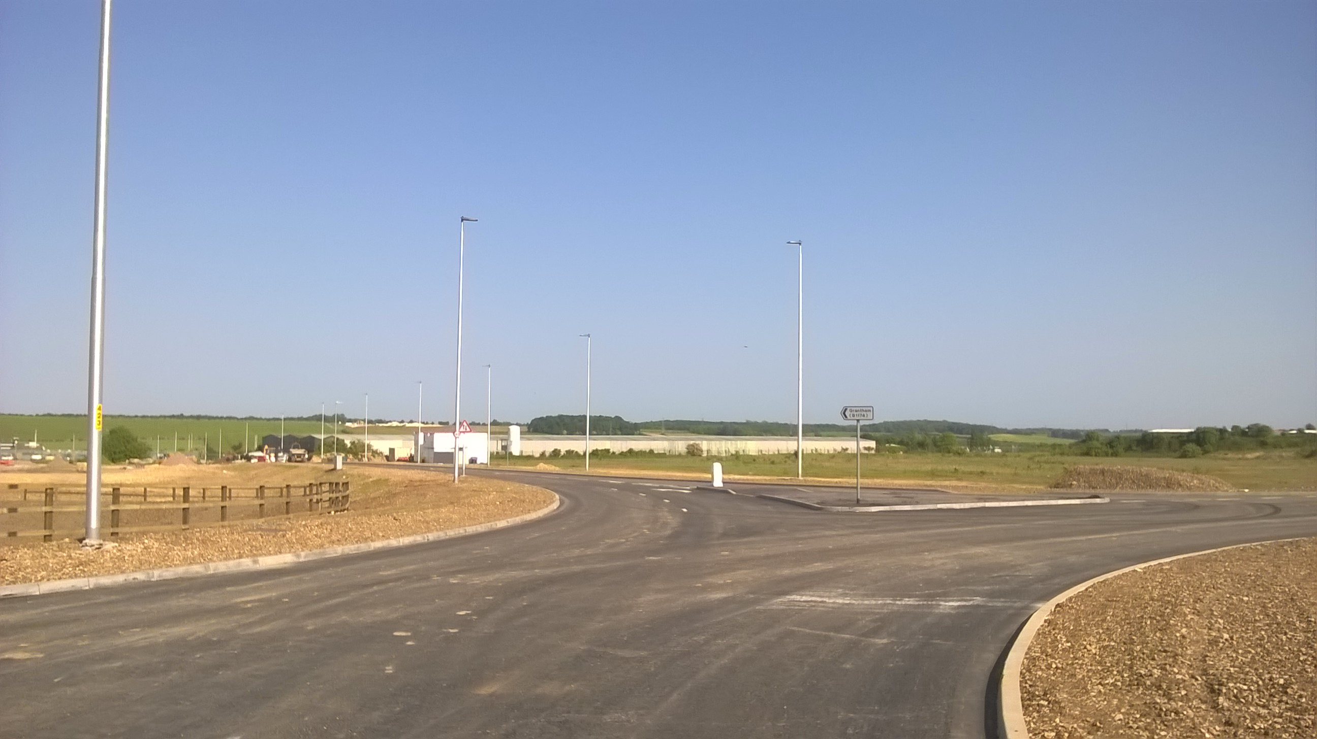
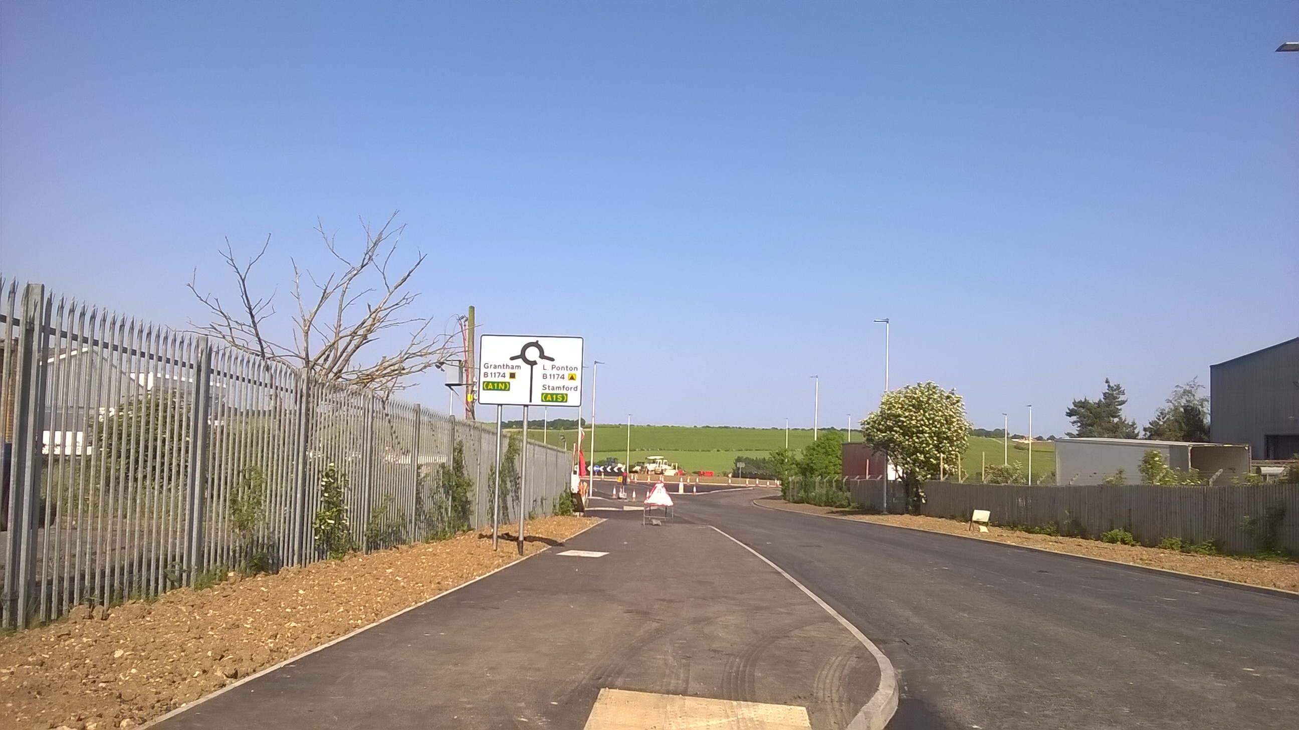
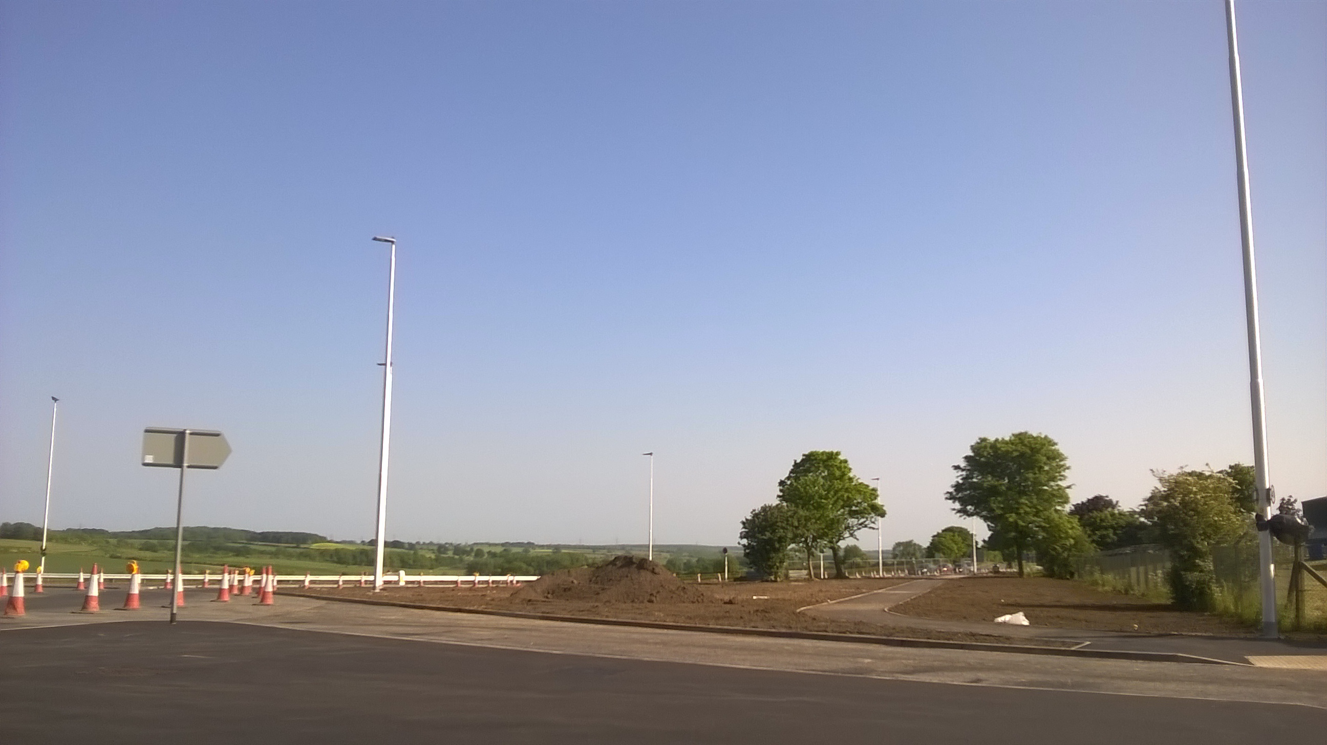
Here are some photos from today:
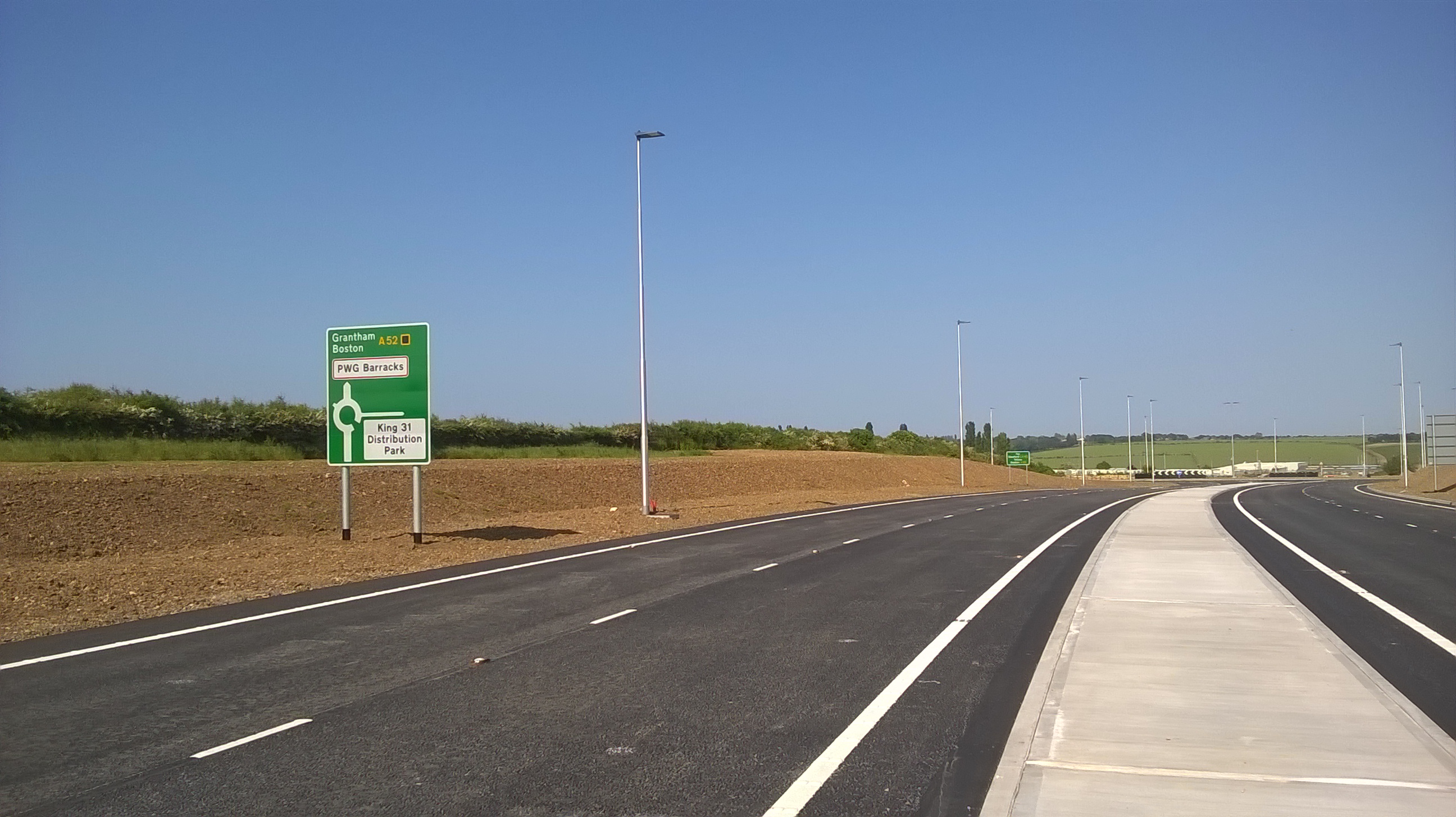
New_A52_looking_towards_King_31_Distribution_Park_roundabout
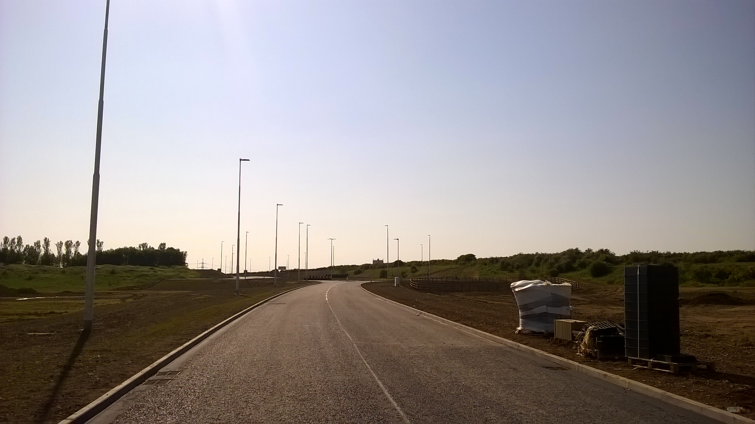
Tollemache_Road_North,_Grantham_looking_East
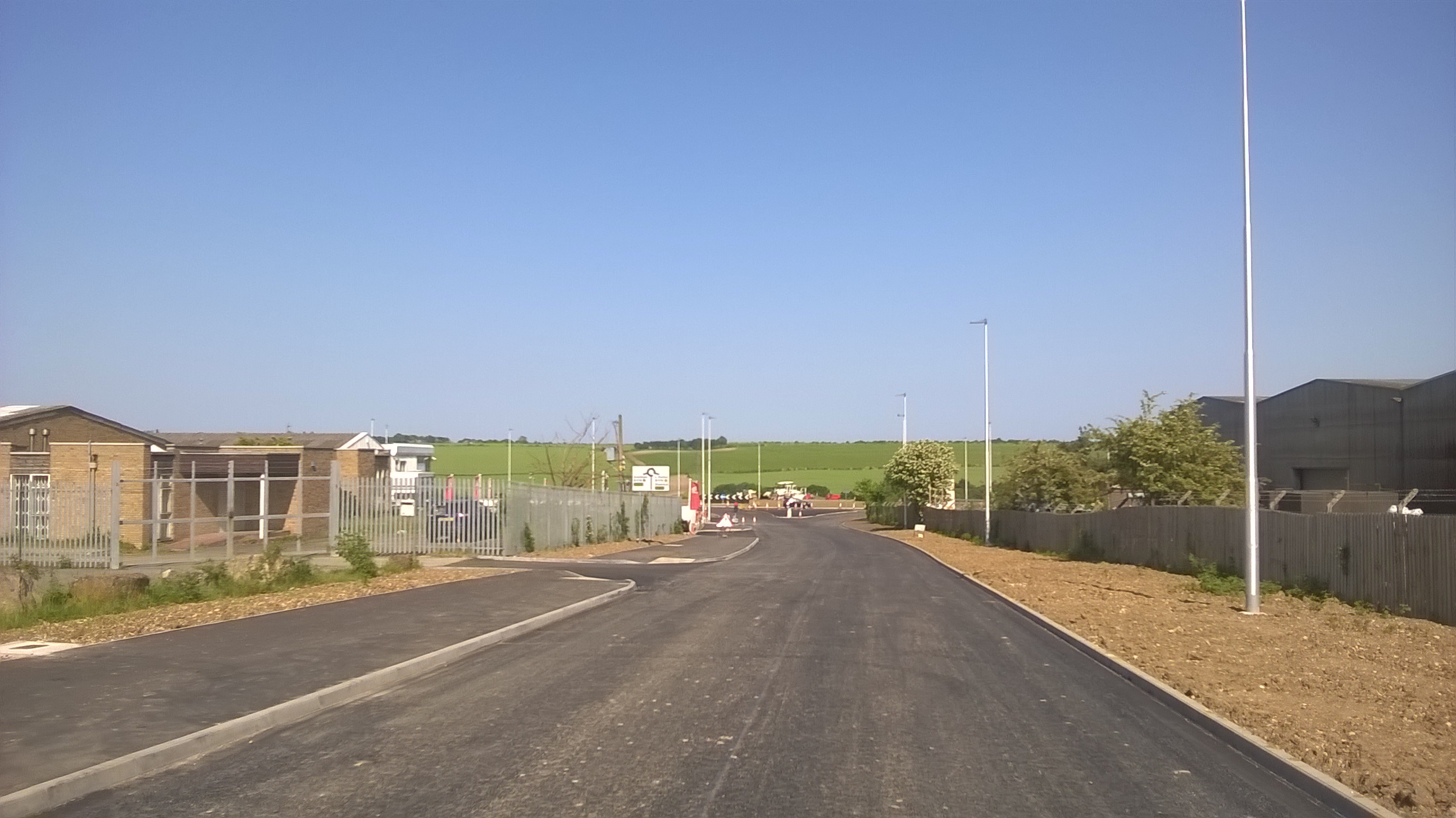
Return_to_Grantham
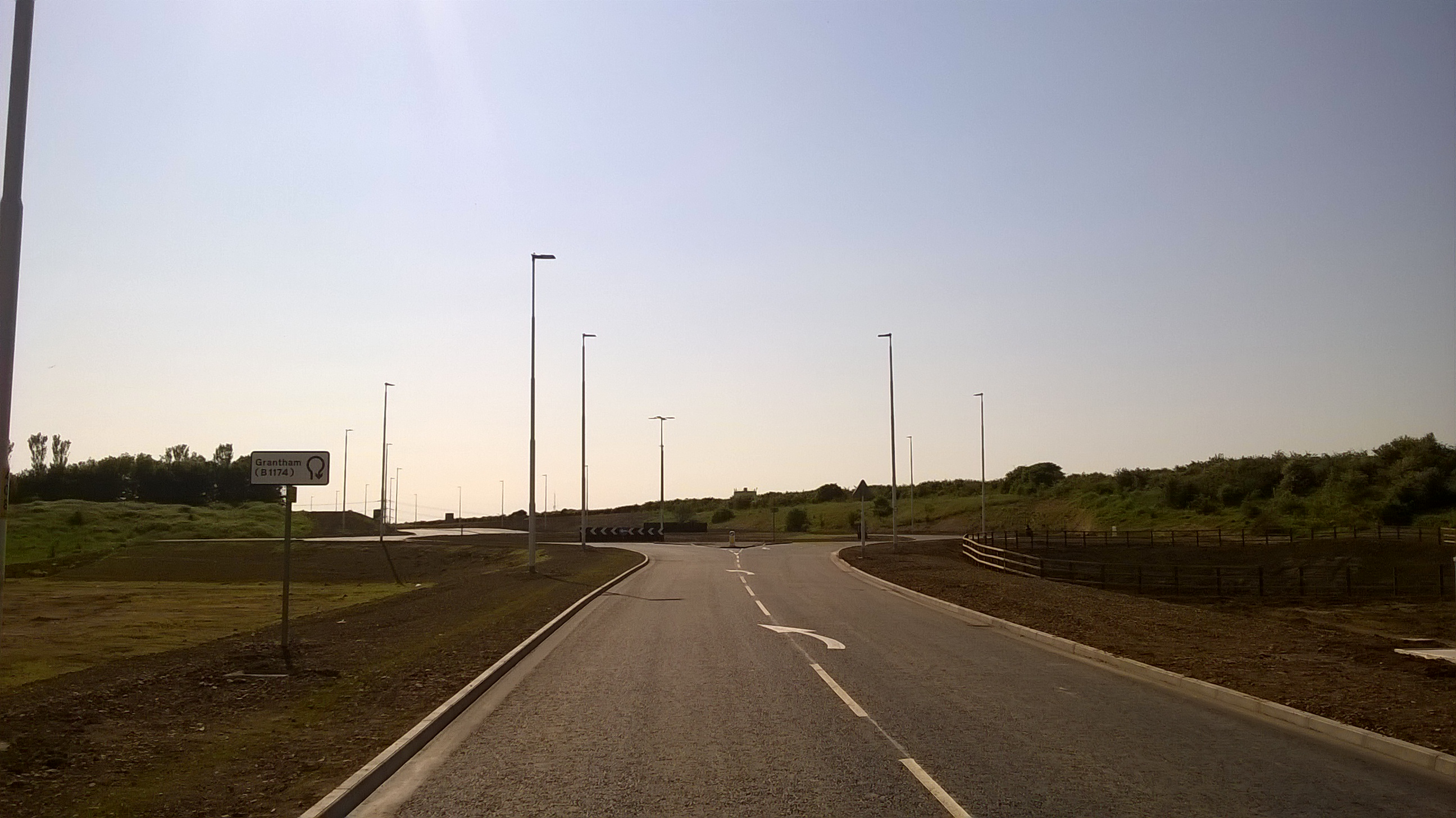
King_31_Distribution_Park_Roundabout
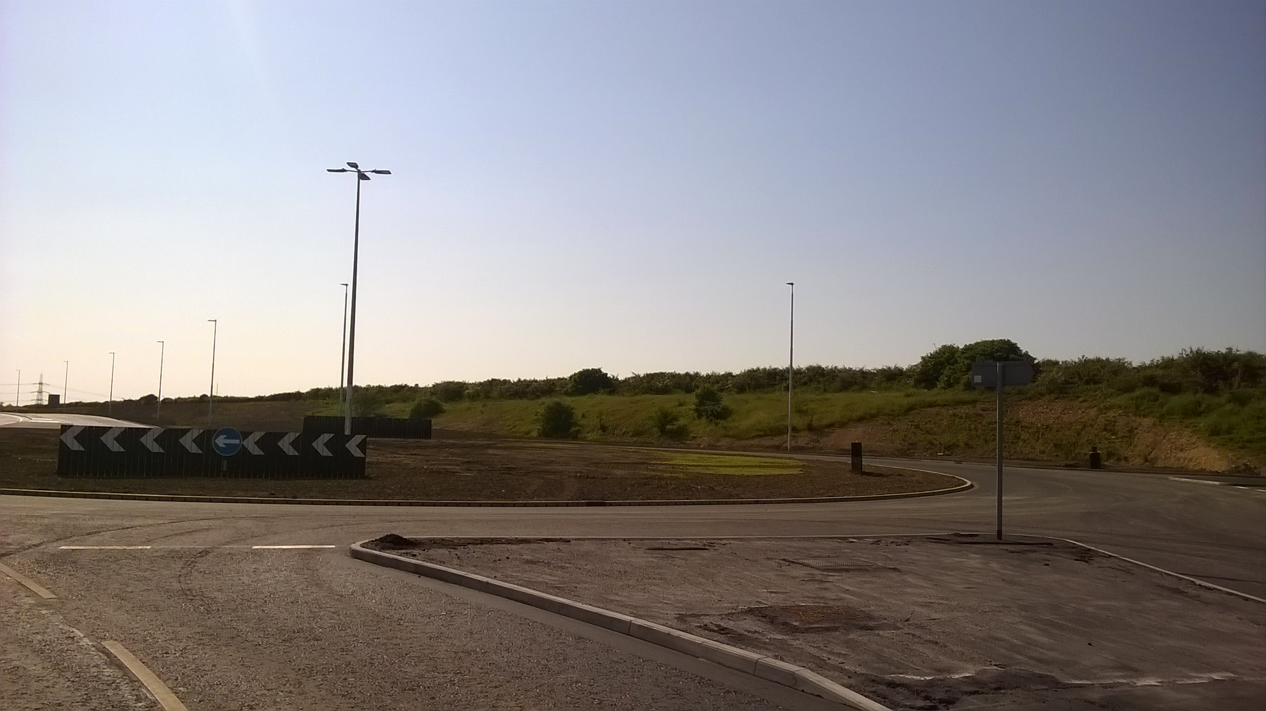
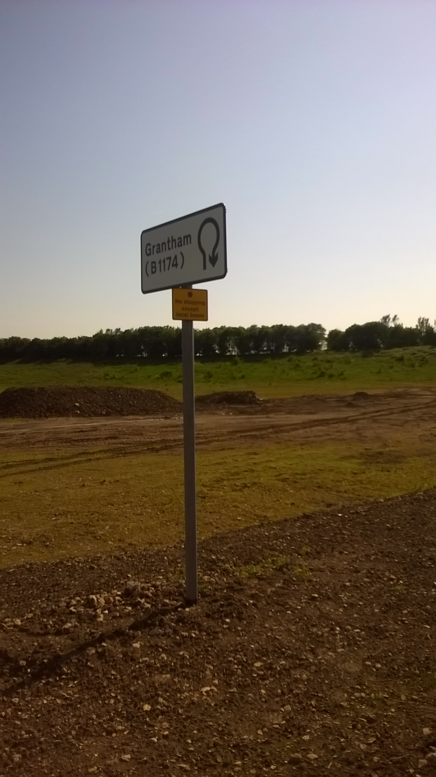
Return to Grantham sign
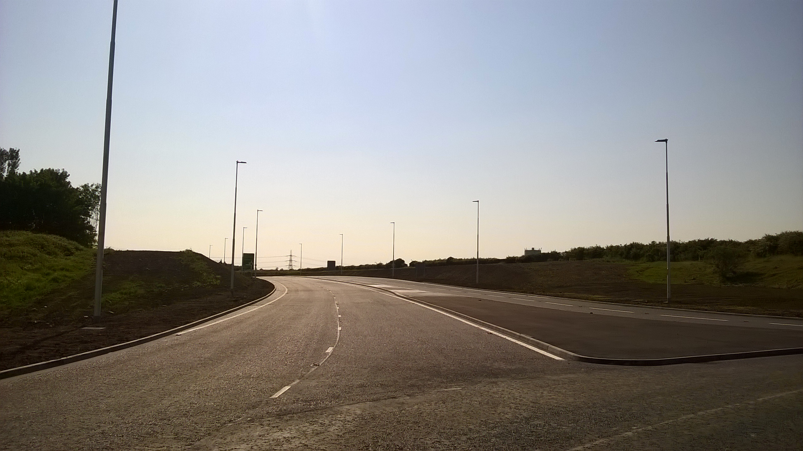
Looking west
ADS for A1

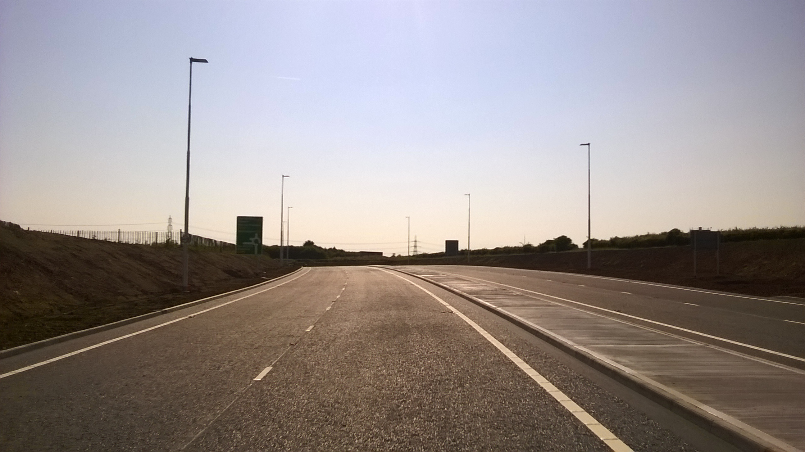
Approaching A1
View back to King 31 roundabout
Balancing Pond

King 31 Roundabout
Nice internally illuminated sign
B1174 roundabout
B1174 realignment
New_A52_looking_towards_King_31_Distribution_Park_roundabout

Tollemache_Road_North,_Grantham_looking_East

Return_to_Grantham

King_31_Distribution_Park_Roundabout

Return to Grantham sign

Looking west

ADS for A1

Approaching A1

View back to King 31 roundabout

Balancing Pond

King 31 Roundabout

Nice internally illuminated sign

B1174 roundabout

B1174 realignment

Is there a road improvement project going on near you? Help us to document it on the SABRE Wiki - help is available in the Digest forum.
Have you browsed SABRE Maps recently? Get involved! - see our guide to scanning and stitching maps
Have you browsed SABRE Maps recently? Get involved! - see our guide to scanning and stitching maps
Re: Grantham southern link road
Comstock wrote:Nice pictures.
Just out of interest, what is a balancing pond?
Thanks
It is an artificial pond where water run-off is stored to avoid overwhelming local watercourses. I've just added a wiki page to that effect: http://www.sabre-roads.org.uk/wiki/inde ... ncing_Pond
Is there a road improvement project going on near you? Help us to document it on the SABRE Wiki - help is available in the Digest forum.
Have you browsed SABRE Maps recently? Get involved! - see our guide to scanning and stitching maps
Have you browsed SABRE Maps recently? Get involved! - see our guide to scanning and stitching maps
From the SABRE Wiki: Balancing Pond :
A balancing pond (also known as a balancing lakes, attenuation or retention ponds) is an artificial basin into which water drains from, for example a road or housing project, constructed to hold water to ensure that local watercourses are not overloaded during heavy rainfall collected by paved surfaces and drained off down specific
