
- A456 (between A4123 and A4030) - the light blue section
- A457 (avoiding Smethwick) - the purple section
It seems odd for two D2 roads to just become S4 and S2 with no further dualling planned.
Moderator: Site Management Team


Truvelo probably had the definitive answer, but I suspect not, especially in the case of A456. Only in the stretch leading up to Five Ways were property lines moved back - and that section *was* dualled. Much of the property on the south side of that road belongs to the Calthorpe Estate, who would have been very skilful at protecting their interests. And S4 has more-or-less coped anyway. The other factor is that the dualling stops at the Birmingham city boundary, so that speaks of a lack of dialogue between Sandwell council and Birmingham council.gepree68 wrote: ↑Tue Apr 27, 2021 15:55 2021-04-27 A456 A457.png
In Birmingham, both A456 and A457 were widened (from S2 to D2) in 1970s (A456) and 1980s (A457):
Was any further widening planned for these two roads?
- A456 (between A4123 and A4030) - the light blue section
- A457 (avoiding Smethwick) - the purple section
It seems odd for two D2 roads to just become S4 and S2 with no further dualling planned.
Yes, that was curious, and probably somewhat speculative. Needless to say, nothing like it ever materialised on the ground.SouthWest Philip wrote: ↑Tue Apr 27, 2021 16:00 A few years ago, the AZ Road Atlas and Birmingham Street Map showed the A41 having been rerouted along the A457 and A4252 between central Birmingham and the M5 which there suggests there may have been grander plans for this route. By the following editions, AZ had reverted to showing the A41 on it's original course.

Perhaps not too dissimilar to a mid-90s AA map renumbering the A523 from A52 to the A6 as A52, and the A52 running into Stoke as the A524. Don't think that really got onto the ground either, so to speak...Chris Bertram wrote: ↑Tue Apr 27, 2021 16:08Yes, that was curious, and probably somewhat speculative. Needless to say, nothing like it ever materialised on the ground.SouthWest Philip wrote: ↑Tue Apr 27, 2021 16:00 A few years ago, the AZ Road Atlas and Birmingham Street Map showed the A41 having been rerouted along the A457 and A4252 between central Birmingham and the M5 which there suggests there may have been grander plans for this route. By the following editions, AZ had reverted to showing the A41 on it's original course.

Well, actually, you say that but...ForestChav wrote: ↑Tue Apr 27, 2021 16:09Perhaps not too dissimilar to a mid-90s AA map renumbering the A523 from A52 to the A6 as A52, and the A52 running into Stoke as the A524. Don't think that really got onto the ground either, so to speak...Chris Bertram wrote: ↑Tue Apr 27, 2021 16:08Yes, that was curious, and probably somewhat speculative. Needless to say, nothing like it ever materialised on the ground.SouthWest Philip wrote: ↑Tue Apr 27, 2021 16:00 A few years ago, the AZ Road Atlas and Birmingham Street Map showed the A41 having been rerouted along the A457 and A4252 between central Birmingham and the M5 which there suggests there may have been grander plans for this route. By the following editions, AZ had reverted to showing the A41 on it's original course.
The A457 dualling ending where it does is almost certainly due to the boundary as already mentioned. However in 1917/1918 it was policy for main roads in Birmingham to have a right of way of 110 feet. This can be seen where dual carriageways have a wide central reservation with two rows of trees running down it. Whether or not this applied to A457 Dudley Road is unclear as it was almost continuously built up on both sides at the time making any widening impossible without a lot of demolition. A report from 1952 shows which roads were due to be widened and only the section between the inner ring and Middleway is included.Chris Bertram wrote: ↑Tue Apr 27, 2021 16:06 Truvelo probably had the definitive answer, but I suspect not, especially in the case of A456.
That is a stretch where the city boundary runs along the road, although the mapping suggests that the dualling was done within the Birmingham boundary. 1:25000 mapping suggests that the boundary is either along the northern highway boundary, or in the centre of the eastbound carriageway. This means that in places the streetlighting is different on each side of the road, and some weight restriction zone signs can be found on cross-turnings.Truvelo wrote: ↑Tue Apr 27, 2021 16:57The A456 like many other main roads in the city was widened to provide a 110 foot right of way in places where it was possible. This obviously meant only the stretches which were still rural by 1917 ended up like this which explains why it is dualled only west of the A4040.
Mapping of Queslett Road is inconsistent. 1:50000 suggests that it's more in Walsall than Birmingham, but 1:25000 indicates the opposite.Truvelo wrote: ↑Tue Apr 27, 2021 17:33 Where a road runs along the city boundary I find it is built to Birmingham's standards rather than the adjacent authority. The lighting etc is always Birmingham. Both sides of Queslett are also strictly Birmingham in character although recent replacements of lighting has seen this diminish somewhat.
I think the border is along the central reservation. This photo I took in 2007 shows differently spaced road markings on the Birmingham and Walsall sides along with the original lighting on the Birmingham side compared with replacements in Walsall.Chris Bertram wrote: ↑Tue Apr 27, 2021 19:50Mapping of Queslett Road is inconsistent. 1:50000 suggests that it's more in Walsall than Birmingham, but 1:25000 indicates the opposite.Truvelo wrote: ↑Tue Apr 27, 2021 17:33 Where a road runs along the city boundary I find it is built to Birmingham's standards rather than the adjacent authority. The lighting etc is always Birmingham. Both sides of Queslett are also strictly Birmingham in character although recent replacements of lighting has seen this diminish somewhat.
According to the National Street Gazetteer, the westbound carriageway is maintained by Birmingham City Council, and the eastbound one by a combination of Walsall and Sandwell MBCs.Truvelo wrote: ↑Tue Apr 27, 2021 19:57I think the border is along the central reservation. This photo I took in 2007 shows differently spaced road markings on the Birmingham and Walsall sides along with the original lighting on the Birmingham side compared with replacements in Walsall.Chris Bertram wrote: ↑Tue Apr 27, 2021 19:50Mapping of Queslett Road is inconsistent. 1:50000 suggests that it's more in Walsall than Birmingham, but 1:25000 indicates the opposite.Truvelo wrote: ↑Tue Apr 27, 2021 17:33 Where a road runs along the city boundary I find it is built to Birmingham's standards rather than the adjacent authority. The lighting etc is always Birmingham. Both sides of Queslett are also strictly Birmingham in character although recent replacements of lighting has seen this diminish somewhat.
It's Sandwell west of the M5 overbridge and Walsall to the east of it.Steven wrote: ↑Tue Apr 27, 2021 20:05According to the National Street Gazetteer, the westbound carriageway is maintained by Birmingham City Council, and the eastbound one by a combination of Walsall and Sandwell MBCs.Truvelo wrote: ↑Tue Apr 27, 2021 19:57I think the border is along the central reservation. This photo I took in 2007 shows differently spaced road markings on the Birmingham and Walsall sides along with the original lighting on the Birmingham side compared with replacements in Walsall.Chris Bertram wrote: ↑Tue Apr 27, 2021 19:50 Mapping of Queslett Road is inconsistent. 1:50000 suggests that it's more in Walsall than Birmingham, but 1:25000 indicates the opposite.
Sometimes I wonder if A-Z number roads how they want rather than how the Council want. Was that the same edition that renumbered the eastern section of the A4540 as A34 and the western half as A41?SouthWest Philip wrote: ↑Tue Apr 27, 2021 16:00 A few years ago, the AZ Road Atlas and Birmingham Street Map showed the A41 having been rerouted along the A457 and A4252 between central Birmingham and the M5 which there suggests there may have been grander plans for this route. By the following editions, AZ had reverted to showing the A41 on it's original course.
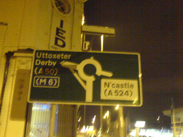
Now that actually happened, at least if you believe the signs.ForestChav wrote: ↑Tue Apr 27, 2021 16:09 Perhaps not too dissimilar to a mid-90s AA map renumbering the A523 from A52 to the A6 as A52, and the A52 running into Stoke as the A524. Don't think that really got onto the ground either, so to speak...
I just dug my Birmingham A-Z out of the car. Rarely used these days, it's the 2008 edition. It shows Hagley Road West with the boundary down the middle of the road, and Queslett Road almost entirely likewise. A4540 is so-numbered all the way round, and is in the minty green colour that they were using for city ring roads, though Wolverhampton didn't get the same treatment. (Coventry isn't in this book).vlad wrote: ↑Tue Apr 27, 2021 20:10Sometimes I wonder if A-Z number roads how they want rather than how the Council want. Was that the same edition that renumbered the eastern section of the A4540 as A34 and the western half as A41?SouthWest Philip wrote: ↑Tue Apr 27, 2021 16:00 A few years ago, the AZ Road Atlas and Birmingham Street Map showed the A41 having been rerouted along the A457 and A4252 between central Birmingham and the M5 which there suggests there may have been grander plans for this route. By the following editions, AZ had reverted to showing the A41 on it's original course.Now that actually happened, at least if you believe the signs.ForestChav wrote: ↑Tue Apr 27, 2021 16:09 Perhaps not too dissimilar to a mid-90s AA map renumbering the A523 from A52 to the A6 as A52, and the A52 running into Stoke as the A524. Don't think that really got onto the ground either, so to speak...

