
I've noticed that the 1966 one inch map on SABRE Maps shows the M4 between Tormarton and the M32 as under construction, while it shows the stretch from the M32 to the west of Newport as being open. The 1967 map meanwhile shows the whole of this stretch of the M4 (Tormarton to Newport) as being open to traffic. Given that the Tormarton stretch was opened as D3M whereas I believe the rest of the 1966 stretch of M4 was D2M at its time of opening (most of it has since either been bypassed by the Second Severn Crossing or has been widened, with the exception of the Brynglas Tunnels which remain as they originally were today), it sounds somewhat plausible that it may have had a different contractor and/or taken longer to build.
It would also be interesting to ask if the M4 between the M32 and the Almondsbury Interchange was originally D2M or D3M? I've seen some photos of it at the time of opening but they are all relatively low resolution and it's difficult to really make out if the M4 has 2 or 3 lanes in each direction to the east of it. If this section was originally D2M, does anyone know when it was upgraded (not including the more recent upgrade to D4M/smart motorway)?
On a side note, Wikipedia claims that the Brynglas Tunnels were opened in May 1967, however the 1966 one inch map shows this stretch of M4 as if it was fully completed. The original Severn Bridge opened in September 1966.
Was the M4 between J18 and J19 opened slightly later than the rest of the 1966 stretch?
Moderator: Site Management Team
Was the M4 between J18 and J19 opened slightly later than the rest of the 1966 stretch?
RJDG14
See my Geograph profile here - http://www.geograph.org.uk/profile/74193
The Swindon Files - Swindon's modern history - http://rjdg14.altervista.org/swindon/
----
If I break a policy designed only to protect me and nobody else, have I really broken anything?
See my Geograph profile here - http://www.geograph.org.uk/profile/74193
The Swindon Files - Swindon's modern history - http://rjdg14.altervista.org/swindon/
----
If I break a policy designed only to protect me and nobody else, have I really broken anything?
-
Brenley Corner

- Member
- Posts: 3857
- Joined: Fri Apr 12, 2002 19:28
- Location: nr. Canterbury, Kent
Re: Was the M4 between J18 and J19 opened slightly later than the rest of the 1966 stretch?
According to the Motorway Database on "roads.org.uk", J18 to J20 was all opened at the same time in Jan 1966 - M4.
My copy of the "History of British Motorways" by George Charlesworth says the same thing.
Tony
My copy of the "History of British Motorways" by George Charlesworth says the same thing.
Tony
Brenley Corner: congesting traffic since 1963; discussing roads since 2002
-
Steven

- SABRE Maps Coordinator
- Posts: 19233
- Joined: Tue Feb 12, 2002 20:39
- Location: Wolverhampton, Staffordshire
- Contact:
Re: Was the M4 between J18 and J19 opened slightly later than the rest of the 1966 stretch?
I really wouldn't trust Wikipedia, especially as there's a far more accurate source right here. Mapping evidence is great, but you've also got to bear in mind the time elapsed for OS to actually create mapping, and any project delays (or inaccurate information received by the OS) would end up being translated into mapping.
Steven
Motorway Historian
Founder Member, SABRE ex-Presidents' Corner
Add your roads knowledge to the SABRE Wiki today!
Have you browsed SABRE Maps recently? Try getting involved!
Motorway Historian
Founder Member, SABRE ex-Presidents' Corner
Add your roads knowledge to the SABRE Wiki today!
Have you browsed SABRE Maps recently? Try getting involved!
From the SABRE Wiki: Network changes - 1960s :
list of the changes to the road network in Great Britain from 1960 - 1969. Includes road openings and renumberings.
Re: Was the M4 between J18 and J19 opened slightly later than the rest of the 1966 stretch?
The thing I find most weird would be that the 1963 one inch OS map shows about 2 miles of M5 at Filton. I brought this up here a while back and others were able to confirm that it does indeed predate the M4 (it is also listed on that page as having opened on the 31st May 1963), although I'd have probably seen it as a bit of a white elephant for its first three years of existence - it looks pretty out of place on its own. In its case, it was built by Gloucestershire's council and I believe it was technically operated as a non-trunk special road with motorway/M5 branding for its first 3 years until it was incorporated into the wider South West/Welsh M4/M32 network that were opened in 1966.Steven wrote: ↑Thu Aug 11, 2022 14:07I really wouldn't trust Wikipedia, especially as there's a far more accurate source right here. Mapping evidence is great, but you've also got to bear in mind the time elapsed for OS to actually create mapping, and any project delays (or inaccurate information received by the OS) would end up being translated into mapping.
I think the so-called Chippenham Spur that some maps showed may have been an early proposed alignment for the M4 that caused confusion for some map makers. It never appeared on any official OS maps to my knowledge. Tormarton did seem like a somewhat strange place for the road to terminate at the time the stretch was opened, since the junction doesn't really have any exits that lead directly to anywhere particularly major, unless you happen to be travelling to Bath or Stroud. It was definitely intended that the motorway would be expanded further east to Maidenhead by the time the 1966 section was opened since I know from an old photo that the junction was built with full provision for an eastwards expansion, which opened 5 years later.
I find the original bridge architecture on the 1966 stretch of the M4 more interesting and varied than that of the 1971 stretch, which in my opinion feels like one of the most boring stretches of motorway anywhere in the country. The 1966 stretch between Tormarton and Newport seems to feature numerous landmarks which were there at its point of opening, including the rather large roundabout bridges with curved supports at Tormarton, the metal railway bridge immediately west of J19, the Almondsbury Interchange, the Severn/Wye Bridges and the Brynglas Tunnels. There is no engineering feature of any particular notability on the Tormarton-Maidenhead stretch aside from maybe the military junction on the eastbound carriageway between J13 and J14.
Regarding my original question, it looks like the Tormarton to Hambrook (J18-19) section was opened about 3 months after the rest of the stretch (December 1966 instead of September), though I'm sure it would have been well under construction by the time the rest of the 1966 section of M4 was opened - it was probably simply lacking some of the finishing touches such as being fully tarmaced or having yet had markings painted and signs installed. It also looks like the majority of the Welsh section was not opened until March and May 1967, with traffic initially being diverted onto the A48 at Chepstow.
I remember travelling down the Welsh side of the M48 in late June and finding how neglected feeling a lot of it felt. It wasn't helped by the fact that the original Severn Bridge was closed on the day for strengthening works, but it did definitely have quite a somewhat narrow (not as narrow as the M50), slightly overgrown feel and several of the bridges felt in quite a poor state. The motorway that I would probably compare it to in terms of standard and traffic would be the M45.
RJDG14
See my Geograph profile here - http://www.geograph.org.uk/profile/74193
The Swindon Files - Swindon's modern history - http://rjdg14.altervista.org/swindon/
----
If I break a policy designed only to protect me and nobody else, have I really broken anything?
See my Geograph profile here - http://www.geograph.org.uk/profile/74193
The Swindon Files - Swindon's modern history - http://rjdg14.altervista.org/swindon/
----
If I break a policy designed only to protect me and nobody else, have I really broken anything?
From the SABRE Wiki: Network changes - 1960s :
list of the changes to the road network in Great Britain from 1960 - 1969. Includes road openings and renumberings.

Re: Was the M4 between J18 and J19 opened slightly later than the rest of the 1966 stretch?
My understanding is that the section of M4 starting at present junction 28 opened as D2M along the entire Welsh section, to J22. The Severn and Wye bridges, and the Beachley viaduct opened as D2 as far as the toll booths next to J21. The motorway continued east from J21 as D2M as far east as the bottom of the steepish hill rising up towards Almondsbury where the eastbound carriageway gained a third (climbing) lane, which became a dedicated lane for the M5. Then D2M through Almondsbury, becoming D3M east of J20, the three lanes being continuous through the M32 junction (J19) and on to Tormarton.RJDG14 wrote: ↑Thu Aug 11, 2022 12:52 I've noticed that the 1966 one inch map on SABRE Maps shows the M4 between Tormarton and the M32 as under construction, while it shows the stretch from the M32 to the west of Newport as being open. The 1967 map meanwhile shows the whole of this stretch of the M4 (Tormarton to Newport) as being open to traffic. Given that the Tormarton stretch was opened as D3M whereas I believe the rest of the 1966 stretch of M4 was D2M at its time of opening (most of it has since either been bypassed by the Second Severn Crossing or has been widened, with the exception of the Brynglas Tunnels which remain as they originally were today), it sounds somewhat plausible that it may have had a different contractor and/or taken longer to build.
It would also be interesting to ask if the M4 between the M32 and the Almondsbury Interchange was originally D2M or D3M? I've seen some photos of it at the time of opening but they are all relatively low resolution and it's difficult to really make out if the M4 has 2 or 3 lanes in each direction to the east of it. If this section was originally D2M, does anyone know when it was upgraded (not including the more recent upgrade to D4M/smart motorway)?
On a side note, Wikipedia claims that the Brynglas Tunnels were opened in May 1967, however the 1966 one inch map shows this stretch of M4 as if it was fully completed. The original Severn Bridge opened in September 1966.
The climbing lane on the eastbound carriageway began just east of where the current M48 merges with the M4, and was extended west slightly to tie in with the new M4/M48 junction.
The 1971 section is the least interesting part of the M4, but it has a handful of things that I look out for:RJDG14 wrote: ↑Thu Aug 11, 2022 17:44 I find the original bridge architecture on the 1966 stretch of the M4 more interesting and varied than that of the 1971 stretch, which in my opinion feels like one of the most boring stretches of motorway anywhere in the country. The 1966 stretch between Tormarton and Newport seems to feature numerous landmarks which were there at its point of opening, including the rather large roundabout bridges with curved supports at Tormarton, the metal railway bridge immediately west of J19, the Almondsbury Interchange, the Severn/Wye Bridges and the Brynglas Tunnels. There is no engineering feature of any particular notability on the Tormarton-Maidenhead stretch aside from maybe the military junction on the eastbound carriageway between J13 and J14.
1. The military junction
2. The TV mast near Membury and the airfield on the westbound side.
3. The modified layout of J13
4. The way the motorway carves through the undulating countryside east of J15 (though the truth is that it is not particularly interesting, just something I remember noticing from my childhood.)
5. The split-level bit between 15 and 16
6. The Tormarton bridges, which means we will be going down hill towards Bristol and the Severn and more interesting features
As you say, the next section is packed with features including the Pucklechurch unbuilt MSA access, the blue bridge, Almondsbury, the Severn Bridges, Celtic Manor, the Newport urban motorway complete with tunnels, the abandoned temporary carriageway at J29 (not so easy to see from the M4). The Cardiff bypass running west to Pencoed (J35) is less interesting, but there needs to be a shout out to the fairytale castle, Castell Coch, overlooking J32. From J36 west, we have a couple of viaducts spanning valleys, then Port Talbot comes into sight ahead and to the right. From here past the north side of Swansea there is plenty to see, with the motorway being elevated for much of its length.
The older sections (J1-8, 18-28 via M48, 39-41) seem more interesting than the newer infill sections (9-18, 29-38), but there are exceptions - the 1990s second Severn Bridge and the Baglan to Lonlas section (41-44), both of which had significant engineering challenges due to the obstacles they cross.
Simon
[Edited to correct references to J29]
Last edited by M4Simon on Fri Aug 12, 2022 17:22, edited 1 time in total.
Did you know there's more to SABRE than just the Forums?
Add your roads knowledge to the SABRE Wiki today!
Have you browsed SABRE Maps recently? Try getting involved!
Please contact me if you want to know more
Add your roads knowledge to the SABRE Wiki today!
Have you browsed SABRE Maps recently? Try getting involved!
Please contact me if you want to know more
Re: Was the M4 between J18 and J19 opened slightly later than the rest of the 1966 stretch?
I think there are at least a couple of mobile phone masts between Reading and the A34 which have been disguised as pine trees to blend in with the woodland the M4 cuts through. Most of the M4 between about Reading and Tormarton feels pretty boring but the disguised masts (I think there are also one or two along the Welsh stretch) give me something to look out for.M4Simon wrote: ↑Fri Aug 12, 2022 07:23My understanding is that the section of M4 starting at present junction 28 opened as D2M along the entire Welsh section, to J22. The Severn and Wye bridges, and the Beachley viaduct opened as D2 as far as the toll booths next to J21. The motorway continued east from J21 as D2M as far east as the bottom of the steepish hill rising up towards Almondsbury where the eastbound carriageway gained a third (climbing) lane, which became a dedicated lane for the M5. Then D2M through Almondsbury, becoming D3M east of J20, the three lanes being continuous through the M32 junction (J19) and on to Tormarton.RJDG14 wrote: ↑Thu Aug 11, 2022 12:52 I've noticed that the 1966 one inch map on SABRE Maps shows the M4 between Tormarton and the M32 as under construction, while it shows the stretch from the M32 to the west of Newport as being open. The 1967 map meanwhile shows the whole of this stretch of the M4 (Tormarton to Newport) as being open to traffic. Given that the Tormarton stretch was opened as D3M whereas I believe the rest of the 1966 stretch of M4 was D2M at its time of opening (most of it has since either been bypassed by the Second Severn Crossing or has been widened, with the exception of the Brynglas Tunnels which remain as they originally were today), it sounds somewhat plausible that it may have had a different contractor and/or taken longer to build.
It would also be interesting to ask if the M4 between the M32 and the Almondsbury Interchange was originally D2M or D3M? I've seen some photos of it at the time of opening but they are all relatively low resolution and it's difficult to really make out if the M4 has 2 or 3 lanes in each direction to the east of it. If this section was originally D2M, does anyone know when it was upgraded (not including the more recent upgrade to D4M/smart motorway)?
On a side note, Wikipedia claims that the Brynglas Tunnels were opened in May 1967, however the 1966 one inch map shows this stretch of M4 as if it was fully completed. The original Severn Bridge opened in September 1966.
The climbing lane on the eastbound carriageway began just east of where the current M48 merges with the M4, and was extended west slightly to tie in with the new M4/M48 junction.
The 1971 section is the least interesting part of the M4, but it has a handful of things that I look out for:RJDG14 wrote: ↑Thu Aug 11, 2022 17:44 I find the original bridge architecture on the 1966 stretch of the M4 more interesting and varied than that of the 1971 stretch, which in my opinion feels like one of the most boring stretches of motorway anywhere in the country. The 1966 stretch between Tormarton and Newport seems to feature numerous landmarks which were there at its point of opening, including the rather large roundabout bridges with curved supports at Tormarton, the metal railway bridge immediately west of J19, the Almondsbury Interchange, the Severn/Wye Bridges and the Brynglas Tunnels. There is no engineering feature of any particular notability on the Tormarton-Maidenhead stretch aside from maybe the military junction on the eastbound carriageway between J13 and J14.
1. The military junction
2. The TV mast near Membury and the airfield on the westbound side.
3. The modified layout of J13
4. The way the motorway carves through the undulating countryside east of J15 (though the truth is that it is not particularly interesting, just something I remember noticing from my childhood.)
5. The split-level bit between 15 and 16
6. The Tormarton bridges, which means we will be going down hill towards Bristol and the Severn and more interesting features
As you say, the next section is packed with features including the Pucklechurch unbuilt MSA access, the blue bridge, Almondsbury, the Severn Bridges, Celtic Manor, the Newport urban motorway complete with tunnels, the abandoned temporary carriageway at 29A (not so easy to see from the M4). The Cardiff bypass running west to Pencoed (J35) is less interesting, but there needs to be a shout out to the fairytale castle, Castell Coch, overlooking J32. From J36 west, we have a couple of viaducts spanning valleys, then Port Talbot comes into sight ahead and to the right. From here past the north side of Swansea there is plenty to see, with the motorway being elevated for much of its length.
The older sections (J1-8, 18-28 via M48, 39-41) seem more interesting than the newer infill sections (9-18, 29A-38), but there are exceptions - the 1990s second Severn Bridge and the Baglan to Lonlas section (41-44), both of which had significant engineering challenges due to the obstacles they cross.
Simon
The most boring feeling part of the M4 in my opinion would be junction 16-17. It's an uninterrupted 12-13 mile stretch through boring countryside, and it would also happen to be the stretch of motorway that I've been along the most, since I live in Swindon and have grandparents and other family members living in Bath. Is the particularly dull nature of this stretch the reason why they decided to do special speed camera patrols on this particular section in the mid 2000s (I think the patrols ended following the 2010 election but most of the speed camera warning signs remain)?
Given that Wales is in general a more rural country than England, I've always found it a little strange how the Welsh M4 actually feels more urban than the majority of the English portion.
I think that during the 1960s, motorways were still seen somewhat as a novelty and so money was spent to make them feel as interesting as possible. Since the 1970s new stretches have generally been seen as more functional and little else. I know that the Nazis were quite keen on adding interesting features to autobahns. Some of these were simply propaganda symbols that were removed immediately after their defeat to the Allies, but there were other features such as certain landscaping elements, unique bridge designs and viewpoints which a democratic government could have done as well. These kinds of features can be seen on some of Britain's earlier motorways built between the late 1950s and mid-late 1960s.
RJDG14
See my Geograph profile here - http://www.geograph.org.uk/profile/74193
The Swindon Files - Swindon's modern history - http://rjdg14.altervista.org/swindon/
----
If I break a policy designed only to protect me and nobody else, have I really broken anything?
See my Geograph profile here - http://www.geograph.org.uk/profile/74193
The Swindon Files - Swindon's modern history - http://rjdg14.altervista.org/swindon/
----
If I break a policy designed only to protect me and nobody else, have I really broken anything?
Re: Was the M4 between J18 and J19 opened slightly later than the rest of the 1966 stretch?
I actually recall driving (in truth being driven, as a child) around these roads at exactly this time. You may imagine interested looks from the rear seat of a 1949 Sunbeam Rapier ...
Reading the "Network changes" detail on our site, this aligns with one experience which must have been Autumn 1966, climbing from the Severn Bridge, missed the turn at Almondsbury interchange, carried on in uncharted territory to Hambrook, where the motorway terminated. I think we had gone specially to Aust services to see the bridge.
J19 - Hambrook
J20 - Almondsbury interchange M4/M5
J21 - Aust services
J22 - Chepstow A466

Re: Was the M4 between J18 and J19 opened slightly later than the rest of the 1966 stretch?
They were by definition a novelty but there wasn't anything very decorative or exciting about the A1(M), first sections of M1 or M6. The bridges and signs were nicely designed but that was about it. The first service areas had some pretensions such as dining on pedestrian bridges over the carriageways but that was about it. The Doncaster bypass has hardly changed nor have the Darlington and Durham bypasses except for the barriers. The only ornamentation came MUCH later with the Angel Of The North. The trees are now more mature thoughRJDG14 wrote: ↑Fri Aug 12, 2022 15:24 I think that during the 1960s, motorways were still seen somewhat as a novelty and so money was spent to make them feel as interesting as possible. Since the 1970s new stretches have generally been seen as more functional and little else. I know that the Nazis were quite keen on adding interesting features to autobahns. Some of these were simply propaganda symbols that were removed immediately after their defeat to the Allies, but there were other features such as certain landscaping elements, unique bridge designs and viewpoints which a democratic government could have done as well. These kinds of features can be seen on some of Britain's earlier motorways built between the late 1950s and mid-late 1960s.
https://www.google.co.uk/maps/@54.48178 ... 6656?hl=en
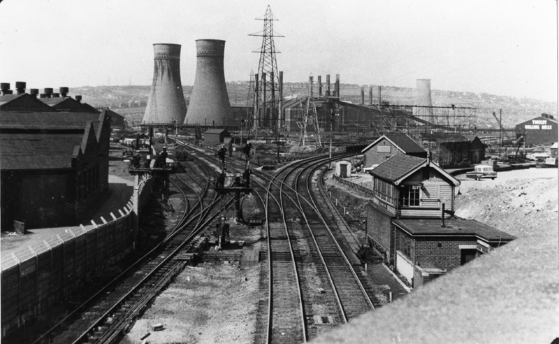
As for the M1 at Sheffield the view was of steelworks and other heavy industry
I do miss the Rugby radio towers though.
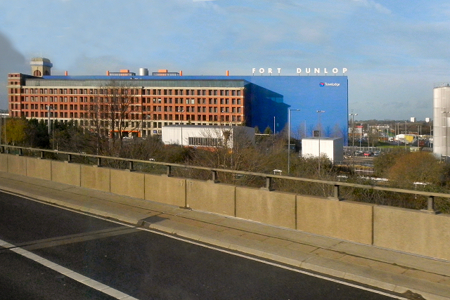
From the M6 you had a fine view of Fort Dunlop
The best viewpoints came courtesy of the route.
https://www.google.co.uk/maps/@53.64740 ... 8192?hl=en
https://www.google.co.uk/maps/@53.64724 ... 6656?hl=en
Re: Was the M4 between J18 and J19 opened slightly later than the rest of the 1966 stretch?
SeeRJDG14 wrote: ↑Thu Aug 11, 2022 17:44
The thing I find most weird would be that the 1963 one inch OS map shows about 2 miles of M5 at Filton. I brought this up here a while back and others were able to confirm that it does indeed predate the M4 (it is also listed on that page as having opened on the 31st May 1963), although I'd have probably seen it as a bit of a white elephant for its first three years of existence - it looks pretty out of place on its own. In its case, it was built by Gloucestershire's council and I believe it was technically operated as a non-trunk special road with motorway/M5 branding for its first 3 years until it was incorporated into the wider South West/Welsh M4/M32 network that were opened in 1966.
viewtopic.php?t=24974
It was the second Filton bypass, the first had been made useless by ribbon development so given it was known the M4 was coming making it a special road would prevent that happening again.
Re: Was the M4 between J18 and J19 opened slightly later than the rest of the 1966 stretch?
I've not noticed the disguised mobile phone masts before - something to look out for next time.RJDG14 wrote: ↑Fri Aug 12, 2022 15:24 I think there are at least a couple of mobile phone masts between Reading and the A34 which have been disguised as pine trees to blend in with the woodland the M4 cuts through. Most of the M4 between about Reading and Tormarton feels pretty boring but the disguised masts (I think there are also one or two along the Welsh stretch) give me something to look out for.
I quite like the wooded part east of J13. In that area, the motorway crosses a minor road (Burnt Hill Road) running through the woods, which I remember seeing as a teenager. As far as I could see, it was long, straight and climbed as you head north away from the motorway. The trees have grown considerably since then, so the road is much harder to see now (https://goo.gl/maps/n8vJpjn4tau34L1F8). I think the reason it grabbed my attention was that it reminded me of woodland roads elsewhere, and I imagined it being part of a very scenic route. I've never found the time to drive it, but on Google Maps, it looks like a nice road, but not quite as long as I imagined it to be. https://goo.gl/maps/DiXUCGurZWqZWwZw5
I'd probably agree with that - I think it is the biggest gap between junctions on the M4 and is fairly tedious.The most boring feeling part of the M4 in my opinion would be junction 16-17. It's an uninterrupted 12-13 mile stretch through boring countryside, and it would also happen to be the stretch of motorway that I've been along the most, since I live in Swindon and have grandparents and other family members living in Bath. Is the particularly dull nature of this stretch the reason why they decided to do special speed camera patrols on this particular section in the mid 2000s (I think the patrols ended following the 2010 election but most of the speed camera warning signs remain)?
Given that Wales is in general a more r ... h portion.
Most of Wales is far more rural than England, but around 1.5 million people (half of Wales's population) live close to the M4, either in the three big cities of Cardiff, Swansea and Newport or in the former mining valleys in Monmouthshire or Glamorgan. Because of the terrain, the motorway finds itself sandwiched between the hills and the sea, and has to run through the urban areas as there is nowhere else sensible to go. Hence we have tunnels, significant river crossings over the Usk, Ogmore, Neath and Loughor and the 1960s elevated section around Port Talbot (which also crosses the Afan).
I think the M4 through South Wales was designed to be functional and to deal with the constraints of the topography. I don't think many of the bridges are particularly attractive, with the obvious exception of the Severn and Wye Bridges. I'd say that the Owen Williams bridges on the original M1 were built to be architecturally interesting, though whether they succeeded is a moot point. The Loughor Bridge is nothing to look at as you cross it, though the views of the river are rather nice. https://goo.gl/maps/DiXUCGurZWqZWwZw5I think that during the 1960s, motorways were still seen somewhat as a novelty and so money was spent to make them feel as interesting as possible. Since the 1970s new stretches have generally been seen as more functional and little else. I know that the Nazis were quite keen on adding interesting features to autobahns. Some of these were simply propaganda symbols that were removed immediately after their defeat to the Allies, but there were other features such as certain landscaping elements, unique bridge designs and viewpoints which a democratic government could have done as well. These kinds of features can be seen on some of Britain's earlier motorways built between the late 1950s and mid-late 1960s.
Simon
Did you know there's more to SABRE than just the Forums?
Add your roads knowledge to the SABRE Wiki today!
Have you browsed SABRE Maps recently? Try getting involved!
Please contact me if you want to know more
Add your roads knowledge to the SABRE Wiki today!
Have you browsed SABRE Maps recently? Try getting involved!
Please contact me if you want to know more

Re: Was the M4 between J18 and J19 opened slightly later than the rest of the 1966 stretch?
The biggest pain around Bristol on the Motorways back around then was the late completion of the M5 Avonmouth bridge, that had so many delays, and was around 5 years late in opening.
Re: Was the M4 between J18 and J19 opened slightly later than the rest of the 1966 stretch?
I remember it well, more to the point the convoluted diversions around it one which involved the Clifton Suspension Bridge, minor roads to Bedminster and the A38.

Re: Was the M4 between J18 and J19 opened slightly later than the rest of the 1966 stretch?
Yes well the first one fell down before it was finished.
“The simple step of a courageous individual is not to take part in the lie" - Aleksandr I. Solzhenitsyn
Johnny Mo
Johnny Mo
-
Chris Bertram

- Member
- Posts: 15765
- Joined: Tue Nov 13, 2001 12:30
- Location: Birmingham, England
Re: Was the M4 between J18 and J19 opened slightly later than the rest of the 1966 stretch?
We were taking my grandparents from Wolverhampton to Bristol airport around this time, and on the way there the diversion was via the A4 Portway, over the Cumberland Basin bridge (happily not swung on that occasion) and then A469 to the junction near Portishead. This is clearly a long way round given the destination (we left M5 at the Clevedon junction), and on the way back I think dad chose A38 into Bristol and then back to M5 via Clifton downs and A4018 Cribbs Causeway, this being long before the retail developments in that area. Next time we went that way, the bridge had (finally) opened.
“The quality of any advice anybody has to offer has to be judged against the quality of life they actually lead.” - Douglas Adams.
Did you know there's more to SABRE than just the Forums?
Add your roads knowledge to the SABRE Wiki today!
Have you browsed SABRE Maps recently? Try getting involved!
Did you know there's more to SABRE than just the Forums?
Add your roads knowledge to the SABRE Wiki today!
Have you browsed SABRE Maps recently? Try getting involved!

Re: Was the M4 between J18 and J19 opened slightly later than the rest of the 1966 stretch?
The 1971 length of M4 between Maidenhead and Tormarton is certainly a very monotonous drive, but I do like the bridges on that length an awful lot. They're strangely elaborate and unlike any other motorway bridges I've ever seen. They have a span made up of what looks like a concrete box section, that is perhaps only half the total width of the deck. The rest of the deck then projects out from that, supported by a series of diagonal props, transferring the weight of the projecting section to the bottom of the box. I've no idea why they are so fiddly or complex but I always enjoy seeing them. Here's a random one.RJDG14 wrote: ↑Thu Aug 11, 2022 17:44I find the original bridge architecture on the 1966 stretch of the M4 more interesting and varied than that of the 1971 stretch, which in my opinion feels like one of the most boring stretches of motorway anywhere in the country. The 1966 stretch between Tormarton and Newport seems to feature numerous landmarks which were there at its point of opening, including the rather large roundabout bridges with curved supports at Tormarton, the metal railway bridge immediately west of J19, the Almondsbury Interchange, the Severn/Wye Bridges and the Brynglas Tunnels. There is no engineering feature of any particular notability on the Tormarton-Maidenhead stretch aside from maybe the military junction on the eastbound carriageway between J13 and J14.
I have to disagree with this!
The M6 Preston Bypass had bridges that were deliberately in a range of different shapes and designs (including "banana" footbridges that look striking even today) and, on that specific scheme, each bridge was painted a different colour in a concerted attempt to give the road visual interest and variety. It's not a night at the Palladium but it was consciously decorative.
The first section of M1 was designed with a very conscious effort to create beautiful structures. The classic Owen Williams overbridges have all sorts of curves and detailing that was totally redundant and was only there to make the bridges decorative rather than purely functional. Many of the underbridges serving railways also had different styling, including angled arches, that would barely be visible from passing trains and completely hidden from the road. The architects of that project were clearly very interested in aesthetics, in a way that few other motorway projects ever were.
For me it was the motorway projects that followed the first lengths of M1 and M6 that were short on decoration and excitement. Those very early projects were showcases for the new concept of a motorway and attention was lavished on them; as motorway construction became a production line they rapidly became very functional.
Chris
Roads.org.uk
Roads.org.uk
Re: Was the M4 between J18 and J19 opened slightly later than the rest of the 1966 stretch?
This wouldn't have mattered if it had, because in the mid-1960s a substantial project put fully freeflow links around both ends of Cumberland basin, so traffic from the A4 Portway to the A38 could continue round one end of the basin or the other. I can recall doing both at different times without stopping.Chris Bertram wrote: ↑Fri Aug 12, 2022 20:56 over the Cumberland Basin bridge (happily not swung on that occasion)
I don't think there's another layout like it in Britain, although in the usual way of such things completion of the project was just a couple of years before the city docks were closed. Some of the elaborate layout seems to have been downsized more recently, but you can still see how it all worked.
Re: Was the M4 between J18 and J19 opened slightly later than the rest of the 1966 stretch?
Best guess, they were able to save on reinforced concrete self-weight while also fulfilling a brief of making it more elaborate and interesting than a utilitarian concrete slab. As an added bonus - and one we would appreciate today - a huge drop in the amount of embodied carbon.Chris5156 wrote: ↑Fri Aug 12, 2022 21:39 The 1971 length of M4 between Maidenhead and Tormarton is certainly a very monotonous drive, but I do like the bridges on that length an awful lot. They're strangely elaborate and unlike any other motorway bridges I've ever seen. They have a span made up of what looks like a concrete box section, that is perhaps only half the total width of the deck. The rest of the deck then projects out from that, supported by a series of diagonal props, transferring the weight of the projecting section to the bottom of the box. I've no idea why they are so fiddly or complex but I always enjoy seeing them.

Re: Was the M4 between J18 and J19 opened slightly later than the rest of the 1966 stretch?
The best example of a motorway landmark that never happened is the proposed obelisk at the Rocquencourt Triangle in Paris. The structure is still there in the middle of the modified directional T - you can see where the extra slips were added to get rid of the wrong side entry and exits in the early 90s. We never planned stuff like that.
Bryn
Terminally cynical, unimpressed, and nearly Middle Age already.
She said life was like a motorway; dull, grey, and long.
Blog - https://showmeasign.online/
X - https://twitter.com/ShowMeASignBryn
YouTube - https://www.youtube.com/@BrynBuck
Terminally cynical, unimpressed, and nearly Middle Age already.
She said life was like a motorway; dull, grey, and long.
Blog - https://showmeasign.online/
X - https://twitter.com/ShowMeASignBryn
YouTube - https://www.youtube.com/@BrynBuck