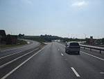
A1/Peterborough - Blyth
Route
Starting to the west of Peterborough, where the A1(M), meets the A605, the A1139 and of course, the continuation of the A1, the quality of the route drops considerably from that of the previous several miles of 1990's motorway. Following the alignment of Ermine Street, almost immediately the East of England Showground can been seen to the east, before passing under the A605, after which the current line of the A1 separates from Ermine Street, not meeting again, for several miles.
Although a reasonable quality of dual carriageway, this section of the A1 falls short of modern standards, with accesses, gaps in the central reserve and poor quality junctions providing historical access rights to villages bypassed in the 1950s and 1960's as the A1 was improved to full dual carriageway standards. We pass Water Newton, Stibbington and Wansford, which features an odd short length of A Class road, the A6118, which seems to be a forgotten relic of an older age, before passing under the A47, former Birmingham to Great Yarmouth trunk road.
Continuing north, the route passes to the east of the sleepy village of Thornhaugh and the less than quiet village of Wittering, which has been consumed by the RAF base of the same name. RAF Wittering is currently the "Home of the Harrier", previously serving as home to nuclear armed Valiant and Victor bombers, a fighter base in the Second World War and base for anti Zeppelin operations in the First World War.
Just to the north of Wittering, the current line of the A1 opened in 1960 deviates to the west of the original route through Stamford at the junction with the B1081, which was grade separated in 2009. Dropping over the ridge near Burghley Park, the mainline drops down into the valley below to pass over the A43, this section (as of Nov 2009) features a ban on HGV's using lane 2 of the A1 heading southbound. The route passes over the River Welland, then in the climb up the opposite hillside, we pass under the A6121 and A606, before cresting the next ridge and rejoining the old line of Ermine Street and the former A1 at the junction with the B1021.
The next several miles consists of a series of unremarkable long straights, passing Tickencote Park, Stretton (and the B668), RAF Cottesmore, South Witham, before reaching Colsterworth. The Colsterworth Bypass links with the B6403 north and south of the village and with the A151 and B676 midway along the bypass. The A1 pretty much follows the same route as the original single carriageway along much of this length. As we head further north, we pass under the Stainby and High Dyke branch of the London and North Eastern Railway, then skirt past the villages of Easton, Stoke Rochford, through Great Ponton and pass Little Ponton, where the B1174 leaves the current alignment to follow the old line of the A1 through Grantham. A new junction has been opened just to the north of the point where the B1174 diverges to accommodate the southern relief road of Grantham, this junction opened in December 2022.
The Grantham bypass opened in 1960, was built considerably further west of the market town than was required, the land between has accommodated the gradual expansion of the town. We pass along almost a facsimile of a route around Stamford, passing over the A607, then under the A52 former Nantwich to Mablethorpe trunk road, before reaching the B1174 again at Gonerby Moor, which was rebuilt from a roundabout to a grade separated dumb bell junction in 2009.
Rejoining the original line, across a flat plain landscape we head towards Newark-on-Trent via Foston, to the west of Long Bennington on yet another bypass, before reaching the B6326, which takes the former route of the A1 through the market town of Newark-on-Trent. Again, like Grantham, the bypass stretches out much further east than was required at the time, again accommodating later expansion of the town. About halfway along the Newark-on-Trent Bypass, which was opened in 1964, there is a very significant junction, perhaps the busiest in the area, where the A1, meets the A46 former Bath to Grimsby and A17 former Newark-on-Trent to King's Lynn trunk road. The junction was originally the intersection of the A1 and A46, however later improvements to the A17 rerouted the A17, so that three key routes met at a single point, leaving a dire need for further improvements, once the improvements to the A46 south west of Newark-on-Trent are complete.
A series of bridges take the A1 over the flood plains of the River Trent, firstly a bridge over the Nottingham and Lincoln railway, then over the River Trent, then two more than are specifically over a waterway, but are designed to allow flood water from the plain to pass the embankment that the A1 is constructed on. The A1 rebounds off the old L&NER route, now the ECML (East Coast Main Lane), where the new, takes up the old route at the junction with the B6325 to pass just to the west of North Muskham, following the old line of the A1 to Carlton-on-Trent, where it meets the B1164 (the old line of the A1), with a minor diversion to the east of Cromwell.
Pretty much all of the current route from here to Adwick le Street (Doncaster) follows an independent route to that of the original A1. Opened in the early 1960's a pair of shallow curves takes the A1 through a pretty unremarkable farm landscape to the village of Tuxford, where it charges right through the village, crossing the old line (B1164) and crosses the A6075, then twisting westward to meet the old line (B1164) at Markham Moor, where until 2009, an earth ramp signaled a future dream to build a major grade separated junction with the A57 and old line of the A1, now the A638, but ended up being a shadow of the dream with a modern compact dumbbell grade separated junction.
The next section, opened originally as the A57, is the first sign of a significant change in the route of the A1 and perhaps an early pre motorway era indication, that key strategic routes where going to avoid major towns and city, passing close enough to be of use, but far enough away to be unaffected by traffic congestion. The Markham Moor to Elkesley section opened in 1957 including a new junction with the B6387, the Elkesley Bypass opened earlier in the 1950's and the Elkesley to Apleyhead section opening in 1958. A noteworthy landmark on this section is the little know Retford Airport, formally Gamston Aerodrome, which came into service in 1942 firstly as a training unit, then later for Bomber Command operating with Wellington Bombers.
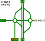
Apleyhead, also known locally as the Dukeries Roundabout and Five Lanes End, was opened in 1958 as part of the Elkesley to Apleyhead section, the junction was improved significantly in 2009 using the old roundabout as the western end of a dumbbell junction, pushing the mainline of the A1 eastwards to create a shallow curve between the previous alignments north and south, which previously had a 45 degree elbow at the old roundabout. The current junction, links the A1 with the A57, A614 and the B6420, the latter previously linked to the A1 at a "T" junction about a quarter of a mile south of the roundabout.
The final leg of this section before reaching the motorway at Blyth, passes through yet more unremarkable farm landscapes, the first 1.5 miles to Ranby was opened in 1959. At Ranby the A620 and B6079 meet the A1, the B6079 being noteworthy as a duplicated number between c1980 to 2008, the other B6079 being the former A616 Middlewood Road / Langsett Road. The section between Ranby and Blyth was opened a year after the A1(M) Doncaster Bypass, in 1962, the previous alignment being the old line of the A614, which before upgrading to dual carriageway, was a reasonably good quality link.
The final part in this section of the journey is the Blyth Bypass, which was constructed along with the section of the A1(M) that is in Nottinghamshire as part of the larger A1(M) scheme, although under a separate contract to a West Riding specification. This explains the special feature of the bypass, i.e. it has hard shoulders, although, as with the whole of the Doncaster Bypass, these are currently substandard at 2.75m in width. The Blyth Bypass was opened in December 1960, with the Doncaster Bypass to the north opening in July 1961.
Blyth village historically was the crossroads of the A614 and A634, with the construction of the bypass, linkage was retained to the then new A1, by reclassification of the last bit of the A614 to become a spur of the A634. The timescale for the reclassification of the section to the north is unclear, but could have occurred at the same time as when the old line of the B6045 to the south of Blyth was improved. The old line of the B6045 originally turned sharply onto the single track Plantation Lane to meet the A1 south of Blyth.
The junction at Blyth was originally a roundabout, this would have signified the end of motorway restrictions to drivers, current design methods place less significant emphasis on these psychological signals to drivers and in 2009, a revised grade separated junction was opened to relieve congestion at the junction, requiring signs to indicated that non motorway traffic has to leave the route.
History
Much of the existing line of the A1 on this section follows close to the historic line of the A1, generally bypassing most settlements with the significant exception of the section north of Markham Moor, where the existing line multiplexes with the A57 to the junction with the A615 then multiplexes with the A615 to the A1(M) at Blyth.
A series of bypasses where constructed through the 1950s and 1960's around market towns in the midland and the new suburban commuter areas of Middlesex. These schemes massively reduced travel times on the Great North Road and provided vital relief for traffic choked towns.
Improvements
In an effort to reduce delays at several roundabouts on the non motorway sections of the A1, a series of improvements were undertaken to replace the roundabouts with grade separated junctions.
In 2018 work started to construct a new grade separated junction south of Grantham, to link the A1 with the A52 Grantham Southern Development Route.
Notable Locations
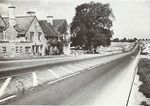
Until recently a roundabout, traffic passes Blyth Interchange without delay.
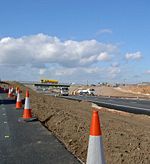
Passing to the east of the original roundabout and mainline of the A1, Apleyhead junction created almost 2 miles of new dual carriageway.
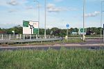
Construction of a new junction at Markham Moor involved reversing the previously engineered flyover approach of the mainline to place the junction above the mainline, reducing the visual impact on nearby homes.
Future
There are current proposals to improve access to the village of Elkesley by means of a new bridge over the A1 and new left-in-left-out slips, affectively a grade separated junction (see: Elkesley Junction). A number of right and U turns will be removed, which will enable the current 50 mph speed limit to be raised to national north of Elkesley, suggesting that the 50 mph will remain past Elkesley. The scheme was part of a dual improvement, that would have seen the junction with the B6387 improved, however a proposed major development is likely to affect that junction and is likely to attract developer funding once the details of the development are finalised.
Another proposal could see a new grade separated access to the village of Wittering, with improved left-in-left-out slips and closing existing gaps in the central reserve. The scheme is currently held in late stages of planning and is likely to go through the Development Consent Order process.
Other than the above and a few minor schemes to close gaps in the central reserve, nothing significant is planned for this section of the A1.
Links
London Gazette
Roads.org.uk
SABRE Forums
Roads UK
Other
| A1 | ||||||||||||||||
| ||||||||||||||||
| ||||||||||||||||
| ||||||||||||||||
| ||||||||||||||||
| ||||||||||||||||
| ||||||||||||||||
| ||||||||||||||||
| ||||||||||||||||
| ||||||||||||||||
| ||||||||||||||||
|

