Newark Southern Link Road
Jump to navigation
Jump to search
| Newark Southern Link Road | |||
| Location Map ( geo) | |||
 | |||
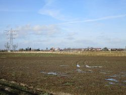
| View of the Southern Link Road | |||
| |||
| Scheme Type | |||
| bypass | |||
The Newark Southern Link Road is a new distributor road to the south of Newark. It links the A46 and A1 at Balderton Interchange.
It is expected to cost around £47m and includes a new crossing of the River Devon. It is due to be completed by March 2020 and will, when complete open up 278ha of land to new development
The relief road is being built in three phases:
- Phase I - central stretch of road between Staple Lane and Bowbridge Lane (opened in late 2016)
- Phase II - eastern stretch linking Staple Lane and the Balderton Interchange
- Phase III - western stretch linking Bowbridge Lane and the A46
The route was also considered as an option for the 2020 A46/Newark Bypass Improvements consultation, but was ruled out at the pre-consultation phase.
Links
Newark Advertiser
| Newark Southern Link Road | ||||
| ||||
|

