A1105
| A1105 | ||||||||||
| Location Map ( geo) | ||||||||||
| ||||||||||
| From: | Hessle (TA019265) | |||||||||
| To: | Hull (TA092286) | |||||||||
| Distance: | 4.8 miles (7.7 km) | |||||||||
| Meets: | A15, A164, B1232, A1166, B1231, A1079 | |||||||||
| Former Number(s): | A164, A63 | |||||||||
| Old route now: | A1166, A63 | |||||||||
| Primary Destinations | ||||||||||
| Highway Authorities | ||||||||||
| Traditional Counties | ||||||||||
| Route outline (key) | ||||||||||
| ||||||||||
Route
The A1105 is an urban road to the west of Kingston upon Hull.
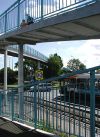
The road starts at the roundabout at the northern end of the Humber Bridge, where it meets the A15 and A164. It heads east along the dual-carriageway Boothferry Road, passing to the north of Hessle. There are glimpses of fields to the left to begin with but on the whole this road is urban and lined with houses from the outset. There are side roads accessed by gaps in the central reservation, with the occasional roundabout serving more important roads. The first, with the B1232, has a pedestrian footbridge over the top of the roundabout.
After passing Anlaby Park the A1166 heads off to the right at another roundabout and the A1105 bears slightly left. It goes under a freight-only railway line to meet the B1231 at a roundabout then continues eastwards once more, narrowing to S2 almost immediately. Now called Anlaby Road, there is another dualled section across the main railway line into Hull (this replaces a closed level crossing) alongside West Park. After narrowing once more the road passes the Royal Infirmary before running alongside the railway station to end at traffic lights on the A1079 in the city centre.
History
The history of the A1105 is somewhat involved.
The road did not exist in 1922. Anlaby Road was the original eastern end of the A164, which ended on the A63 Midland Street just to the west of where the A1079 is now, whereas Boothferry Road had not been built. The latter new Hessle Bypass road was given the A1105 number on opening on 28 January 1930 (the section from Anlaby Road to Pickering Road had opened on 26 March 1926). Its original western end was on the A63 Ferriby Road, just to the west of the current western end of the A1105.
The A1105 and A164 route into Hull from the west avoided the route through the centre of Hessle taken by the A63 and so the former was made the trunk route, with the 1946 Ten-Mile Map suggesting that the A1105 had been extended into the centre of Hull along what was the A164. As traffic was directed this way it made sense for road numbering to follow suit and so the A1105 and A63 swapped numbers within a few years, with the A63 following the route detailed above and the A1105 running along Ferriby Road and Hessle Road, although the two end points remained the same.
More recently, the new Clive Sullivan Way has been built further south as the main road into Hull from the west. The A63 has naturally taken on this route, with the A1105 reverting to its old route, although the ends have moved slightly owing to road improvements. The 1950s version of the A1105 is now largely unclassified, although the A1166 and A63 both follow Hessle Road for short distances.


