A15 (Jersey)
Jump to navigation
Jump to search

| A15 | ||||
| Location Map ( geo) | ||||
| ||||
| St Clements Way | ||||
| From: | Havre des Pas (XD929803) | |||
| To: | Howard Davis Park (XD928799) | |||
| Distance: | 0.3 miles (0.5 km) | |||
| Meets: | A4, A17, A3 | |||
| Highway Authorities | ||||
| Traditional Counties | ||||
| Route outline (key) | ||||
| ||||
This article is about the Jersey A15.
For the British A15, see A15.
For the Manx A15, see A15 (Isle of Man).
For the British A15, see A15.
For the Manx A15, see A15 (Isle of Man).

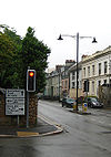
The A15/A17 junction
Beginning at a mini roundabout on the A4, the A15 heads north through the eastern part of St Helier. It crosses a signalised crossroads with the A17, north of which the road is one-way, northbound only. It ends at a complicated junction at the entrance to Howard Davies Park on the ring road, with a filter lane to the eastbound A3, going against the main section of the A3. This allows right turning traffic to avoid the crossroads between the A3 and A6.

