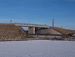
A1(M) Dishforth to Barton
| A1(M) Dishforth to Barton | |||
| Location Map ( geo) | |||
 | |||
| |||
| Scheme Type | |||
| Upgrade to motorway | |||
| Construction Start Date | |||
| 2009 | |||
| Opening Date | |||
| 2018 | |||
| On road(s) | |||
| A1(M) | |||
The A1(M) from Dishforth to Barton is a mostly-online upgrade of the A1 dual carriageway between junctions 49 and 56. It was upgraded in two related schemes: the Dishforth to Leeming scheme (junction 49 to 51) which started in 2009 and was completed in 2012, and the Leeming to Barton scheme (junction 51 to 56), which was completed in 2018.
Dishforth to Leeming scheme
Upgrade to full three lane motorway standard, Dishforth to Leeming scheme work started on site in March 2009 for completion in 2012.
Initially the entire Dishforth to Barton stretch was going to be upgraded as part of this scheme, but then the Leeming to Barton stretch was put on hold.
Leeming to Barton scheme
The Leeming to Barton scheme was initially put on hold but then resurrected.
Much of the new motorway paralleled the existing A1, with a diversion from the existing line of the A1 at Marne Barracks in Catterick. A new junction, Catterick Central Interchange, has been built; several former A1 junctions were closed with access being transferred to the new A6055 local access road.
Construction started in March 2014, with the improvements fully opening to traffic in March 2018. By May 2018, all works were complete.
Links
National Highways
- A1 Dishforth to Barton Improvement Scheme
- A1 Dishforth to Leeming Improvement Scheme (A1 Dishforth to Barton)
legislation.gov.uk
- The A1 Motorway (North of Leeming to Scotch Corner Section and Connecting Roads) Scheme 1996 - this legislation relates to an unbuilt alignment and is revoked by 2008/2253
- The A1 Trunk Road (Dishforth to Barton) (Detrunking) Order 2008 - Orders to de-trunk the old A1 once the A1(M) special road opens
Pathetic Motorways
Roads UK
SABRE forum topics


