Star.pngStar.pngStar grey.pngStar grey.pngStar grey.png

A1/Named Junctions

From Roader's Digest: The SABRE Wiki
< A1(Redirected from A1 Named Junctions)
Jump to navigation Jump to search

Central London - South Mimms

Main Article: A1 Central London - South Mimms
Image Name Classified Road(s) Grid Reference More Info Map
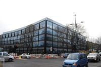
Angel Building - Geograph - 2917437.jpg Angel A401 / A501 TQ314831
SABRE • Google • geo
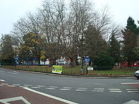
Highbury Corner, London N5 - Geograph - 1063990.jpg Highbury Corner A1199 / A1200 TQ316847
SABRE • Google • geo
Photo-required.png Nags Head A503 TQ304860
SABRE • Google • geo
Archway, London N19 - Geograph - 1638618.jpg Archway A400 / B519 TQ293869
SABRE • Google • geo
Henlys Corner - Geograph - 187659.jpg Henlys Corner A406 / A598 TQ247894
SABRE • Google • geo
M1 Junction 2 - Coppermine - 11445.jpg Fiveways Corner A41 / M1 TQ222906
SABRE • Google • geo
Mill Hill Circus - Geograph - 1751947.jpg Mill Hill Circus A5100 / B1461 TQ216923
SABRE • Google • geo
Mill Hill- Apex Corner, NW7 - Geograph - 92471.jpg Apex Corner A41 / A5109 TQ208928
SABRE • Google • geo
Borehamwood- A1-A411 Stirling Corner roundabout - Geograph - 4375454.jpg Stirling Corner A411 TQ208952
SABRE • Google • geo

South Mimms - Peterborough

Main Articles: A1(M) South Mimms - Baldock • A1 Baldock - Alconbury • A1(M) Alconbury - Peterborough

Image Name Classified Road(s) Grid Reference More Info Map
Bignells Corner.jpg Bignell's Corner
Junction 1
M25 / A1081 TL224001 Unofficially called South Mimms, after the services accessed by the junction.
SABRE • Google • geo
Approaching junction 2 northbound - Geograph - 2513444.jpg Roestock
Junction 2
A1001 TL213062
SABRE • Google • geo
Junction 3 northbound on A1(M) - Geograph - 2513463.jpg Roehyde
Junction 3
A414 / A1001 TL210074
SABRE • Google • geo
The A414 junction with the A1.jpg Oldings Corner
Junction 4
A414 / A1001 / A6129 TL224104
SABRE • Google • geo
Photo-required.png Lemsford Interchange
Junction 5
B195 / B197 TL224658
SABRE • Google • geo
Derelict hotel on A1000 Welwyn - Geograph - 2536360.jpg The Clock
Junction 6
A1000 / B197 / B656 TL234157
SABRE • Google • geo
The A1(M) at Stevenage - Geograph - 4550044.jpg Langley Sidings
Junction 7
A602 TL232225
SABRE • Google • geo
Almost at junction 8 - A1(M) - Geograph - 2458253.jpg Coreys Mill
Junction 8
A602 / B197 TL222273
SABRE • Google • geo
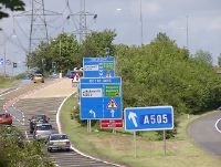
Jct 9 Northbound - Coppermine - 11945.JPG Letchworth Gate
Junction 9
A505 TL233309
SABRE • Google • geo
Photo-required.png Stotfold Interchange
Junction 10
A507 TL238502
SABRE • Google • geo
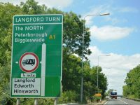
A1 approaching the Langford Turn - Geograph - 4653855.jpg Langford Turn TL215403
SABRE • Google • geo
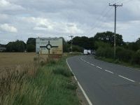
Photo-required.png Edworth Turn TL214407
SABRE • Google • geo
A1, northbound - Geograph - 4653905.jpg Biggleswade South Roundabout A6001 TL204429
SABRE • Google • geo
Hill Lane (B658) - Geograph - 4620486.jpg Biggleswade North Roundabout A6001 / B658 TL215926
SABRE • Google • geo
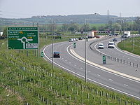
Black Cat Roundabout.jpg Black Cat Roundabout A421 / A428 TL159554
SABRE • Google • geo
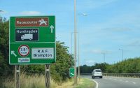
Road sign by the A1 - Geograph - 4668267.jpg Brampton Interchange B1514 TL174223
SABRE • Google • geo
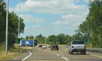
Brampton Hut.jpg Brampton Hut A14 / A141 TL194719
SABRE • Google • geo
The A1 becomes the A1(M) - Geograph - 4668500.jpg Alconbury South B1043 TL188752
SABRE • Google • geo
Alconbury North Interchange.jpg Alconbury North
Junction 14
A14(M) TL188770
SABRE • Google • geo
Photo-required.png Sawtry Interchange
Junction 15
B1043 TL188752
SABRE • Google • geo
Brick Patterns, Norman Cross - Geograph - 885202.jpg Norman Cross
Junction 16
A15 / B1043 TL159907
SABRE • Google • geo
Photo-required.png Fletton Parkway Interchange
Junction 17
A605 / A1139 TL15369
SABRE • Google • geo

Peterborough - Darrington

Main Articles: A1 Peterborough - Blyth • A1(M) Blyth - Adwick le Street • A1 Adwick le Street - Darrington

Image Name Classified Road(s) Grid Reference More Info Map
WansfordA1a.jpg Wansford Interchange A47 / A6118 TF013572
SABRE • Google • geo
A1 approaching junction with B1081 - Geograph - 3460063.jpg Carpenters Lodge B1081 TF036045
SABRE • Google • geo
Photo-required.png Wothorpe Junction A43 TF100375
SABRE • Google • geo
Photo-required.png Stamford Interchange A606 TF100143
SABRE • Google • geo
Colsterworth new junction - Coppermine - 22395.JPG Colsterworth Interchange A151 / B676 SK936238
SABRE • Google • geo
A1 - B1174 exit ahead - Geograph - 2644173.jpg Little Ponton Interchange B1174 SK919319
SABRE • Google • geo
Photo-required.png Spittlegate Junction A52 SK910333
SABRE • Google • geo
GranthamBypass62b.jpg Harlaxton Road Interchange A607 SK898342
SABRE • Google • geo
A1 turn off for A52 - Geograph - 3454461.jpg Barrowby Interchange A52 SK886365
SABRE • Google • geo
A1 at Gonerby Moor - Geograph - 215766.jpg Gonerby Moor B1174 SK887400
SABRE • Google • geo
Brownhills Leisure World and A1 from the... (C) Ian Paterson - Geograph - 409610.jpg Winthorpe A17 / A46 / B6166 SK812559
SABRE • Google • geo
A1 northbound - Geograph - 3768795.jpg Carlton on Trent Interchange B1164 SK758637
SABRE • Google • geo
A1 Southbound - Geograph - 1327185.jpg Tuxford Interchange A6075 / B1164 SK737494
SABRE • Google • geo
The new Markham Moor Junction - Geograph - 1327166.jpg Markham Moor A57 / A638 / B1164 SK719736
SABRE • Google • geo
A1, northbound - Geograph - 4790277.jpg Twyford Bridge Interchange B6387 SK698752
SABRE • Google • geo
The new roundabout and bridge over the A1 at what was 5 lane ends - Geograph - 1126558.jpg Apleyhead A57 / A614 / B6420 SK646782
SABRE • Google • geo
WP 20160522 17 47 37 Pro.jpg Ranby Interchange A620 / B6079 SK635629
SABRE • Google • geo
Almost there on the A1 at Blyth Notts - Geograph - 717256.jpg Blyth Interchange
Junction 34
A614 / B6045 SK623883
SABRE • Google • geo
Piggy back onto the M18 - Geograph - 546085.jpg Wadworth Viaduct
Junction 35
M18 SK565984
SABRE • Google • geo
Photo-required.png Warmsworth Interchange
Junction 36
A630 SE529831
SABRE • Google • geo
The A635, Junction 37 with the A1(M) - Geograph - 282379.jpg Ducker Holt
Junction 37
A635 SE525053
SABRE • Google • geo
Photo-required.png Redhouse
Junction 38
A638 SE521093
SABRE • Google • geo
A1 - approaching Barnsdale Bar - Geograph - 2646326.jpg Barnsdale Bar A639 / A6021 SE508137
SABRE • Google • geo

Darrington - Scotch Corner Junctions 40-55

Main Articles: A1(M) Darrington - Dishforth • A1 Dishforth - Barton

Image Name Classified Road(s) Grid Reference More Info Map
Photo-required.png Darrington Interchange
Junction 40
A162 SE469436
SABRE • Google • geo
New Interchange A1(M) - M62 Ferrybridge - Geograph - 56468.jpg Holmfield
Junction 41
M62 SE468242
SABRE • Google • geo
Photo-required.png Selby Fork Interchange
Junction 42
A63 SE44558
SABRE • Google • geo
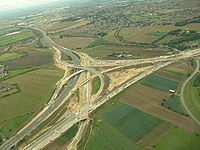
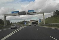
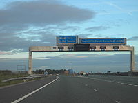
A64 - A1 Junction - Geograph - 253792.jpg Hook Moor
Junction 43
M1 SE433352
SABRE • Google • geo
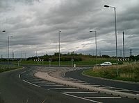
Bramham Crossroads - Geograph - 44584.jpg Bramham Crossroads
Junction 44
A64 SE431401
SABRE • Google • geo
Photo-required.png Grange Moor Roundabout
Junction 45
A659 SE408458
SABRE • Google • geo
Photo-required.png Kirk Deighton Interchange
Junction 46
B1224 SE402658
SABRE • Google • geo
Photo-required.png Allerton Park Interchange
Junction 47
A59 SE392645
SABRE • Google • geo
Photo-required.png Aldborough Gate Interchange
Junction 48
A6055 / A168 SE378825
SABRE • Google • geo
A1 - A168 (A19) Junction - Geograph - 257031.jpg Dishforth
Junction 49
A168 SE369729
SABRE • Google • geo
A1(M) junction 50 - Geograph - 3145891.jpg Baldersby
Junction 50
A61 SE353763
SABRE • Google • geo
Photo-required.png Leeming
Junction 51
A684 SE278904
SABRE • Google • geo
Photo-required.png Catterick Central
Junction 52
A6136 SE230979
SABRE • Google • geo
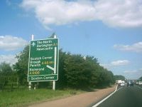
A1 sign at Scotch Corner.JPG Scotch Corner
Junction 53
A66 / A6108 / A6055 NZ215053
SABRE • Google • geo

Scotch Corner - Washington Junctions 56-65

Main Articles: A1(M) Barton - Washington

Image Name Classified Road(s) Grid Reference More Info Map
Photo-required.png Barton
Junction 56
B6275 NZ217082
SABRE • Google • geo
Photo-required.png Blackwell Spur Interchange
Junction 57
A66(M) NZ238328
SABRE • Google • geo
Photo-required.png Burtree
Junction 58
A68 NZ262179
SABRE • Google • geo
Junction 59 A1(M) - Geograph - 214439.jpg Aycliffe
Junction 59
A167 NZ283210
SABRE • Google • geo
Photo-required.png Bradbury
Junction 60
A689 NZ314286
SABRE • Google • geo
Approaching the A1 - Geograph - 1905180.jpg Bowburn
Junction 61
A177 / A688 NZ308374
SABRE • Google • geo
Photo-required.png Carrville
Junction 62
A690 NZ302444
SABRE • Google • geo
Photo-required.png Blind Lane
Junction 63
A167 / A183 / A693 NZ279524
SABRE • Google • geo
Photo-required.png Vigo Interchange
Junction 64
A195(M) / A195 NZ282367
SABRE • Google • geo
Photo-required.png Birtley Interchange
Junction 65
A194(M) / A1231 NZ282567
SABRE • Google • geo

Washington - Edinburgh

Main Articles: A1 Washington - Morpeth • A1 Morpeth - Dunbar • A1 Dunbar - Portobello • A1 Portobello - Central Edinburgh
Image Name Classified Road(s) Grid Reference More Info Map
Photo-required.png Harlow Green
Junction 66
A167 / B1295 NZ266575
SABRE • Google • geo
Photo-required.png Coalhouse Interchange
Junction 67
(B1426) NZ266430
SABRE • Google • geo
Photo-required.png Lobley Hill Interchange
Junction 68
A692 / B1426 NZ219712
SABRE • Google • geo
Photo-required.png Gateshead Quays Interchange
Junction 69
A184 NZ219731
SABRE • Google • geo
Photo-required.png Dunston Interchange
Junction 70
(B6317) NZ269843
SABRE • Google • geo
Photo-required.png Metro Centre Interchange
Junction 71
(A1114) / (B6317) NZ219947
SABRE • Google • geo
Photo-required.png Swalwell Interchange
Junction 72
B6317 NZ269986
SABRE • Google • geo
Photo-required.png Derwenthaugh Interchange
Junction 73
A694 NZ219986
SABRE • Google • geo
Photo-required.png Scotswood Interchange
Junction 74
A191 / A6085 NZ219986
SABRE • Google • geo
Photo-required.png Denton Burn Interchange
Junction 75
A69 / A186 NZ212529
SABRE • Google • geo
Photo-required.png Westerhope Interchange
Junction 76
A167 / B6324 NZ211947
SABRE • Google • geo
Photo-required.png Kenton Bar
Junction 77
A167 / A696 / B6918 NZ211679
SABRE • Google • geo
Photo-required.png Fawdon Interchange
Junction 78
(B1318) NZ211352
SABRE • Google • geo
Photo-required.png North Brunton Interchange
Junction 79
A1056 / B1318 NZ210325
SABRE • Google • geo
Photo-required.png Seaton Burn
Junction 80
A19 / A1068 / B1318 NZ200945
SABRE • Google • geo
Photo-required.png Denwick Interchange B1340 NU200143
SABRE • Google • geo
Photo-required.png Charlton Mires B6341, B6347 NU176205
SABRE • Google • geo
The Spott road heading to its junction with the A1 trunk road - Geograph - 1220952.jpg Spott Roundabout NT680773
SABRE • Google • geo
Looking back on the B6370 - Geograph - 1221106.jpg Thistly Cross Roundabout A199 / B6370 NT649774
SABRE • Google • geo
Photo-required.png Abbotsview Junction A199 / A6093 NT517746
SABRE • Google • geo
Photo-required.png Oaktree Junction B6471 / A199 NT488738
SABRE • Google • geo
Photo-required.png Gladsmuir Junction B6363 NT450733
SABRE • Google • geo
A198-A1 junction - Geograph - 410642.jpg Bankton Junction A198 / B6371 NT404736
SABRE • Google • geo
Photo-required.png Old Craighall Junction A720 / B6415 NT337706
SABRE • Google • geo


A1
Sections
Projects
Junctions
Services
Crossings
Roads
Places
Miscellaneous
Related Pictures
View gallery (591)
Old A1 south - Geograph - 381111.jpgHenlys Corner - Geograph - 187659.jpg20160605-1935 - Old A1 Catterick Central junction from new motorway - 54.370595N 1.636547W.jpgPonteland Road (B6918) - Geograph - 3584609.jpgA1246 (old A1) Fairburn - Coppermine - 21253.JPG
Named Junction Lists
Motorways: M1  • M5  • M18  • M25 & A282  • M27 & Spurs

A roads: A1  • A2  • A3  • A4  • A5  • A6  • A7  • A8  • A9  • A10  • A11  • A12  • A13  • A14  • A15  • A16  • A17  • A18  • A19  • A20  • A21  • A22  • A23  • A24  • A25  • A26  • A27  • A28  • A29
A30  • A31  • A32  • A33  • A34  • A35  • A36  • A37  • A38  • A39  • A40  • A41  • A43  • A44  • A45  • A46  • A47  • A48  • A49  • A50  • A51  • A52  • A53  • A54  • A55  • A56  • A57  • A58  • A59
A60  • A61  • A62  • A63  • A64  • A65  • A66  • A68  • A69  • A70  • A71  • A72  • A73  • A74  • A75  • A76  • A77  • A78  • A79  • A80  • A81  • A82  • A83  • A84  • A85  • A86  • A87  • A88  • A89
A90 & M90  • A91  • A92  • A205  • A303  • A404  • A406  • A483

Places: Basingstoke  • Birmingham  • Bournemouth & Poole  • Central London  • Crawley  • Cumbernauld  • Derby  • Doncaster  • Falkirk & Grangemouth
Limerick  • Manchester  • Milton Keynes  • Southampton  • Telford  • Wolverhampton


SABRE - The Society for All British and Irish Road Enthusiasts
Discuss - Digest - Discover - Help