A2047
| A2047 | |||||||
| Location Map ( geo) | |||||||
| |||||||
| From: | Hilsea (SU656037) | ||||||
| To: | Fratton (SU651000) | ||||||
| Via: | North End | ||||||
| Distance: | 2.7 miles (4.3 km) | ||||||
| Meets: | A288, M275, A3, B2152, A2030 | ||||||
| Former Number(s): | A3, B2151 | ||||||
| Highway Authorities | |||||||
| Traditional Counties | |||||||
| Route outline (key) | |||||||
| |||||||
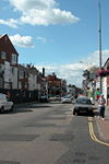
The A2047 runs entirely as an urban road through residential parts of Portsmouth. Since the whole of Portsmouth was re-signed in the early 21st century (I can't recall the exact year) the road's designation does not appear on any signpost, anywhere in the city.
We begin at a small one-way loop with the A288 in Hilsea, about 300 yards short of its own northern terminus on the A3. The junction is commonly known as "The Coach and Horses Roundabout" after the pub you will find at the Northern side of the loop. We now head south on London Road (the original line of the A3) through Hilsea and North End.
At the centre of North End, a short spur of the A2047 (still being the old A3) leaves at a signal-controlled junction and travels along Kingston Crescent to meet the A3 and M275 at the Rudmore Roundabout. This roundabout also serves as the entry point to the Continental Ferry Port and also to Whale Island (a naval training facility), and is terribly congested in peak times.
From here we are running on Kingston Road (now the old B2151), where we encounter the B2152 Lake Road junction, which would take us straight to Portsmouth city centre. Our road continues south onto Fratton Road, past St Mary's Church (probably the oldest remaining building in Portsmouth) and into Fratton (surprisingly enough!) Here we find the terminus of the road, which occurs at a roundabout junction with the A2030 next to Fratton station.
The route is characterised along most of its length by rather boring terraced housing, the occasional block of 3-storey flats, and the usual array of small-town shops that you tend to find away from the main city centre, as well as a constant supply of buses (this is the main bus route into Portsmouth) and frequent traffic lights. Centre road markings are also apparently optional, as they frequently vanish.

