A272/Haywards Heath Relief Road
| A272 Haywards Heath Relief Road | |||
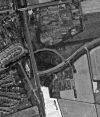
| Location Map ( geo) | |||
 | |||
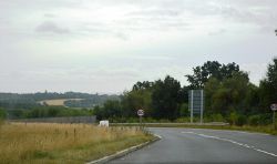
| Eastern end of the Relief Road | |||
| |||
| From: | Tylers Green, Cuckfield | ||
| To: | The Birch Hotel, Haywards Heath | ||
| Scheme Type | |||
| Relief Road | |||
| Construction Start Date | |||
| 2000 | |||
| Opening Date | |||
| 2015 | |||
| On road(s) | |||
| A272 | |||
Overview
The Hayward Heath relief road was built between 2000 and 2015 to the south of the town, the previous route was renumbered B2272. The new Relief road is mostly new and was built as S2, a small section of road was pre existing to the south on the route of the C307 (West Sussex).
The Relief road has 7 roundabouts, 6 t junctions and 1 bridge over the railway line. The road is subjected to a range of speed limits; 30, 40, 50 & NSL.
Plans
Mid Sussex needed to build more homes and decided to expand Haywards Heath, the outcome of this was a new village to be built on greenfield to the south west of the town, an area which was mostly woodland, part of the contract of building the village was to build a new road to relieve traffic from the town centre by taking it around the town on its southern edge.
Route
The Route while heading West to East. Leaving cuckfield along the original route of the A272 you take the right turn at Butlers Green Roundabout as you have to TOTSO. Here you follow the realigned Isaacs Lane which was originally part of the B2028 and then A273 before 2015. This section of road is subjected to a 40MPH speed limit. Then you get to Bolnore Roundabout where you can enter the village of Bolnore and also the end of the A273 which takes the name of Isaacs Lane. The A272 continues south and is now called Traunstein Way, named after the twinned town in Germany, Traunstein. This section of road is subjected to NSL and is dead straight. Then you get to Lower Village Roundabout which provides access to Bolnore Village, then the road is subjected to a 40MPH speed limit again until gets to Highbank Roundabout where the C307 heads south called Rocky Lane and also access to Bolnore Village to the North. Here the A272 gets the name Rocky Lane and heads over the new railway bridge as its speed limit drops to 30MPH. At the next roundabout Sandrocks Roundabout Rocky Lane joins its old alignement, this roundabout provides access to a new housing development to the south and access to old properties on the old alignment of the Rocky Lane. Then the A272 follows the old Rocky Lane until it meets the B2112 at Foxhill Roundabout. Here the A272 follows a new section of road south of the Princess Royal Hospital and North of Hurstwood Lane, this section has a 50MPH speed limit and has wide verges allowing potential future dualling or improvements. Before reaching the end of the relief road it has two T junctions providing access to Hurstwood Lane and a new housing estate, then it ends on The Birch Hotel Roundabout where it TOTSO and speed limit drops to 30MPH again.
Use
The Haywards Heath Relief road, alike Burgess Hills Relief road are known to take usually the same as the old route would take. In Haywards Heath case this is true, at very low traffic hours it is quicker and a mile shorter to take the B2272 instead, however during peak traffic the relief road can take 6 minutes while the old route would take 7 or 8 minutes.
History
2000
- Tylers Green Roundabout Created
- Isaacs Lane Realigned (A272)
- Chownes Mead Lane Access Changed
- B2184 Route shortened
- Bolnore Roundabout Created
2004
- Traunstein Way Created (A272)
- Lower Village Roundabout Created
2011
- Foxhill Roundabout Created
2012
- The Birch Hotel Roundabout Created
- Northern Access to Hurstwood Lane Closed, new access on T Junction on Rocky Lane (A272)
- Rocky Lane (A272) Partially opened for local traffic and through route for Hurstwood Lane
2014
- Rocky Lane (A272) Fully Opened
- Rocky Lane (A272/C307) Straightened
- Rocky Lane (A272/C307) Realigned (but not opened)
- New Railway Bridge Created
- Sandrocks Roundabout Created
- Highbanks Roundabout Created but not open for traffic
2015
- Relief Road Fully Opened
- Highbanks Roundabout Opened to Traffic
- Rocky Lane (C307) Old Alignment Naturalised (Bridge remains for cyclists)


