Star.pngStar.pngStar grey.pngStar grey.pngStar grey.png

A28 (Northern Ireland)/Named Junctions

From Roader's Digest: The SABRE Wiki
Jump to navigation Jump to search
Image Name Classified Road(s) Grid Reference More Info Map
Photo-required.png Sugar Island A2, A27, A28 J085266
SABRE • Google • geo
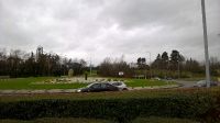
McCanns Corner-Newry-Dec2016.jpg McCann's Corner A1, A27, A28 J075282
SABRE • Google • geo
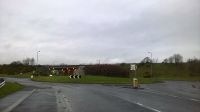
20190404-1931 - Carnbane Interchange looking west 54.201738N 6.359073W.jpg Carbane Interchange A28 J069292
SABRE • Google • geo
Photo-required.png Augher A4 H563536
SABRE • Google • geo


A28 (Northern Ireland)
Junctions
Roads
Places
Armagh • Augher • Aughnacloy • Newry
Related Pictures
View gallery (18)
Favour Royal Road, Aughnacloy - Geograph - 2685857.jpgDerrycourtney Road (A28) - Geograph - 617715.jpgArmagh to Markethill Road (A28) - Geograph - 651994.jpgA1 Northbound - Coppermine - 20034.JPG20190404-1928 - Carnbane Interchange eastern dumbbell looking north 54.20165N 6.359416W.jpg

SABRE - The Society for All British and Irish Road Enthusiasts
Discuss - Digest - Discover - Help