A38/Taunton - Highbridge
| A38 | ||||||||||
| Location Map ( geo) | ||||||||||
| ||||||||||
| From: | Taunton (ST248256) | |||||||||
| To: | Edithmead (ST335492) | |||||||||
| Distance: | 20.2 miles (32.5 km) | |||||||||
| Meets: | A358, A3259, A361, M5, A39, B3139, B3140 | |||||||||
| Primary Destinations | ||||||||||
| Highway Authorities | ||||||||||
Somerset Council | ||||||||||
| Counties | ||||||||||
Somerset | ||||||||||
| Route outline (key) | ||||||||||
| ||||||||||
Taunton - Huntworth
The A38 has had various routes through Taunton over the years. Until 1960 it came right in to the centre by Corporation Street, across The Parade (the town square) and leaving by East Street, and indeed until 1929 (when it was relocated to new premises near the railway station) the Parade had been the location of the main Taunton livestock market. Most towns have their market day midweek, but Taunton's was on Saturday, and the combination of old lorries loaded with sheep and cattle, market stalls, and summer Saturday holiday traffic to the south-west on the A38 must have been extraordinary. In 1960 a route similar to the current one was put together from assorted side streets to the south, with a one-way circuit at both ends where it joined the old route. At the east end this was northbound on Billet Street and south on Silver Street. In the 1980s Billet Street was incorporated in a new shopping development and the route was pushed furthet to the east again. After this winding it's way around the back of Tauntons Town Centre, the A38 now Multiplexes withe the A358 along the new Chritchard Parkway and Toneway to Creech Castle Crossroads, where it turns north onto the traditional route once more; the route until the 1980s here was to continue east from East Reach along Hamilton Road, and then round the long corner into Bridgwater Road. At this point, known as Halcon Corner, a longstanding semi-permanent AA roadside office (as well as a classic AA phone box) was a favourite stop for westward-bound holiday motorists, as well as the office where many in Taunton traditionally renewed their AA memberships. Almost immediately Bathpool Bridge takes us over the River Tone, and then the railway before we enter Bathpool itself. Once a small village between the river and canal, it is now rapidly being absorbed into Taunton proper, as is Monkton Heathfield to the north. The large Jaguar and Land Rover dealerships hint at the affluence and land ownership of many of the residents in the area too.
As the urban area finally comes to an end, the road opens up into a Dual Carriageway for the junction with the A3259 at Monkton Elm. This is the old route of the A361, which for many years passed around the north of Taunton. Today the A361 seems to end, as it did in 1922, at the further end of the short D2 section, at Walford Cross. Obviously, after some convoluted multiplexing, the A361 does reappear many miles to the south as it crosses Devon from Tiverton to Barnstaple. The southbound carriageway of the dualled road has been hatched out substantially to allow for turning traffic, but heading north it is still mostly 2 lanes until we reach the top of Adsborough Hill, although latterly as a S2+1 layout, where the old 'suicide lane' has been reinstated as an overtaking lane for northbound traffic up the hill.
Much of this stretch of the A38 was rebuilt as a S3 with suicide lane up the middle in the 1930s-60s, before the M5 had reached this far south. The reason was that this was one of the main routes into the South West, always prime holiday destinations, and the volume of traffic on summer weekends resulted in huge jams at times. After the opening of the M5, the route was eventually relined as a WS2 in an attempt to reduce accidents, but in recent years the two main running lanes have once more been reduced to their original width. This allows the central lane to be used for climbing lanes, turning lanes or just left hatched out.
As the climbing lane comes to an end at the top of the hill, a slip lane signed for Thurloxton leads first into Adsborough Bypass. This is the original, 1922, route of the A38, with a new route having been built to bypass Adsborough. The old road is still open to traffic, and largely as it was when the bypass was built, seemingly in the 1930s. The regular bus service from Taunton to Bridgwater long continued to turn along the old road through the village. North of Adsborough, the road becomes S2+1 again, with a long layby on the southbound side showing the original route, before opening up into a short dualled section, which allowed the southbound buses to make their right turn into the village in a protected manner.
The next section has largely been left as a wide single carriageway, albeit with plenty of room for safe overtaking. A farm entrance on the right reveals a short realignment, and then as we enter the speed limit for North Petherton, a pair of laybys show further realignments. Despite the appearance on the map, the A38 has always followed Fore Street through North Petherton, it is probable that the route via High Street and North Street was replaced in the Turnpike era, and indeed High Street today is unexpectedly a narrow country lane without shops. To the north of this small town, the former gap to Bridgwater is slowly being filled with industrial units, and a new housing development accessed from the Huntworth Roundabout.
Through Bridgwater
The Huntworth Roundabout provides access to the M5 Interchange, via a short dualled spur between the two roundabouts. Back on the main route, the OS mark the A38 as being briefly dualled north of the Roundabout, however this is nothing more than a generous flared approach. A little further on, the road swings left, with a layby on the right showing a minor realignment, and we are now on Taunton Road, which, after another roundabout will lead us right into the town centre. It will be slow, however, with traffic lights and pedestrian crossings regularly forcing traffic to a crawl. To the right is the Bridgwater and Taunton Canal, which is crossed on a slightly humped bridge. To the left is the Hamp Estate, one of several large post-war housing estates built in Bridgwater as it developed as a major industrial centre.
Eventually, we reach the last set of lights and turn right onto Broadway, Bridgwaters inner relief road, opened in 1958 when the A38 was rerouted. This junction has been through a range of reorganisations. Originally a straightforward set of signals which caused significant delays to northbound through A38 traffic which needed to turn right here, it was rebuilt around 1970 as an experimental style of roundabout, with a small inner island, multiple lanes across the layout, and metal raised channels to separate traffic; it was known across Somerset as "that (expletive deleted) roundabout", and while a fine attempt by traffic engineers caused untold misunderstanding among road users. After a short period it was replaced by another signalised layout, and there have been further changes since then. As at Taunton, the A38 traffic through the very centre of the town had created considerable difficulties and delays as traffic built up in the 1950s. The original route of the A38 continues ahead, into St Mary Street, past the church and onto Cornhill. Here it met the original route of the A39, with the two multiplexing along Fore Street, over the Town Bridge and down Eastover. The new route which crosses the River Parrett on Blake Bridge is only slightly shorter, but being a dual carriageway with fewer junctions and no pedestrians out shopping it must have been a lot quicker when new. However, with traffic lights now at Salmon Parade and Eastover junctions, it doesn't feel very fast these days!
Monmouth Street is named after the Duke of Monmouth, local hero from the 1685 Monmouth Rebellion, which culminated in the Battle of Sedgemoor, just outside the town. It has always been part of the A38/9 multiplex through Bridgwater, it was simply widened when Broadway was built. The Eastover Junction is also the start of the A372, heading east across the levels towards Yeovil. The next major junction is the Cross Rifles Roundabout, where the A38 and A39 split once more (sort of). The western arm of the roundabout is The Clink, a road built in stages during the 1980s and 90s to provide access to the new retail developments around the north of the town centre. It is now one of the busiest routes in the town!
Heading North up Bristol Road, another set of traffic lights provides access to The Drove, a new road built in the 1990s and subsequently extended as part of the Northern Distributor Road. This has recently been upgraded as part of the A39, which now seems to loop around both sides of the town! As with Taunton Road, this part of the A38 can be very congested, particularly inbound, at times. Shortly beyond The Drove, a long gap in the older houses on the east side markes where the old Somerset & Dorset Railway Bridgwater branch used to cross overhead at a shallow angle, although all trace of the bridge and embankment has been removed. This is a notably straight section of the road. Eventually, the roundabout at Express Park is reached, and from there to the M5 junction at Dunball the road is dualled. This was done in the 1960s by simply building a new road parallel to the old (Turnpike era) road. The northbound carriageway is the new road, all the way to the Dunball Roundabout, where we meet the A39 yet again!
Dunball - Edithmead
The Dunball Roundabout provides a link, via a spur of the A39 to the M5 at Dunball Interchange. The route was dualled as it provided an important access into Bridgwater. North of the roundabout, however, the A38 reverts to single carriagway, passing through Downend and Walpole. The latter is little more than a farm or two, albeit also home to the large Car Auction site. There is also an old loop of road around the back of Dunball Motors, although again the current alignment seems to date back to the Turnpike era.
We now climb over the low hill, an outlier of the Polden Ridge, which is home to the village of Pawlett. In the past it was easy to tell that the village had been bypassed, but with the large field between the road and houses now developed it is less clear. On a map, however, the old road, conveniently named 'Old Main Road' is more visible. Beyond the village, a long straight drops back onto the levels, across Bleak Bridge over the Huntspill River and into West Huntspill. Either side of Bleak Bridge, old loops show the original alignment of the road here, which was extensively straightened and widened, and the bridge built, in 1940, during WW2, when the very straight Huntspill River was built as a combined drainage and wartime factory water supply project, to the new explosives factory that lasted into recent years to the east of the M5 nearby. The Huntspill stretches in a straight line almost to Glastonbury, and is a key part of preventing the longstanding flooding of the Somerset levels in winter
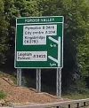
Huntspill village is a long slow drag at 30, albeit with little to actually bring traffic to a stop. It is, however, spread out with few places where fields can't be seen. The small settlement of Alstone then links Huntspill to Highbridge, which historically was another major bottleneck on the A38. The River Brue is crossed on the Brue Bridge, and then we wind past the derelict Highbridge Hotel to Cornhill, where a small roundabout joins the B3139 Market Street. Heading North up Church Street it is difficult to picture stationary summer traffic here in the 1950s as a Steam Train bound for Burnham-on-Sea crossed the level crossing (just where the bus stops ae nowadays), but it caused miles of jams. This was the Somerset & Dorset line to Burnham, busiest with trains on a summer Saturday and Sunday just when the A38 was overloaded. In 1951 the regular trains were cut back to Highbridge station, for as well as interrupting the A38 they crossed the main Bristol to Taunton railway on the level as well, but special excursion trains from various points in Somerset were allowed to continue (and disrupt) well into the 1960s.
A new roundabout at the other end of the B3139 multiplex also provides access to the Asda store, and then the road climbs over the railway line on Bristol Bridge and takes a straight route north east to the next roundabout at the Isleport Business Park. The business park seems to have been built as much to provide better access to the older Walrow Industrial estate at the other end as to increase development space, but is now more or less full. Another long straight finally brings us to Edithmead, the end of this non primary section of the A38.