A5046
Jump to navigation
Jump to search
| A5046 | ||||
| Location Map ( geo) | ||||
| ||||
| From: | St Nicholas Place (SJ338905) | |||
| To: | Byrom Street (SJ346909) | |||
| Via: | Tithebarn Street | |||
| Distance: | 0.6 miles (1 km) | |||
| Meets: | A5036, A565, A5051, A5038, A57, A59 | |||
| Primary Destinations | ||||
| Highway Authorities | ||||
| Traditional Counties | ||||
| Route outline (key) | ||||
| ||||
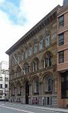
The A5046 is an east-west road to the north of Liverpool city centre.
It originally started on the A5045 on the bank of the Mersey but has now been cut back to start on the A5036 near the Queensway Tunnel exit. It then heads east along Chapel Street (which is one-way) and Tithebarn Street (which isn't). The A5046 used to end on the A5038 Hatton Garden but now continues on into Great Crosshall Street (once again one-way) which allows access to the Churchill Way flyovers. Alternatively, keep straight on to end on the A59 Byrom Street at a complicated traffic-light-controlled junction.

