A632
| A632 | ||||||||||
| Location Map ( geo) | ||||||||||
| ||||||||||
| From: | Matlock (SK302598) | |||||||||
| To: | Cuckney (SK565712) | |||||||||
| Via: | Chesterfield | |||||||||
| Distance: | 22.5 miles (36.2 km) | |||||||||
| Meets: | A615, A619, A61, A617, A6192, A60, A616 | |||||||||
| Former Number(s): | B6015, B6041 | |||||||||
| Primary Destinations | ||||||||||
| Highway Authorities | ||||||||||
| Traditional Counties | ||||||||||
| Route outline (key) | ||||||||||
| ||||||||||
For the original A632 from Rotherham to Charltonbrook, now largely A629, see A632 (Rotherham - Charltonbrook).
The A632 is a non-primary A-road connecting the Peak District with the Dukeries.
Route
Matlock - Cuckney
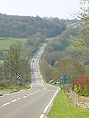
We begin at a tight junction with the A615 in Matlock Green and immediately head up a long, steep and winding hill, which has around a mile of 14% gradient. After a couple of miles the opposite occurs - we descend the equally steep Slack Hill near Kelstedge, which has two lanes on the uphill side. A run past pastures and farmland takes us into Chesterfield.
The A632 TOTSOs left, although the straight-ahead route is signed for the town centre. We meet the A619 at a roundabout by a Morrison's, then multiplex with it to Chesterfield town centre, bypassing the shopping area with a short D2 1980s relief road. We diverge from the A619 at a roundabout from the same era and meet the A61 at a north-facing GSJ immediately afterwards.
We pass Chesterfield Royal Hospital, and the new location of Arkwright Town. I say new, because the old village of 400 people was completely demolished and moved a quarter-mile in 1995 when it was threatened by escaping methane gas from an abandoned coal mine.
We then pass Long Duckmanton, cross the M1 and come to a roundabout where we meet the A6192 which provides access to the motorway at J29A. We then ascend a long hill, climbing past Bolsover Castle and through the narrow village centre of Bolsover. A right turn at traffic lights, which replaced the mini-roundabout, takes us out of town and over a staggered junction with the B6417 (old A618).
The road narrows as we travel towards Langwith, and pass under a single-carriageway railway arch, the traffic flow controlled by traffic lights. We enter Cuckney by passing its cricket club and cross the A60 at an at-grade crossroads with the A60. The road then bends to the left and ends almost immediately at a T-junction on the A616.
History
Originally, what's now the A632 comprised of two 'B' roads either side of Chesterfield.
The first section, between Matlock and Chesterfield, was the B6015. The current A632 has exactly the same route as that road, although the original B6015 followed the aptly named Steep Turnpike in Matlock and was later rerouted onto a easier gradient.
The second section, between Chesterfield and Cuckney, was the B6041. Apart from the fact that that road did not cross the A60, the A632 follows its original route entirely. However, the 1932 Ten-Mile map suggests that the road was later rerouted in the Bolsover area, following what is now the B6418 up to Shuttlewood, where it doubled back on the current B6419 to rejoin its original route.
The A632 took over the B6041 in 1935 (albeit with the direct route through Bolsover). It was not extended through Chesterfield to Matlock until the 1960s.


