A653
| A653 | |||||||||||||
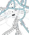
| Location Map ( geo) | |||||||||||||
| |||||||||||||
| From: | Dewsbury (SE247218) | ||||||||||||
| To: | Leeds (SE306330) | ||||||||||||
| Distance: | 8.9 miles (14.3 km) | ||||||||||||
| Meets: | A638, A6029, A650, M62, A6110, M621, A639, A61, A64 | ||||||||||||
| Primary Destinations | |||||||||||||
| Highway Authorities | |||||||||||||
| Traditional Counties | |||||||||||||
| Route outline (key) | |||||||||||||
| |||||||||||||
The A653 is an urban A-road in the West Riding.
Route
Dewsbury - Leeds
We start by leaving the A638 Dewsbury Ring Road and heading steeply uphill on a non–primary 30MPH S2. After about a mile or so we cross the B6128, gain a 40MPH limit and become an urban D2, which we remain for the next two miles, going up and down until we reach the motorway. Pre–motorway, the original line of the last section of this road passed just to the left of the current line.
We arrive at Tingley Roundabout, the M62's J28, which is where we also say hello and goodbye to the A650 (whose eastbound carriageway runs through the middle of the roundabout). At the other side of the roundabout, we gain primary status, keep our D2 and become an NSL as we drop downhill towards the White Rose Shopping Centre.
We pass through two roundabouts and then fork right off the main line of the road, which becomes the A6110 Leeds Outer Ring Road. We head uphill, now on a non–primary 40MPH S2, which once again becomes an urban D2 with regular pelican crossings. Prior to the motorway age, this part of the road was one of the main routes into Leeds, and even these days, it's a very busy road at peak times.
We continue to drop downhill towards the centre of Leeds, passing through the suburb of Beeston. At this point we become a 30MPH S2 and then we leave our original course in order to pass over the M621. Nothing remains of the original road at this point and the motorway interchange, now M621 J3, has been heavily altered over the years (it was the end of the M1 for some time). These days it's a bit of a roller coaster, with dips and rises as we negotiate our way over motorways, pedestrian access and railway lines.
Eventually we arrive at a set of traffic lights, where we accept traffic coming off the motorway and we turn into a large 4-lane roundabout. Continue through this roundabout and at the other side, where you need to decide if you are going back towards Dewsbury, is the historical termination point of the A653, where it joined the A643.
We continue into yet another roundabout / one way system, where this time the options are to continue into the centre of Leeds, or to pass it by, to the south. We shall pass it by, turning towards the right onto Great Wilson Street, passing by ASDA's HQ.
We continue on a 40MPH D2 where until the A653 came to an end where it met the A61. However the A61 has been re-routed (once again!!) towards the south-east of the city, and we have been given part of its former route. Therefore we must turn left onto a one-way street (straight on is the A639). This becomes an S4, and we cross the River Aire on Crown Point Bridge. We arrive at a complicated junction where we now meet the A61.
Since the completion of the eastern side of the Leeds Inner Ring Road, the A653 has been extended along Marsh Lane, and now terminates at the junction of the A64 as it becomes motorway.
Original Author(s): Chris W
History
The Dewsbury Road Diversion at Tingley, from M62 J28 Tingley Interchange to Hesketh Lane, was opened on 22 February 1974 per the Land Compensation Act notice.


