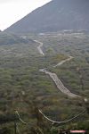
Ascension Island/Old Mountain Road
| Old Mountain Road | |||
| Location Map ( geo) | |||
| |||
| From: | Georgetown | ||
| To: | Two Boats | ||
| Distance: | 3 miles (4.8 km) | ||
| Highway Authorities | |||
Ascension Island Government | |||
This is probably the oldest road on the island, providing a connection between the island Capital of Georgetown and the original barracks on Green Mountain. However, as time progressed the importance of the road waned, and it is now just one of many roads on the island, and perhaps one of the lesser routes at that.
Georgetown - Two Boats
Despite the first section out of Georgetown now being one way into town, we shall start in Georgetown, as this is the historic start of the route. Starting as a two-way route roughly opposite the junction with the Pierhead road, the old mountain road heads west to the Obsidian Hotel, at which point it ceases to be two-way. The road is narrow, and climbs steadily, at times in a shallow cutting, and winds up the lower slopes of Cross Hill, a conical lump which dominates Georgetown. A pair of double-back forks to the left lead across the front of Cross Hill, the lower is unsurfaced and leads to a picnic site, the upper one to a military installation on the summit.
Just beyond these junctions, the road reaches the junction with Hogan's Bypass (see below), and becomes two-way once more. Traffic from the bypass has to give way (at a stop line) to the downhill traffic. The road is immediately much wider, and gradually increases in width until it could comfortably accommodate a dual carriageway, if only traffic levels required it! Before it becomes that wide, however, it sweeps around some sharp double bends, and then passes the islands only filling station (petrol is gradually being phased out) and then the junction with English Bay Road. This junction is called One Boat, although the actual boat is a little further along.
The road is now a full four lanes wide, although restricted by scattered cones along the verges, as it passes One Boat Golf Club in a long straight, climbing steadily all the time. Some more sharp bends bring us to the top of the hill and the village of Two Boats (these boats are not visible from the road). The village has a blanket 20 limit, and is the main settlement for the islands residents. A left turn leads past the (occasionally open) shop and cafe, where it becomes the Ariane Road. There is also a road which loops through Two Boats, emerging at the top of the village. Other side roads wind between houses. The main road, meanwhile, has several speed bumps as it passes through the village, more than the side roads! At the top of the village, in front of Thistle Hill, the road swings to the south and past the island School. It then quickly reaches a stop line with the New Mountain Road, which is now the main road up the mountain.
Hogans Bypass
Built to relieve the narrow and steep Old Mountain Road, Hogans Bypass runs from the 'dangerous junction' on the Airhead Road through to the old mountain road below Cross Hill. It is wide, with a couple of good straights punctuated by twistier sections. Whilst a much better road than the old road, it is a longer way around for traffic.


