Star.pngStar.pngStar grey.pngStar grey.pngStar grey.png

B1355

From Roader's Digest: The SABRE Wiki
Jump to navigation Jump to search
B1355
Location Map ( geo)
Cameraicon.png View gallery (7)
From:  Sculthorpe (TF908308)
To:  Burnham Market (TF831432)
Distance:  9.7 miles (15.6 km)
Meets:  A148, B1155, A149
Highway Authorities

Norfolk

Traditional Counties

Norfolk

Route outline (key)
B1355 Fakenham - Sculthorpe
B1355 Sculthorpe - Burnham Market

The B1355 is a rural B-road in north Norfolk linking Fakenham to the coast. The road was originally unclassified but gained its number by the 1924-25 OS Ministry of Transport map.

Route

South Creake

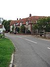
The road starts on the A148 between Sculthorpe and Fakenham. It heads north, avoiding Sculthorpe completely. After a couple of miles the road goes through South Creake and North Creake in quick succession as it follows the narrow River Burn.

After North Creake the road bears left away from the river to cross a saddle and descend into Burnham Market. By the church the road meets the B1155 and turns right to multiplex along that road. We have to TOTSO left immediately afterwards as this is part of a one-way system through the town (although here the road is two-way) and traffic heading the other way moves automatically onto the southbound B1355. There's a left turn at the next T-junction and then the B1355 regains its number by taking the next turn right.

The road continues north out of town to end at a T-junction at a sharp corner on the A149.

History

The original route in 1962

Originally the B1355 started on the B1105 on the western side of Fakenham. However, in 1963 the opening of a new 0.35 mile link from Sculthorpe to the B1355 and the rerouting of A148 along it resulted in the shortening of the B1355 to a new starting point on Creake Road.


The shortened route after 1963


B1355
Places
Related Pictures
View gallery (7)
Front Street (B1355) through South Creake - Geograph - 942545.jpgBridge over the River Burn - Geograph - 942540.jpgB1355 north west towards Burnham Market - Geograph - 415708.jpgB1355 north towards South Creake - Geograph - 400562.jpgManor Farm, converted barn - Geograph - 385473.jpg
Other nearby roads
Fakenham
B1300 – B1399
B1300 • B1301 • B1302 • B1303 • B1304 • B1305 • B1306 • B1307 • B1308 • B1309 • B1310 • B1311 • B1312 • B1313 • B1314 • B1315 • B1316 • B1317 • B1318 • B1319
B1320 • B1321 • B1322 • B1323 • B1324 • B1325 • B1326 • B1327 • B1328 • B1329 • B1330 • B1331 • B1332 • B1333 • B1334 • B1335 • B1336 • B1337 • B1338 • B1339
B1340 • B1341 • B1342 • B1343 • B1344 • B1345 • B1346 • B1347 • B1348 • B1349 • B1350 • B1351 • B1352 • B1353 • B1354 • B1355 • B1356 • B1357 • B1358 • B1359
B1360 • B1361 • B1362 • B1363 • B1364 • B1365 • B1366 • B1367 • B1368 • B1369 • B1370 • B1371 • B1372 • B1373 • B1374 • B1375 • B1376 • B1377 • B1378 • B1379
B1380 • B1381 • B1382 • B1383 • B1384 • B1385 • B1386 • B1387 • B1388 • B1389 • B1390 • B1391 • B1392 • B1393 • B1394 • B1395 • B1396 • B1397 • B1398 • B1399
Earlier Iterations: B1300 • B1304 • B1305 • B1306(W) • B1306(E) • B1308 • B1309 • B1312 • B1318 • B1320 • B1330 • B1332 • B1333 • B1335 • B1336
B1343 • B1344 • B1345 • B1353 • B1358 • B1360 • B1361(E) • B1361(W) • B1372 • B1373 • B1375 • B1378 • B1380 • B1383 • B1389 • B1392 • B1393 • B1397


SABRE - The Society for All British and Irish Road Enthusiasts
Discuss - Digest - Discover - Help