Star.pngStar.pngStar grey.pngStar grey.pngStar grey.png

B4148

From Roader's Digest: The SABRE Wiki
Jump to navigation Jump to search
B4148
Location Map ( geo)
Cameraicon.png View gallery (1)
From:  Erdington (SP123910)
To:  Whitehouse Common (SP133978)
Distance:  5.9 miles (9.5 km)
Meets:  A38, A452, A5127, A453
Highway Authorities

Birmingham

Traditional Counties

Warwickshire

Route outline (key)
B4148 The Norton Crossroads – Whitehouse Common
B4148 (Spur) Chester Road – Walmley
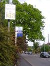
Vehicle-activated sign on the Penns Lane branch of the B4148 in Sutton Coldfield

The B4148 is an urban B-road on the northern edge of Birmingham.

It starts at the A38 TOTSO of The Norton Crossroads on the edge of Erdington and heads northeast to cross the A452 in Tyburn before heading northwards into Walmley. Here, at a set of traffic lights, a spur of the B4148 comes in from the west, having started on the A5127 (former A38) at Chester Road. In fact, this spur (and the road ahead) is the original route of the B4148; the bit south via Tyburn was added in the 1940s.

The B4148 now forms a bypass of Sutton Coldfield. It heads north along Walmley Road to a set of traffic lights where it TOTSOs left. Walmley Road continues into Reddicap Heath where it takes the left fork; the B4148, however, forks right (and has priority) into Hollyfield Road, which leads to Whitehouse Common. The B4148 ends here at traffic lights on the A453. Prior to the construction of the A38 Sutton Coldfield bypass, which severed the link, the road ahead, although unclassified, was the quickest way to Lichfield from here.



B4148
Junctions
Related Pictures
View gallery (1)
Slow Down! - Geograph - 1290017.jpg
Other nearby roads
Birmingham
A34 • A38 • A38(M) • A41 • A42 (Reading - Birmingham) • A45 • A47 • A435 • A441 • A452 • A453 • A455 (Birmingham - Stafford) • A456 • A457 • A458 • A4027 • A4028 • A4029 • A4030 • A4040 • A4097 • A4123 • A4166 • A4167 • A4400 • A4540 • A4723 • A5127 • B38 (Selly Oak) • B384 • B3800 • B4025 • B4043 • B4096 • B4100 (Birmingham) • B4114 • B4118 (Birmingham) • B4120 • B4121 • B4122 (Birmingham) • B4123 • B4124 • B4125 • B4126 • B4127 • B4128 • B4128 (Suffolk Street, Birmingham) • B4129 • B4129 (Birmingham City Centre) • B4130 • B4131 • B4132 • B4133 • B4134 • B4135 • B4136 • B4137 • B4140 • B4141 (Birmingham) • B4142 • B4143 (Birmingham) • B4144 • B4145 • B4146 • B4147 • B4167 • B4182 • B4217 • B4284 • B4498 • B4514 • B4515 • B4516 • B4531 • B4532 • B4533 • B4552 • B4730 • E05 • E24 • E28 (Birmingham - Ipswich) • E33 (London - Glasgow) • E116 (Old System) • Holyhead Road • Longest Lane • M5 • M6 • M40 • M42 • M600 • Northern and Western Motorway • Ryknild Street • T13 (Britain) • T14 (Britain) • T15 (Britain) • T16 (Britain) • T35 (Britain) • T53 (Britain)
Sutton Coldfield
B4100 – B4199
B4100(N) • B4100(S) • B4101 • B4102 • B4103 • B4104(N) • B4104(S) • B4105(E) • B4105(W) • B4106 • B4107 • B4108 • B4109 • B4110 • B4111 • B4112 • B4113 • B4114 • B4115 • B4116 • B4117 • B4118(W) • B4118(E) • B4119
B4120 • B4121 • B4122(N) • B4122(S) • B4123 • B4124 • B4125 • B4126 • B4127 • B4128 • B4129 • B4130 • B4131 • B4132 • B4133 • B4134 • B4135 • B4136 • B4137 • B4138 • B4139
B4140 • B4141 • B4142 • B4143 • B4144 • B4145 • B4146 • B4147 • B4148 • B4149 • B4150 • B4151 • B4152 • B4153 • B4154 • B4155 • B4156 • B4157 • B4158 • B4159
B4160 • B4161 • B4162 • B4163 • B4164 • B4165 • B4166 • B4167 • B4168 • B4169 • B4170 • B4171 • B4172 • B4173 • B4174 • B4175 • B4176 • B4177 • B4178 • B4179
B4180 • B4181 • B4182 • B4183 • B4184 • B4185 • B4186 • B4187 • B4188 • B4189 • B4190 • B4191 • B4192 • B4193 • B4194 • B4195 • B4196 • B4197 • B4198 • B4199
Earlier usesB4100 • B4105 • B4107 • B4111 • B4113 • B4115 • B4119 • B4128 • B4129 • B4139 • B4141 • B4143
B4150 • B4158(N) • B4158(S) • B4160 • B4162 • B4164 • B4177 • B4181 • B4184 • B4186 • B4192 • B4197

SABRE - The Society for All British and Irish Road Enthusiasts
Discuss - Digest - Discover - Help