Star.pngStar.pngStar grey.pngStar grey.pngStar grey.png

Ballycuddahy Interchange

From Roader's Digest: The SABRE Wiki
Jump to navigation Jump to search
Ballycuddahy Interchange
Acomhal Bhaile Uí Chuidithigh
Location Map ( geo)
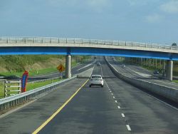
The M8 joins the M7 - Geograph - 4148152.jpg
The M8/M7 merge
Cameraicon.png View gallery (1)
Location
Ballycuddahy
County
Laois
Highway Authority
Transport Infrastructure Ireland
Junction Type
Fork
Roads Joined
M7, M8

Ballycuddahy Interchange is junction 19 of the M7 and junction 1 of the M8.

It is a simple fork interchange, with no access to the westbound M7 from the M8 (or vice versa).

Routes

Route To Notes

M7

Áth Cliath DUBLIN

M7

Luimneach LIMERICK No access from M8 north-bound

M8

Corcaigh CORK No access from M7 east-bound


Ballycuddahy Interchange
Related Pictures
View gallery (1)
The M8 joins the M7 - Geograph - 4148152.jpg
Junctions on the M7 and N7
1 Red Cow • 1A Newlands Cross • 2 Kingswood • 3 Citywest • 3A Junction 3A • 4 Rathcoole • 5 Steelstown • 6 Castlewarden • 7 Kill • 8 Johnstown • 9 Maudlings • 10 Newhall • 11 Great Connell • 12 Newbridge • 13 Kildare • 14 Monsteravin • 15 Ballybrittas • 16 Portlaoise East • 17 Togher • 18 Port Laoise West • 19 Ballycuddahy • 21 Borris-in-Ossory • 22 Roscrea • 23 Moneygall • 24 Toomevara • 25 Nenagh • 26 Carrigatogher • 27 Birdhill • 28 Newport • 29 Ballysimon • 30 Rossbrien
Junctions on the M8 and N8
Ballycuddahy  • 3 Rathdowney  • 4 Urlingford  • 5 Twomileborris  • 6 Horse and Jockey  • 7 Cashel North  • 8 Fethard  • 9 Cashel South  • 10 Cahir North  • 11 Cahir South  • 12 Carrigane  • 13 Mitchelstown South  • 14 Moorepark  • 15 Corrin  • 16 Rathcormac South  • 17 Watergrasshill  • 18  Killydonoghoe  • 19 Dunkettle Interchange  • Dunkettle Roundabout • Merchant's Quay

SABRE - The Society for All British and Irish Road Enthusiasts
Discuss - Digest - Discover - Help