Bridge of Brown
| Bridge of Brown | |||
| Location Map ( geo) | |||
 | |||
| |||
| From: | Grantown on Spey | ||
| To: | Tomintoul | ||
| Location | |||
| Bridge of Brown | |||
| County | |||
| Inverness-shire • Banffshire | |||
| Highway Authority | |||
| Moray • Highland | |||
| Opening Date | |||
| 1754, 1980s | |||
| Additional Information | |||
| |||
| On road(s) | |||
| A939 | |||
The Bridge of Brown spans the Burn of Lochy a few miles west of Tomintoul to the north of the Cairngorms. There are actually 2 bridges here, the old one built by Caulfeild as part of his military road from Braemar to Fort George, and the modern crossing which replaces it. The A939 which crosses the bridge drops steeply down on either side, round some sharp bends to reach the bridge that lies at the bottom of a narrow valley.
The Old Bridge
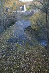
The old bridge was built in c1754 by Major Caulfeild as part of his road north. It is a simple single span arch bridge which has unfortunately suffered badly since it was bypassed, and the north face of the bridge has now crumbled, taking part of the deck with it. The bridge was always a narrow pinch point between sharpish bends and presumably only took a single lane of traffic, which must have been a difficult pinch point for traffic.
The New Bridge
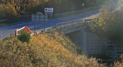
Lying immediately upstream, just below the confluence with the Burn of Brown, the new bridge is an uncompromising square concrete structure with a single span. It offers the benefit to traffic of a full S2 roadway, but visually it adds nothing to this dramatic landscape.
| Bridge of Brown | ||
|


