C450 (Stockport)
Jump to navigation
Jump to search
| C450 | ||||
| Location Map ( geo) | ||||
| ||||
| From: | Marple Bridge (SJ964894) | |||
| To: | Stockport MBC boundary (SJ996882) | |||
| Via: | Mellor | |||
| Distance: | 2.4 miles (3.9 km) | |||
| Meets: | A626, C451 | |||
| Highway Authorities | ||||
| Traditional Counties | ||||
| Route outline (key) | ||||
| ||||
This article is about the Class III road numbered C450 by Stockport MBC.
For other roads that are numbered C450, see C450.
For other roads that are numbered C450, see C450.
The C450 is a Classified Unnumbered Road which runs from the A626 in Marple Bridge along Town Street, Longhurst Lane and Moor End Road as far as the Stockport MBC border, where it meets the C451 Shiloh Road.
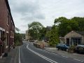
Longhurst Lane in Marple Bridge

The route passing through Mellor
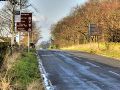
The eastern end of the C450


