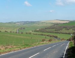
C55 (Brighton and Hove)
Jump to navigation
Jump to search
| C55 | |||
| Location Map ( geo) | |||
 | |||
| |||
| Saddlescombe Road | |||
| From: | C300 (WSCC) Saddlescombe Road, Poynings | ||
| To: | C56 Devil's Dyke Road | ||
| Distance: | 0.9 miles (1.4 km) | ||
| Meets: | C300 (WSCC), C56 | ||
| Highway Authorities | |||
| Traditional Counties | |||
This article is about the Class III road numbered C55 maintained by Brighton and Hove Council.
For other roads numbered C55, see C55.
For other roads numbered C55, see C55.
C55 (Brighton and Hove) is part of one of the three routes from Brighton to the north. The C55 covers the gap between the C56 which heads to the Devils Dyke and the border with West Sussex where it becomes the C300 (West Sussex).
As well as it being the C55, it is also listed to be the C2217 (Brighton and Hove) as well.
| C55 (Brighton and Hove) | ||
| ||
|
