Star.pngStar.pngStar grey.pngStar grey.pngStar grey.png

C65 (Fife)

From Roader's Digest: The SABRE Wiki
Jump to navigation Jump to search
C65
Location Map ( geo)
Cameraicon.png View gallery (4)
From:  St Andrews (NO497162)
To:  Pitscottie (NO420134)
Distance:  5.1 miles (8.2 km)
Meets:  B939, B939
Highway Authorities

Fife

Traditional Counties

Fife

Route outline (key)
C65 St Andrews - Pitscottie
This article is about the Class III road numbered C65 maintained by Fife Council.
For other roads numbered C65, see C65
.


The C65 starts at a mini roundabout on the B939, Buchanan Gardens in St Andrews, and continues south west along Hepburn Gardens. After crossing another roundabout, it leaves the town behind, and meanders gently as it crosses the landscape, more or less parallel to the B939, meeting it again just short of Pitscottie.

The C65 heading westwards downhill near Backfield of Ladeddie.


C65 (Fife)
Related Pictures
View gallery (4)
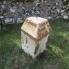
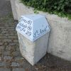
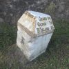
C65 Milestone at Denork.jpgC65 heading west through Fife.jpgMilestone Hepburn Gardens.jpgMilestone at Balone, St Andrews.jpg
Other nearby roads
St Andrews
Class III Roads maintained by Fife Council
C1 • C2 • C3 • C4 • C5 • C6 • C7 • C8 • C9 • C10 • C11 • C12 • C13 • C14 • C15 • C16 • C17 • C18 • C19 • C20
C21 • C22 • C23 • C24 • C25 • C26 • C27 • C28 • C29 • C30 • C31 • C32 • C33 • C34 • C35 • C36 • C37 • C38 • C39 • C40
C41 • C42 • C43 • C44 • C45 • C46 • C47 • C48 • C49 • C50 • C51 • C52 • C53 • C54 • C55 • C56 • C57 • C58 • C59 • C60
C61 • C62 • C63 • C64 • C65 • C66 • C67 • C68 • C69 • C70 • C71 • C72 • C73 • C74 • C75 • C76 • C77 • C78 • C79 • C80
C81 • C82 • C83 • C84 • C85 • C86 • C87 • C88 • C89 • C90  • C91 • C92 • C93 • C94 • C95 • C96 • C97 • C98 • C99 • C100
C101 • C102 • C103 • C124 • C125 • C126 • C127 • C128 • C129 • C130 • C131 • C132


SABRE - The Society for All British and Irish Road Enthusiasts
Discuss - Digest - Discover - Help