Star.pngStar.pngStar grey.pngStar grey.pngStar grey.png

Cannon Bridge

From Roader's Digest: The SABRE Wiki
Jump to navigation Jump to search
Cannon Bridge
Location Map ( geo)
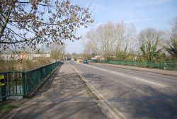
Cannon Bridge - Geograph - 2343869.jpg
Cameraicon.png View gallery (1)
Location
Tonbridge Eastern Bypass
County
Kent
Highway Authority
Kent
On road(s)
A26
Crossings related to the A26

Cannon Bridge crosses the River Medway on the A26. The is a primary route part of the Tonbridge Eastern Bypass.

It was opened on 2 July 1970 by Councillor John Brooker along with the first stage of the Eastern Bypass of Cannon Lane and Vale Road (to Vale Rise). It was the first river bridge built in the town since the The Big Bridge of 1888.


Cannon Bridge
Related Pictures
View gallery (1)
Cannon Bridge - Geograph - 2343869.jpg
Crossings of the River Medway & The Swale
River MedwayTurners Hill Bridge • Forest Row Bridge • Hartfield Bridge • Ashurst Bridge • Colliersland Bridge • Penshurst Bridge • Tonbridge Bypass Bridge • The Big Bridge • Cannon Bridge • Branbridge Bypass Bridge • Hampstead Lane Bridge • Maidstone Bridge • St Peters Bridge (Maidstone) • Allington M20 Motorway Bridge • Medway New Bridge • Medway Bridge • Rochester Bridge • Medway Tunnel
River LenCentenary Viaduct (Maidstone)
The SwaleSheppey Crossing • Kingsferry Bridge


SABRE - The Society for All British and Irish Road Enthusiasts
Discuss - Digest - Discover - Help