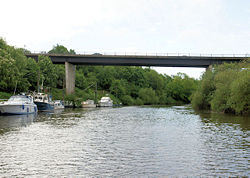
Carrington Bridge
Jump to navigation
Jump to search
| Carrington Bridge | |||
| Location Map ( geo) | |||
 | |||
| |||
| Location | |||
| Worcester | |||
| County | |||
| Worcestershire | |||
| Highway Authority | |||
| Worcestershire | |||
| Opening Date | |||
| 1985 | |||
| On road(s) | |||
| A4440 | |||
Carrington Bridge is one of two road crossings of the River Severn and its flood plain in Worcestershire. It was constructed in 1985 as part of the Worcester Southern Bypass, the A4440. On the eastern side of the bridge is a roundabout with the A38, while a short distance to the west is a roundabout with the A449.
Due to the proximity to the roundabout, combined with the sheer volume of traffic on the S2 A4440, traffic can be found regularly at a standstill heading eastbound across the bridge.
In 2019, a project commenced to dual the A4440, which necessitated the building of a second bridge to the south of the original
Links
legislation.gov.uk
- The Worcestershire County Council (Carrington Bridge) Scheme 2018 Confirmation Instrument 2019 - This instrument confirms a Scheme that authorises the Council to construct over the navigable waters of the River Severn, the bridge specified in the Schedule to the Scheme as part of a highway they are proposing to construct between the Ketch Roundabout and the Powick Roundabout, Worcester
| Carrington Bridge | ||
| ||
|


