Star.pngStar.pngStar grey.pngStar grey.pngStar grey.png

Chepstow

From Roader's Digest: The SABRE Wiki
(Redirected from Cas-gwent)
Jump to navigation Jump to search
Chepstow
Cas-gwent
Location Map ( geo)
Cameraicon.png View gallery (34)
County
Monmouthshire
Highway Authority
Monmouthshire
Forward Destination on
M48 • A48 • A466
Next Primary Destinations
Bristol • Gloucester • Newport
Places related to the M48
Places related to the A48
Bridgend • Swansea • Neath • Carmarthen • Cardiff • Newport • Port Talbot • Gloucester • Ledbury

Chepstow / Cas-gwent is a Primary Destination and town on the Welsh border, sitting alongside the Severn estuary and Severn Bridge.

History

Chepstow in 1953

Chepstow is one of the Primary Destinations where the town's road network has hardly changed since the war. The biggest change, apart from the arrival of the M4 (now M48) several miles to the south, is that the A48 has been provided with a new bridge across the River Wye, resulting in it being diverted away from the eastern end of the town centre. The only other change is that the A466 spur into the town centre has been downgraded to become part of an extended B4293.


Chepstow Inner Relief Road

Stage 1

Stage 1 - east of Hardwick Terrace

Mount Pleasant to Station Road was opened on 2 March 1973. Contractor was Haywood Group of Chepstow, cost £140,000.


Stage 2

Stage 2 - looking eastwards across the bridge

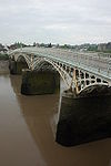
The 1 mile S2 road from Station Road to Gloucester Road was completed in January 1988 (per the Trunk Roads, England, into the 1990's Report), to complete the relief road. Outturn works cost £8 million. The viaduct section, Chepstow New Bridge, was reported as opened by Wyn Roberts, Minister of State for Wales in the Gloucester News of 4 February 1988.


Routes

Route To Notes

M48

London / Llundain, Bristol / Bryste (M4) Accessed via A466

M48

Cardiff / Caerdydd, Newport / Casnewydd (M4) Accessed via A466

A48

Lydney, Gloucester

A48

Caerwent

A466

Monmouth / Trefynwy

B4235

Usk / Brynbuga Usk is reached via A472

B4293

Itton, Devauden, Trelleck


Chepstow
Junctions
Crossings
Roads
Related Pictures
View gallery (34)
Chepstow Bridge - Geograph - 811612.jpgChepstow old bridge - Geograph - 300604.jpgView from bridge - Geograph - 682942.jpgLooking up towards Cross Keys Pub - Geograph - 555090.jpgRoad and rail - Geograph - 300596.jpg
Places in Wales
Major destinationsBridgend Pen-y-bont ar Ogwr • Cardiff Caerdydd • Cwmbrân • Llanelli • Merthyr Tydfil Merthyr Tudful • Neath Castell-nedd • Newport Casnewydd • Port Talbot • Swansea Abertawe • Wrexham Wrecsam
Other primary destinationsAbergavenny Y Fenni • Aberystwyth • Bala Y Bala • Bangor • Betws-y-Coed • Brecon Aberhonddu • Builth Wells Llanfair-ym-Muallt • Caernarfon • Cardigan Aberteifi • Carmarthen Caerfyrddin • Chepstow Cas-gwent • Conwy • Dolgellau • Fishguard Abergwaun • Haverfordwest Hwlffordd • Holyhead Caergybi • Llandeilo • Llandovery Llanymddyfri • Llandrindod Wells Llandrindod • Llandudno • Llangollen • Llangurig • Machynlleth • Milford Haven Aberdaugleddau • Mold Yr Wyddgrug • Monmouth Trefynwy • Newtown Y Drenewydd • Pembroke Dock Doc Penfro • Porthmadog • Queensferry • Rhayader Rhaeadr Gwy • Ruthin Rhuthun • St Clears Sanclêr • Tenby Dinbych-y-pysgod • Welshpool Y Trallwng
Other placesAberaeron • Abergele • Barry Y Barri • Beaumaris • Caerphilly Caerffili • Cardiff-Wales Airport Maes Awyr Caerdydd-Cymru • Denbigh Dinbych • Ebbw Vale Glen Ebwy • Flint Y Fflint • Harlech • Hirwaun • Lampeter Llanbedr Pont Steffan • Llangefni • Pontypool Pont-y-pŵl • Pontypridd • Prestatyn • Presteigne Llanandras • Pwllheli • Rhyl Y Rhyl • St Asaph Llanelwy • St Davids Tyddewi • Treherbert • Treorchy Treorci • Y Felinheli

SABRE - The Society for All British and Irish Road Enthusiasts
Discuss - Digest - Discover - Help