Category:A47 pictures
Jump to navigation
Jump to search
Media in category 'A47 pictures'
The following 81 files are in this category, out of 81 total.
 1983 plans - Coppermine - 21321.jpg 738 × 1,024; 95 KB
 19901111 guyhirn bridge001.jpg 1,706 × 1,185; 416 KB
 19901111 guyhirn bridge007.jpg 1,706 × 1,185; 298 KB
 A10 A47 - Hardwick Roundabout - Coppermine - 1312.jpg 600 × 420; 25 KB
 A10-A47 Interchange near King's Lynn - Geograph - 4627659.jpg 640 × 427; 315 KB
 A17 approaching A47 junction roundabout - Geograph - 4996383.jpg 640 × 424; 47 KB
 A47 - Abandoned - Coppermine - 2361.jpg 500 × 375; 42 KB
 A47 - Abandoned - Coppermine - 2362.jpg 500 × 375; 52 KB
 A47 - Abandoned - Coppermine - 2363.jpg 500 × 375; 50 KB
 A47 - Abandoned - Coppermine - 2364.jpg 500 × 375; 40 KB
 A47 - East Dereham Old DC (17).jpg 1,280 × 960; 548 KB
 A47 - East Dereham Old DC - Aerial view.JPG 482 × 371; 47 KB
 A47 - East Dereham Old DC - Eastern Approach (1).jpg 640 × 480; 17 KB
 A47 - East Dereham Old DC - Eastern Approach (2).jpg 640 × 480; 30 KB
 A47 - East Dereham Old DC - Eastern Approach (3).jpg 480 × 640; 23 KB
 A47 - East Dereham Old DC - Eastern Approach (4).jpg 640 × 480; 28 KB
 A47 - East Dereham Old DC - Happy Eater (1).jpg 1,280 × 960; 351 KB
 A47 - East Dereham Old DC - Happy Eater (10).jpg 1,280 × 960; 404 KB
 A47 - East Dereham Old DC - Happy Eater (2).jpg 1,280 × 960; 296 KB
 A47 - East Dereham Old DC - Happy Eater (3).jpg 1,280 × 960; 435 KB
 A47 - East Dereham Old DC - Happy Eater (5).jpg 1,280 × 960; 381 KB
 A47 - East Dereham Old DC - Happy Eater (6).jpg 1,280 × 960; 370 KB
 A47 - East Dereham Old DC - Happy Eater (7).jpg 1,280 × 960; 422 KB
 A47 - East Dereham Old DC - Happy Eater (8).jpg 1,280 × 960; 393 KB
 A47 - East Dereham Old DC - Happy Eater (9).jpg 1,280 × 960; 374 KB
 A47 - East Dereham Old DC - New alignment.jpg 1,280 × 960; 370 KB
 A47 - East Dereham Old DC - Start of new section.jpg 1,280 × 960; 142 KB
 A47 - East Dereham Old DC - W'bound C'way (1).jpg 640 × 480; 26 KB
 A47 - East Dereham Old DC - W'bound C'way (10).jpg 640 × 480; 23 KB
 A47 - East Dereham Old DC - W'bound C'way (2).jpg 640 × 480; 27 KB
 A47 - East Dereham Old DC - W'bound C'way (3).jpg 640 × 480; 24 KB
 A47 - East Dereham Old DC - W'bound C'way (5).jpg 640 × 480; 23 KB
 A47 - East Dereham Old DC - W'bound C'way (7).jpg 640 × 480; 23 KB
 A47 - East Dereham Old DC - W'bound C'way (8).jpg 640 × 480; 26 KB
 A47 - East Dereham Old DC - W'bound C'way (9).jpg 640 × 480; 22 KB
 A47 Abandoned section - Coppermine - 2358.jpg 500 × 375; 69 KB
 A47 Abandoned section - Coppermine - 2359.jpg 500 × 375; 48 KB
 A47 Abandoned section - Coppermine - 2360.jpg 500 × 375; 73 KB
 A47 Abandoned section of the A47 - Coppermine - 2356.jpg 500 × 375; 54 KB
 A47 East Norton - Geograph - 601112.jpg 640 × 384; 60 KB
 A47 Hardwick flyover - Geograph - 466912.jpg 640 × 294; 96 KB
 A47 junction - Geograph - 646033.jpg 640 × 426; 69 KB
 A47 Postwick Viaduct from River Yare - Geograph - 674486.jpg 640 × 372; 42 KB
 A47 Running Alongside the M6 Motorway - Geograph - 1190660.jpg 640 × 480; 60 KB
 A47 Running Alongside the M6 Motorway - Geograph - 1190666.jpg 640 × 480; 61 KB
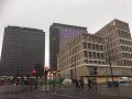
 A47, Birmingham city-centre - Coppermine - 4350.jpg 768 × 576; 62 KB
 A47-easternend-1992-before-after.jpg 478 × 236; 48 KB
 Abandoned section of the A47 - Coppermine - 2357.jpg 500 × 375; 56 KB
 Breydon Bridge (C) Glen Denny - Geograph - 1970866.jpg 640 × 480; 67 KB
 Crossing The Ouse - Geograph - 1519586.jpg 640 × 480; 73 KB
 Guyhirn New Bridge crossing the River Nene - Geograph - 4924244.jpg 640 × 473; 98 KB
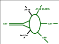
 HardwickNew.png 472 × 355; 4 KB
 HardwickOld.png 472 × 355; 3 KB
 IMG 5417.JPG Birmingham image 2019.jpg 960 × 720; 115 KB
 IMG 9014.JPG A47 Birmingham street lights.jpg 960 × 718; 51 KB
 IMG 9015.JPG A47 Birmingham street lights.jpg 960 × 720; 40 KB
 IMG 9015.JPG Phosco FL345 Spacefloods.jpg 960 × 720; 31 KB
 IMG 9019.JPG A47 M6 Birmingham.jpg 960 × 720; 57 KB
 IMG 9021.JPG A47 M6 Birmingham.jpg 960 × 720; 50 KB
 Leicester - Coppermine - 17941.jpg 1,024 × 768; 176 KB
 Level crossing, Wisbech bypass - Geograph - 1349126.jpg 640 × 426; 71 KB
 Looking west along the A47 - Geograph - 520776.jpg 640 × 480; 80 KB
 Norwich Bypass (A47) - Geograph - 4726577.jpg 640 × 427; 377 KB
 On And Off Slip Roads - Geograph - 1677757.jpg 480 × 640; 61 KB
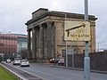
 Remains of Masshouse Circus.jpg 1,024 × 768; 183 KB
 River Welland bridge, A47 (C) Peter Whatley - Geograph - 3586306.jpg 640 × 480; 81 KB
 Roadworks on the A47 - Geograph - 4363951.jpg 640 × 480; 61 KB
 Runham Road from Acle New Road - Geograph - 2680880.jpg 640 × 480; 54 KB
 Sabre-norwich.jpg 10,913 × 1,547; 1.25 MB
 Spitfire Island - Geograph - 47346.jpg 640 × 465; 88 KB
 St Augustine Road Bridge - Geograph - 489667.jpg 500 × 640; 99 KB
 The Acle Straight - Geograph - 262089.jpg 640 × 481; 77 KB
 The Long Shoot Nuneaton - Geograph - 1449054.jpg 640 × 480; 79 KB
 Thickthorn Interchange - Geograph - 73633.jpg 640 × 457; 164 KB
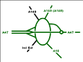
 Thickthorn.png 472 × 355; 4 KB
 Underpass - Coppermine - 17940.jpg 1,024 × 768; 174 KB
 View south across the A47 - Geograph - 916646.jpg 480 × 640; 111 KB


.jpg)

.jpg)
.jpg)
.jpg)
.jpg)
.jpg)
.jpg)
.jpg)
.jpg)
.jpg)
.jpg)
.jpg)
.jpg)
.jpg)


.jpg)
.jpg)
.jpg)
.jpg)
.jpg)
.jpg)
.jpg)
.jpg)


_Glen_Denny_-_Geograph_-_1970866.jpg)

_Tim_Heaton_-_Geograph_-_1723187.jpg)


_-_Geograph_-_4726577.jpg)


_Peter_Whatley_-_Geograph_-_3586306.jpg)


