Category:Pictures from the 1970s pictures
Jump to navigation
Jump to search
Media in category 'Pictures from the 1970s pictures'
The following 200 files are in this category, out of 364 total.
(previous page) (next page)- 1000004747.jpg 707 × 983; 243 KB
- 1970 - Bristol, The Triangle. - Coppermine - 15704.jpg 1,001 × 679; 284 KB
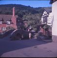
- 1970 Alerford Untitled-102.jpg 1,776 × 1,817; 2.61 MB
- 1970 Poole Quayside - Coppermine - 15706.jpg 984 × 664; 269 KB
- 1970 Wells- Market Square & A39 - Coppermine - 15705.jpg 1,000 × 676; 275 KB
- 1972 Kodachrome Untitled-69.jpg 1,253 × 1,236; 1.1 MB
- 197311 - Bottom of Maybank Avenue - view of Roundabout and Charlie Brown's Pub.jpg 1,032 × 1,014; 363 KB
- 197311 - Charlie Brown's (The Roundabout Pub).jpg 984 × 1,026; 371 KB
- 197311 - Child's Corner looking towards Buckhurst Hill.jpg 1,020 × 1,014; 384 KB
- 197311 - Childs Corner looking towards Ilford from the top of Maybank Avenue.jpg 1,020 × 1,002; 363 KB
- 197311 - Remains of Block of Flats on Child's Corner (Maybank Avenue on Right).jpg 1,007 × 1,008; 373 KB
- 197311 - Remains of the Block of Flats at Child's Corner.jpg 1,026 × 1,020; 382 KB
- 197311 - Southend Road - Roof and tiles gone - Row of houses opposite Maybank Avenue.jpg 1,020 × 1,014; 402 KB
- 197311 - The Last Occupant in Maybank Avenue, Charlie Browns in background.jpg 1,020 × 1,014; 364 KB
- 197311 - Traffic Lights at Child's Corner facing towards Ilford.jpg 1,026 × 1,008; 404 KB
- 1977A18M.jpg 619 × 402; 119 KB
- 20190313 191833023 iOS.jpg 1,244 × 963; 243 KB
- 20190313 192349452 iOS.jpg 1,753 × 755; 450 KB
- 20190313 205721859 iOS.jpg 1,450 × 1,129; 337 KB
- A A telephone box, Loughbrickland - Geograph - 1604546.jpg 454 × 640; 85 KB
- A minor trip on the ferry - Flickr - 52925205174.jpg 640 × 632; 73 KB
- A1063 Cambs.jpg 252 × 152; 24 KB
- A2 Church Hill Canterbury 1976.jpg 764 × 519; 282 KB
- A259 April 1979 - Coppermine - 9915.jpg 757 × 800; 88 KB
- A27 Titchfield 1979.jpg 640 × 407; 206 KB
- A30 Country House Interchange.png 300 × 230; 46 KB
- A30 Honiton Exeter 1972 original.jpg 2,800 × 1,308; 465 KB
- A30 Honiton Exeter Motorway Scheme A.jpg 2,800 × 1,308; 468 KB
- A30 Honiton Exeter Motorway Scheme B.jpg 2,800 × 1,308; 468 KB
- A30, 1975 - Coppermine - 21836.jpg 485 × 342; 21 KB
- A32 Fareham High Street.jpg 640 × 406; 235 KB
- A33, 1979 - Coppermine - 9912.jpg 757 × 800; 112 KB
- A34 Drayton 1973 copy.jpg 745 × 833; 425 KB
- A38(M) approaching Dartmouth Circus, 1975 - Coppermine - 8873.JPG 480 × 640; 30 KB
- A404MOriginalTerminus.jpg 963 × 873; 290 KB
- A419Blunsdon.jpg 1,134 × 846; 481 KB
- A419Cricklade.jpg 962 × 454; 212 KB
- A419Latton.jpg 1,034 × 940; 345 KB
- A419Swindon.jpg 919 × 831; 405 KB
- A5002 Whaley Bridge.jpg 676 × 399; 158 KB
- A55 - Britannia Bridge - Coppermine - 18605.jpg 800 × 539; 34 KB
- A68Belfast.PNG 260 × 277; 179 KB
- A82 Ballachulish Br 1974 - Coppermine - 12828.jpg 1,024 × 689; 182 KB
- A82 Ballachulish Br 1975 - Coppermine - 12827.jpg 1,024 × 689; 166 KB
- A82 Ballachulish Bridge under construction in 1974 - Coppermine - 12829.jpg 1,280 × 862; 271 KB
- Ads-local-1975.png 413 × 343; 138 KB
- Ads-nrt-1975.png 358 × 196; 97 KB
- Aerial view to junction 12 (M5) - Geograph - 6402094.jpg 640 × 427; 94 KB
- Aerial view towards Cressex - Geograph - 987696.jpg 640 × 413; 84 KB
- Alconbury Trumpet 1973.jpg 676 × 669; 290 KB
- Aldermaston Roundabout 1973.jpg 1,110 × 672; 505 KB
- Alderney Roundabout original proposal.png 500 × 248; 42 KB
- Alfreton Interchange 1973.jpg 1,014 × 694; 443 KB
- Anniesland Cross interchange 1970s.png 406 × 600; 60 KB
- Ansty Interchange 1973.jpg 1,427 × 1,033; 889 KB
- Appleby Magna to Kegworth alternative routes February 1978.jpg 478 × 560; 45 KB
- Approaching Horns Bridge on A61 - Geograph - 605192.jpg 640 × 434; 50 KB
- Army and Navy Scheme A5.png 800 × 512; 73 KB
- Army and Navy Scheme B.png 800 × 466; 72 KB
- Ashford, Kent - Geograph - 1158617.jpg 640 × 431; 63 KB
- Audley Range 003.jpg 640 × 428; 148 KB
- Audley Range 005.jpg 640 × 425; 144 KB
- Aug 30 1975 - Coppermine - 21838.jpg 483 × 342; 21 KB
- August 30 1975 - Coppermine - 19185.jpg 492 × 350; 41 KB
- B2232.jpg 546 × 154; 58 KB
- Bar End Interchange 1973.jpg 929 × 836; 538 KB
- Barnton Junction 1971 proposal.png 600 × 262; 39 KB
- Beckton Alps, 1973 - Geograph - 130201.jpg 640 × 424; 60 KB
- Belfast 1970.JPG 3,000 × 1,724; 981 KB
- Bentley Interchange 1973.jpg 674 × 1,299; 557 KB
- Berrygrove.jpg 612 × 816; 187 KB
- Bescot junction and M6 in 1977 - Geograph - 810614.jpg 640 × 427; 79 KB
- Billericay High Street 1972 - Geograph - 247154.jpg 640 × 404; 57 KB
- Black Dam opening.jpg 2,000 × 1,251; 1.57 MB
- Black Dam Roundabout 1973.jpg 883 × 681; 403 KB
- Black Prince Interchange 1976.jpg 528 × 683; 259 KB
- Blackfriars Road, Salford - Geograph - 2264799.jpg 640 × 427; 64 KB
- Blackhorse Interchange initial proposal.png 300 × 300; 58 KB
- Bluebell Interchange 1976.jpg 678 × 622; 288 KB
- Blythbury Interchange.png 400 × 286; 32 KB
- Bolton Road 038.jpg 640 × 426; 92 KB
- Boreham Interchange 1974 proposal.png 520 × 600; 126 KB
- Botley Road bridge, Oxford - 1979 renewal - Geograph - 816710.jpg 640 × 427; 62 KB
- Bradford Trolleybus at Saltaire Terminus - Geograph - 1398546.jpg 640 × 539; 65 KB
- Bradford Trolleybus nearing Thornton - Geograph - 1299453.jpg 640 × 542; 59 KB
- Bredbury Interchange 1972 first stage.png 600 × 366; 43 KB
- Bredbury Interchange 1976 proposal.png 410 × 600; 60 KB
- Bredbury Interchange Layout Y.png 574 × 600; 274 KB
- Bredbury Interchange Layout Z.png 574 × 600; 279 KB
- Brenley Corner 1976.jpg 971 × 759; 482 KB
- Bridge1972.jpg 618 × 416; 114 KB
- Bristol RELL near Newtownards - Geograph - 1604706.jpg 640 × 465; 98 KB
- Broadmarsh Interchange 1973.jpg 1,608 × 1,193; 895 KB
- Broadmead Roundabout 1972 proposal.png 600 × 264; 44 KB
- Buckfast and the Dart Bridge from the air - Geograph - 1449027.jpg 640 × 403; 175 KB
- Burdock Way 1973.JPG 1,151 × 744; 120 KB
- Bursledon Roundabout Hamble Lane.jpg 1,280 × 857; 823 KB
- Bus near Newcastle - Geograph - 1637910.jpg 640 × 431; 101 KB
- Buslane-1975.png 278 × 147; 50 KB
- Capringstone Interchange.png 366 × 578; 37 KB
- CastledawsonRoundabout1974.jpg 499 × 461; 131 KB
- Catthorpe Interchange 1973.jpg 1,737 × 1,963; 757 KB
- Chadderton Roundabout - Geograph - 993519.jpg 640 × 494; 102 KB
- Change carr.png 236 × 191; 58 KB
- Cheetham Street, Rochdale, Lancashire - Geograph - 346738.jpg 640 × 484; 77 KB
- Chelmer Valley Route 1973.png 868 × 2,000; 664 KB
- Chelmsford Bypass 1971 Scheme.jpg 2,112 × 2,290; 776 KB
- Chelmsford Bypass 1974 Scheme.jpg 2,112 × 2,290; 787 KB
- Chelmsford Bypass Scheme A5.jpg 2,112 × 2,290; 739 KB
- Chelmsford Bypass Scheme B.jpg 2,112 × 2,290; 740 KB
- Chelmsford Bypass Scheme C.jpg 2,112 × 2,290; 764 KB
- Cheshire Area Road Network Outline Proposals 16 Jan 1970.jpg 515 × 643; 173 KB
- Children crossing.png 181 × 202; 56 KB
- Church Street, Tewkesbury - Geograph - 1576408.jpg 540 × 359; 45 KB
- Churchill Way East roundabout.jpg 915 × 685; 426 KB
- Churchill Way West Roundabout.jpg 1,017 × 607; 407 KB
- Coleshill Interchange 1973.jpg 1,660 × 1,285; 828 KB
- Construction of the A3(M) - Geograph - 1002012.jpg 640 × 425; 58 KB
- Cork City railway 1974 - 1 - Geograph - 3168859.jpg 640 × 460; 123 KB
- Cork City railway 1975 - 10 - Geograph - 2345990.jpg 640 × 480; 78 KB
- Cork City railway 1975 - 11 - Geograph - 3169824.jpg 640 × 472; 68 KB
- Cork City railway 1975 - 5 - Geograph - 3169220.jpg 640 × 480; 74 KB
- Cork City railway 1975 - 6 - Geograph - 3169230.jpg 640 × 480; 84 KB
- Cornaway Lane Roundabout at 1973.jpg 285 × 318; 68 KB
- Corporation Street And The Arndale Centre - Geograph - 2120601.jpg 640 × 482; 97 KB
- Coul Roundabout 1970 proposal.png 360 × 230; 35 KB
- Coventry Ring Road 1973.jpg 943 × 588; 380 KB
- Coventry Road Proposals 1973.jpg 2,510 × 2,408; 1.71 MB
- Crossing the road - Geograph - 1350167.jpg 640 × 484; 69 KB
- Darlington Inner Ring Road Complete.png 1,114 × 1,200; 282 KB
- Dartford North 1976.jpg 375 × 621; 173 KB
- DartfordApproachNT.jpg 481 × 821; 142 KB
- DartfordApproachST.jpg 1,281 × 831; 335 KB
- DartfordTunnelDuelling.jpg 829 × 1,893; 369 KB
- Denham Interchange 1973.jpg 1,670 × 702; 784 KB
- Dornie Bridge - Geograph - 8335.jpg 640 × 338; 148 KB
- Draughtburn Interchange.png 600 × 244; 37 KB
- Drybridge Interchange.png 600 × 448; 61 KB
- Dummer Interchange opening.jpg 2,000 × 1,500; 1.8 MB
- Dusty Miller, Burnt Mill Corner - Geograph - 2802410.jpg 640 × 415; 51 KB
- Duxford Interchange original proposal.png 600 × 600; 62 KB
- Extract from Morriston Bypass Opening Brochure.jpg 1,000 × 741; 121 KB
- Fingle Glen 1972 proposal.png 600 × 256; 40 KB
- Frimley Interchange 1973.jpg 1,635 × 1,030; 833 KB
- Gargrave Road Roundabout 1973 proposal.png 506 × 600; 54 KB
- Geograph-3461240-by-David-Hillas.jpg 640 × 536; 44 KB
- Gloucester Barton gates junc-pre 1975! - Coppermine - 318.jpg 523 × 330; 41 KB
- Gogar Roundabout 1971 offline scheme.png 428 × 504; 48 KB
- Gogar Roundabout 1971 online scheme.png 292 × 590; 36 KB
- Gourock-1976.jpg 800 × 554; 297 KB
- Great North Way 4 - Coppermine - 6512.jpg 1,600 × 300; 54 KB
- Hanger Lane station and intersection, 1978 - Geograph - 3598317.jpg 640 × 390; 82 KB
- Hapsford Interchange 1973.jpg 425 × 608; 174 KB
- Haslingden Road 010.jpg 640 × 430; 71 KB
- Headingley Bypass.png 534 × 600; 241 KB
- High Street Winchcombe in 1973 - Geograph - 754565.jpg 464 × 640; 52 KB
- Hockley Fork 1973.jpg 509 × 802; 284 KB
- Hockley Lights 1976.JPG 600 × 402; 31 KB
- Hockley Lights.JPG 464 × 308; 27 KB
- Hogs Back Guildford 1973.jpg 947 × 674; 412 KB
- Holly Hall - Geograph - 1117923.jpg 588 × 553; 46 KB
- Hulbert Road Interchange construction.jpg 1,471 × 2,000; 943 KB
- Hutcheon Street, Aberdeen (C) Peter Ward - Geograph - 66232.jpg 433 × 640; 53 KB
- IDR opening (1).PDF ; 1.07 MB
- IDR opening (2).PDF ; 1.22 MB
- Itchen Bridge under construction - Geograph - 1479998.jpg 640 × 422; 64 KB
- Itchen Chain Ferry 1973.jpg 1,409 × 240; 223 KB
- Junction 11 of the M27 in 1978 - Geograph - 2429360.jpg 640 × 399; 53 KB
- Ketley Interchanges original proposal.png 420 × 600; 65 KB
- Kings Road, 1979 - Geograph - 1438111.jpg 640 × 432; 62 KB
- Knowlbank Interchange Northern Route.png 720 × 478; 61 KB
- Lane ends.png 233 × 191; 53 KB
- Langstone Roundabout 1973.jpg 1,652 × 612; 627 KB
- Lawthorn Interchange.png 318 × 500; 42 KB
- Leigh Road 1973.jpg 511 × 574; 188 KB
- Leslie Roundabout interchange.png 360 × 312; 36 KB
- Lindsay's Bridge, Banbridge (4) - Geograph - 989156.jpg 640 × 436; 109 KB
- Lissue level crossing near Lisburn - Geograph - 1648214.jpg 640 × 363; 63 KB
- Littlebrook Interchange 1976.jpg 956 × 1,103; 753 KB
- Llanwrtyd Wells - Geograph - 1752986.jpg 640 × 415; 69 KB
- London Wall - Geograph - 1020813.jpg 640 × 638; 123 KB
- Longbridge Island 1970 alternatives.png 2,000 × 1,200; 295 KB
- Longbridge Island 1970 proposal.png 600 × 484; 60 KB
- Lorry-cpz-1975.png 270 × 490; 173 KB
- Lower Quay Roundabout 1973.jpg 273 × 210; 47 KB


