Category:Warning Sign/Bend pictures
Jump to navigation
Jump to search
Media in category 'Warning Sign/Bend pictures'
The following 115 files are in this category, out of 115 total.
 'Formerly B2065' - Coppermine - 4361.jpg 640 × 480; 132 KB
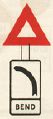 1954 Highway Code - Bend.jpg 254 × 571; 18 KB
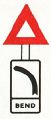 1959 Highway Code - Bend.jpg 210 × 490; 12 KB
 20161023-1619 - R572 south of Glengarriff - 51.7465163N 9.5530586W.jpg 3,072 × 2,304; 1.6 MB
 20180402-1043 - Horseshoe Pass 6 53.0046968N 3.19163W.jpg 3,072 × 2,304; 1.56 MB
 A ROAD WITH NO NAME - Coppermine - 9974.jpg 1,354 × 900; 276 KB
 A16 Portable Survey Camera - Coppermine - 15068.JPG 1,600 × 1,200; 173 KB
 A3 - Coppermine - 21961.jpg 1,024 × 768; 213 KB
 A3 approaching Rhencullen (C) Chris Gunns - Geograph - 1883634.jpg 640 × 480; 81 KB
 A39 Porlock Hill - advance warning - Coppermine - 325.jpg 512 × 384; 41 KB
 A4067 heading to Crai - Geograph - 1676548.jpg 640 × 480; 66 KB
 A5 passes over B4473 - Geograph - 1037672.jpg 640 × 480; 87 KB
 A617 NEWARK ROAD - KIRKLINGTON - NOTTINGHAMSHIRE - Coppermine - 22465.jpg 1,471 × 2,047; 639 KB
 A672 Oldham Road - Coppermine - 17625.JPG 1,229 × 922; 607 KB
 A80 upgrade - Coppermine - 23614.jpg 1,136 × 852; 95 KB
 A82 Urquhart Castle - junction on bend - max speed 30.jpg 1,280 × 960; 995 KB
 A823(M) - Coppermine - 8829.jpg 1,280 × 960; 153 KB
 A828-duror3.jpg 640 × 427; 161 KB
 A830 start of primary S1 - Coppermine - 10599.jpg 1,400 × 952; 202 KB
 A85 Glen Ogle - Coppermine - 1325.jpg 480 × 360; 19 KB
 A889-sign.jpg 640 × 427; 93 KB
 A9 Berriedale Braes Improvement - August 2020 left-right bends.jpg 1,920 × 1,440; 779 KB
 A9 Berriedale Braes Improvement - February 2019 hairpin long zoom.jpg 1,920 × 1,440; 735 KB
 A9 Berriedale escape lane - Coppermine - 19849.jpg 1,280 × 960; 169 KB
 A9 Cambusavie - Junction on bend, reduce speed now.jpg 1,280 × 960; 829 KB
 A9 North Kessock Junction - Coppermine - 8522.jpg 1,024 × 768; 115 KB
 A9 North Kessock Junction - Coppermine - 8538.jpg 1,024 × 768; 107 KB
 A9 North Kessock Junction - Coppermine - 8542.jpg 1,024 × 768; 157 KB
 A9 The Mound - Bend, reduce speed now.jpg 1,280 × 960; 846 KB
 A90 AWPR - Deeside Junction - sliproad bend warning sign.jpg 1,920 × 1,440; 862 KB
 A90 Stonehaven Junction - northbound exit slip.jpg 1,600 × 1,200; 801 KB
 A95 Ballindalloch - Bend reduce speed now nb.jpg 1,024 × 1,365; 743 KB
 A95 Ballindalloch - Bend reduce speed now sb.jpg 1,280 × 768; 577 KB
 Abandoned Motorway Junction - Geograph - 18901.jpg 640 × 480; 132 KB
 Alton Towers - Coppermine - 3277.jpg 640 × 480; 62 KB
 B1040 towards Papworth - Geograph - 456130.jpg 640 × 480; 60 KB
 B1115 towards Burford Bridge and Stowmarket - Geograph - 958678.jpg 640 × 467; 102 KB
 B1341 - Geograph - 2556061.jpg 640 × 359; 206 KB
 B41013? Reeves Green - Coppermine - 12869.jpg 640 × 480; 87 KB
 B4368 road to Clun - Geograph - 872993.jpg 640 × 474; 109 KB
 B6259 Aisgill - red squirrels for 5 miles.jpg 2,000 × 1,125; 965 KB
 B751 near Kilmaurs - Geograph - 1715176.jpg 640 × 480; 96 KB
 B847 and Cuiltaloskin - Geograph - 1237183.jpg 640 × 468; 64 KB
 B9090 White Bridge realignment - farm traffic and junction on bend signs.jpg 1,920 × 1,440; 1.22 MB
 B9090 White Bridge realignment - vehicle activated sign at SE end of new road.jpg 1,920 × 1,440; 705 KB
 B9090-white-br2.jpg 640 × 427; 172 KB
 B9163 near Balblair - Coppermine - 6093.jpg 1,357 × 869; 299 KB
 B9176 - Coppermine - 13623.jpg 1,024 × 768; 125 KB
 Bend sign - Coppermine - 23455.jpg 1,600 × 1,200; 319 KB
 Bend sign - Coppermine - 23456.jpg 1,200 × 1,600; 440 KB
 Bend sign in Tobermory - Coppermine - 23316.jpg 700 × 900; 227 KB
 Bend sign with new triangle Cobham Bus Museum - Coppermine - 23558.JPG 1,200 × 1,600; 531 KB
 Boarder Ahead - Geograph - 1666687.jpg 640 × 480; 66 KB
 Cloot Drove leading on to Wash Bank - Geograph - 2920635.jpg 640 × 480; 93 KB
 Cumb-basin4.jpg 640 × 379; 139 KB
 Dangerous Corner - Coppermine - 750.jpg 450 × 600; 41 KB
 Dangerous corner edited.JPG 939 × 672; 170 KB
 Danson Interchange Londonbound.JPG 3,648 × 2,736; 3.57 MB
 Drumbane Road - Geograph - 731120.jpg 640 × 479; 85 KB
 Electricity Pole with Multiple uses - Coppermine - 11576.jpg 434 × 734; 88 KB
 End of M22.JPG 2,000 × 1,177; 1.15 MB
 Flyover for the A64 at Brambling Fields - Geograph - 281875.jpg 640 × 480; 143 KB
 Giles hill warning sign.JPG 1,600 × 1,200; 169 KB
 Golden Road - Coppermine - 18686.jpg 1,024 × 768; 306 KB
 GR150, MA50 and Z9554M on Jenkins Lane - Coppermine - 20218.JPG 1,292 × 1,344; 621 KB
 Head of the Connor Pass - Geograph - 4664966.jpg 640 × 480; 454 KB
 Illuminated chevrons - Coppermine - 20246.jpg 800 × 553; 78 KB
 Illuminated chevrons - Coppermine - 20247.jpg 800 × 595; 142 KB
 Illuminated chevrons - Coppermine - 20248.jpg 800 × 477; 110 KB
 Illuminated chevrons - Coppermine - 20249.jpg 800 × 509; 86 KB
 IMG 1564.JPG old street light RAF Cosford.jpg 788 × 960; 89 KB
 Ireland - Yellow diamond signs - Coppermine - 1365.jpg 564 × 458; 30 KB
 Killearn-br2.jpg 640 × 427; 156 KB
 Kincraig - Bend oncoming vehicles.jpg 1,280 × 960; 1.04 MB
 M2 Ballymena northern terminus.JPG 2,000 × 1,155; 1.04 MB
 M56 J3 - 10 - A5103 5 - Coppermine - 1451.jpg 600 × 450; 54 KB
 M90 - Craigend Interchange - Coppermine - 8777.jpg 1,280 × 960; 118 KB
 M90 - Craigend Interchange - Coppermine - 8778.jpg 1,280 × 960; 106 KB
 M90, Balmanno Hill - Coppermine - 11038.jpg 1,024 × 768; 58 KB
 Main Street, Kirk Deighton - Geograph - 724375.jpg 640 × 386; 57 KB
 Mast arm signal on the A82 at Dumbarton. - Coppermine - 4435.JPG 640 × 480; 48 KB
 New road layout ahead bend to left sign on A836.jpg 2,127 × 1,819; 140 KB
 New Road to Lynmouth - Geograph - 3537826.jpg 640 × 427; 120 KB
 Non standard bend sign - Coppermine - 4352.jpg 839 × 510; 79 KB
 Old A863 Coillore - Pre-Worboys bend.jpg 1,280 × 960; 109 KB
 Old signs by the old road - Geograph - 1409999.jpg 480 × 640; 113 KB
 P020510 09.59 -01-.jpg 960 × 1,280; 538 KB
 Quebec Bridge - Coppermine - 13581.jpg 1,024 × 571; 112 KB
 Road junction on the B992 - Geograph - 666136.jpg 640 × 426; 49 KB
 Road warnings on the Connor Pass - Geograph - 1575708.jpg 640 × 427; 98 KB
 Rsz img 0744.jpg 1,440 × 1,080; 242 KB
 Slow - Oasis Camel Centre - Geograph - 725678.jpg 640 × 480; 70 KB
 Smithy Bank, Alton - Coppermine - 3284.jpg 640 × 480; 115 KB
 The A483 in Cwrt - Geograph - 1703806.jpg 640 × 428; 124 KB
 The B1117 near St.Jacob's Hall - Geograph - 253501.jpg 640 × 480; 78 KB
 The B1248 near North Grimston - Geograph - 198882.jpg 640 × 480; 154 KB
 The B4308 travelling East - Geograph - 807194.jpg 640 × 481; 133 KB
 The Road from the B1233 towards Olive Bush Farm - Geograph - 194615.jpg 640 × 480; 107 KB
 TSRGD 512.1.jpg 450 × 392; 57 KB
 TSRGD 512.1L.jpg 450 × 392; 57 KB
 TSRGD 512.2.jpg 450 × 392; 57 KB
 TSRGD 512.2L.jpg 450 × 392; 57 KB
 TSRGD 512.jpg 450 × 392; 57 KB
 TSRGD 512L.jpg 450 × 392; 56 KB
 Warning Right Bend Sign.jpg 1,024 × 768; 91 KB
 Wellbank - Geograph - 9994.jpg 640 × 480; 124 KB
 West Wittering - Geograph - 5118.jpg 640 × 427; 225 KB
 Z-Sign near Calverleigh - Coppermine - 8018.jpg 640 × 457; 45 KB


_Chris_Gunns_-_Geograph_-_1883634.jpg)


_-_Coppermine_-_8829.jpg)


_near_Steeple_Bumpstead_-_Geograph_-_222187.jpg)


_Andrew_Abbott_-_Geograph_-_2054226.jpg)


