Star grey.pngStar grey.pngStar grey.pngStar grey.pngStar grey.png

Derry/Named Junctions

From Roader's Digest: The SABRE Wiki
Jump to navigation Jump to search
Image Name Classified Road(s) Grid Reference More Info Map
Photo-required.png Altnagelvin Roundabout A6 / A514 C449158
SABRE • Google • geo
Photo-required.png Ballyarnet Roundabout A515 C439207
SABRE • Google • geo
Photo-required.png The Branch A2 / B507 / B521 C422196
SABRE • Google • geo
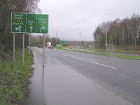
Approaching the Caw Roundabout - Geograph - 108198.jpg Caw Roundabout A2 / A514 / A515 C462181
SABRE • Google • geo
Photo-required.png Crescent Link Roundabout A514 C463170
SABRE • Google • geo
Photo-required.png Culmore Roundabout A2 / A515 C444197
SABRE • Google • geo
Photo-required.png Duke Street Roundabout A2 C439162
SABRE • Google • geo
Photo-required.png Foyleside A2 C436163
SABRE • Google • geo
Photo-required.png Gransha Roundabout A2 C465184
SABRE • Google • geo
Photo-required.png Harbour Square A2 / B529 C435169
SABRE • Google • geo
Photo-required.png Kilfennan Roundabout A514 / B530 C460164
SABRE • Google • geo
Photo-required.png Maydown Roundabout A2 C479198
SABRE • Google • geo
Photo-required.png Pennyburn Roundabout A2 C438185 A2 leaves this junction in 3 directions
SABRE • Google • geo
Photo-required.png Skeoge Roundabout A2 / A515 C414204
SABRE • Google • geo
Photo-required.png Waterside Roundabout A2 C439167 no other roads
SABRE • Google • geo


Derry
Junctions
Crossings
Roads
A2 (Northern Ireland) • A5 (Northern Ireland) • A6 (Northern Ireland) • A40 (Northern Ireland) • A514 (Northern Ireland) • A515 (Northern Ireland) • B48 (Northern Ireland) • B71 (Northern Ireland) • B193 (Northern Ireland) • B194 (Northern Ireland) • B507 (Northern Ireland) • B508 (Northern Ireland) • B521 (Northern Ireland) • B522 (Northern Ireland) • B523 (Northern Ireland) • B524 (Northern Ireland) • B525 (Northern Ireland) • B526 (Northern Ireland) • B527 (Northern Ireland) • B528 (Northern Ireland) • B529 (Northern Ireland) • B530 (Northern Ireland) • C501 (Northern Ireland) • C502 (Northern Ireland) • C503 (Northern Ireland) • C508 (Northern Ireland) • C516 (Northern Ireland) • C568 (Northern Ireland) • C571 (Northern Ireland) • C572 (Northern Ireland) • C573 (Northern Ireland) • C574 (Northern Ireland) • C575 (Northern Ireland) • C576 (Northern Ireland) • C577 (Northern Ireland) • C578 (Northern Ireland) • C579 (Northern Ireland) • C581 (Northern Ireland) • Causeway Coastal Route • E16 • E100 • E117 (Old System) • M23 (Northern Ireland) • N13 • R236 • R237 • R238 • T3 (Northern Ireland) • T7 (Northern Ireland) • T17 (Northern Ireland) • T22 (Northern Ireland) • T59 • T73 • T74 • Wild Atlantic Way
Places
Miscellaneous
Related Pictures
View gallery (32)
Craigavon Bridge, Derry - Geograph - 746425.jpgTraffic lights at Altnagelvin junction - Geograph - 674050.jpgLink road, Derry - Londonderry - Geograph - 2794467.jpgA515 Foyle Bridge - Coppermine - 15749.jpgThe Foyle Bridge - Flickr - 8681245786.jpg
Named Junction Lists
Motorways: M1  • M5  • M18  • M25 & A282  • M27 & Spurs

A roads: A1  • A2  • A3  • A4  • A5  • A6  • A7  • A8  • A9  • A10  • A11  • A12  • A13  • A14  • A15  • A16  • A17  • A18  • A19  • A20  • A21  • A22  • A23  • A24  • A25  • A26  • A27  • A28  • A29
A30  • A31  • A32  • A33  • A34  • A35  • A36  • A37  • A38  • A39  • A40  • A41  • A43  • A44  • A45  • A46  • A47  • A48  • A49  • A50  • A51  • A52  • A53  • A54  • A55  • A56  • A57  • A58  • A59
A60  • A61  • A62  • A63  • A64  • A65  • A66  • A68  • A69  • A70  • A71  • A72  • A73  • A74  • A75  • A76  • A77  • A78  • A79  • A80  • A81  • A82  • A83  • A84  • A85  • A86  • A87  • A88  • A89
A90 & M90  • A91  • A92  • A205  • A303  • A404  • A406  • A483

Places: Basingstoke  • Birmingham  • Bournemouth & Poole  • Central London  • Crawley  • Cumbernauld  • Derby  • Doncaster  • Falkirk & Grangemouth
Limerick  • Manchester  • Milton Keynes  • Southampton  • Telford  • Wolverhampton


SABRE - The Society for All British and Irish Road Enthusiasts
Discuss - Digest - Discover - Help