Dublin Inner Orbital Route
| Dublin Inner Orbital Route | |||||||||||||||||||||||||||||||||||||||||||
 | |||||||||||||||||||||||||||||||||||||||||||
| From: | Beresford Place (O164346) | ||||||||||||||||||||||||||||||||||||||||||
| To: | Beresford Place (O163346) | ||||||||||||||||||||||||||||||||||||||||||
| Meets: | R105, R108, R110, R114, R118, R132, R137, R138, R148, R801, R802, R803, R804, R805, R811, R813, R814, R815, R816 | ||||||||||||||||||||||||||||||||||||||||||
| Highway Authorities | |||||||||||||||||||||||||||||||||||||||||||
| Traditional Counties | |||||||||||||||||||||||||||||||||||||||||||
| Route outline (key) | |||||||||||||||||||||||||||||||||||||||||||
| |||||||||||||||||||||||||||||||||||||||||||
The Dublin Inner Orbital Route is a Ring Road created out of existing streets around the city centre. It was created in 2002 with the aim of directing traffic towards the main car parks while avoiding traffic bottlenecks within the central core of the city.
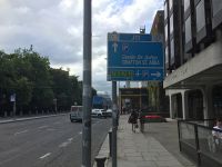
All the major junctions along the route are numbered, with light blue 'stack' direction signs indicating the junction number. The junctions are numbered sequentially from J1 to J40 in a clockwise direction (skipping J19), with J19 and J41-47 being assigned somewhat randomly to junctions which are only accessible when travelling anti-clockwise.
When the system was launched, Dublin City Council were expecting the junction numbers to be promoted by local businesses. The numbers were placed on road signs across Dublin as if they were destinations. It was launched at the same time as a number of new traffic restrictions in the city centre.
As might be expected of a city centre route created out of existing streets, the route is difficult to follow. It has to snake around turning restrictions and one way roads, there are many options which are generally ignored, and there are many routes which could cause the junction numbers to appear to jump around significantly. More importantly, most of the roads it uses are radial routes that were built to get traffic in and out of the city, not to keep it going round.
Road Signs
All road signs are erected on H-shaped mast-arm posts.
Original System
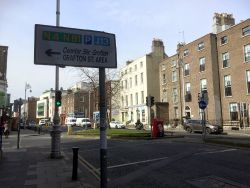
The first system was introduced in August 2002. It used an orange colour scheme, and directed motorists to radial routes (named by their road number), nearby car parks and nearby numbered junctions. It was devised by the city council, with advice from consultants.
'An Lár' ("City Centre") was presented in Irish only, to save space.
Direction signs with an orange background were used for the Orbital Route itself, while signs with a white background were used on approaches to the system. Junction numbering generally worked clockwise from Custom House Quay, and clustered around different one way systems.
Overall, the system was widely criticised for being too confusing, as it focused on junction and road numbering that local people didn't know. The orange colour was too closely associated with roadworks, too. The scheme's introduction cost €200,000, and following resistance from residents, a public information campaign was launched.
Only a few weeks into the project - and with only an estimated 50 out of 500 road signs erected - the project was stopped following complaints from the Department of Transport.
Second System
The sore subject was revisited in October 2003, and the new system built upon lessons learned by the first.
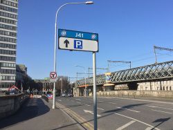
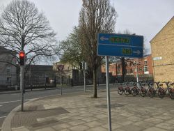
The orange colour scheme was changed to light blue. The different signs for the Orbital Route and its approaches were kept, with all signs having a light blue heading. The heading included the Dublin City Council logo and two circles, denoting the two orbital routes.
While directions to N-roads were kept, most R-roads were removed and replaced by the name of the suburb. 'An Lár' was translated into English, and some car parks were named. There were now 42 junctions.
The rethink cost €20,000, and took place with support from the Department of Transport. They later suggested any urban area could now copy the scheme, which Cork did.
These signs would go on to remain in place for over 15 years. When the roads in Dublin City Centre were renumbered in 2010, these signs remained and as a result few people were aware of the renumbering. The city council logo was later patched with an updated version.
March 2020 Revision
The system was revised again in March 2020, as part of a project to simplify the signing across the city.
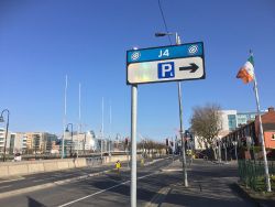
The new signs all have a white background with a light blue header, regardless of whether you're on the Orbital Route or approaching it. The header shows the junction number, and two of the orbital logos.
The only information the new signs contain is directions to the nearest car and/or bike paring area (in an inbound direction), and directions to the M50 (in an outbound direction). The car parks are now all divided into four zones.
There are no other road numbers, or junction numbers, on the signs, making it somewhat difficult to follow the orbital as a through route. The aim is to get traffic heading towards the M50 instead. This aim reflects the fact that all primary routes in the city centre were downgraded in 2010.
At the same time, all of the junction numbers were changed. The start point was moved one junction around Custom House, and the new junction numbers followed the clockwise route. One turning lost its number, while several junctions gained numbers (generally those good for accessing car parks). Overall, the number of junctions increased by five. Only the Parnell and Mountjoy areas kept the same junction number.
Route
Although the Inner Orbital wasn't devised until 2002, the concept dates back as far as 1966. Following a number of recommended new dual carriageways, Dublin Corporation developed the Inner Tangent, which was extremely similar to the Inner Orbital.
In 1973 the eastern section was removed from the Inner Tangent, as this would have been made redundant by the Liffey Crossing. Instead, the ambition of the western side (known as the Western Tangent) was scaled up, becoming a grade-separated D3.
Short sections of the Inner Tangent were built as a high priority, including North King Street and Cuffe Street. Most were postponed due to the high costs and complaints about the route in The Liberties. A watered-down version of the Western Tangent was opened in 1989. The rest of the project, including a shortcut and tunnel along Parnell Street and a large interchange at Smithfield, was effectively abandoned.
The Inner Orbital is not the direct successor to that project, but it was inevitable that it was going to choose to run via the new dual carriageways instead of narrower city streets.
The route of the Orbital is significantly different in each direction. Streets unique to that direction are shown in bold.
Clockwise
- Memorial Road
- City Quay
- Lombard Street East
- Westland Row
- Lincoln Place
- Merrion Street Lower
- Merrion Square West
- Merrion Square South
- Fitzwilliam Street Lower
- Fitzwilliam Street Upper
- Fitzwilliam Square East
- Fitzwilliam Place
- Leeson Street Lower
- St Stephen's Green
- Cuffe Street
- Kevin Street Lower
- Bride Street
- Bride Road
- Nicholas Street
- High Street
- Bridge Street Upper
- Bridge Street Lower
- Usher's Quay
- Usher's Island
- Blackhall Place
- North King Street
- George's Lane
- Brunswick Street North
- Church Street Upper
- North King Street
- Bolton Street
- King's Inn's Street
- Parnell Street
- Parnell Square West
- Parnell Square North
- Gardiner Row
- Great Denmark Street
- Gardiner Place
- Mountjoy Square West
- Gardiner Street Middle
- Gardiner Street Lower
It is curious that the clockwise route crosses over the anti-clockwise route by using Bride Street around St Patrick's College, rather than following the dual carriageway.
Anti-Clockwise
- Gardiner Street Lower
- Gardiner Street Middle
- Mountjoy Square West
- Gardiner Place
- Great Denmark Street
- Gardiner Row
- Parnell Square East
- Cavendish Row
- Parnell Street
- Ryder's Row
- Capel Street
- North King Street
- Queen Street
- Blackhall Street
- Blackhall Place
- Ellis Quay
- Arran Quay
- Bridge Street Lower
- Bridge Street Upper
- High Street
- Nicholas Street
- Patrick Street
- Kevin Street Upper
- Kevin Street Lower
- Cuffe Street
- St Stephen's Green
- Merrion Row
- Merrion Street Upper
- Merrion Square West
- Clare Street
- Lincoln Place
- Westland Row
- Pearse Street
- Tara Street
- Beresford Place
There is some confusion over the route at Mountjoy Square. Official publicity shows it taking the shorter route along Parnell Street, but road signs indicate that it follows the clockwise route and uses Great Denmark Street. This may have been an early change.
It's also odd that it uses the unclassified Blackhall Street rather than continuing along Queen Street to the Liffey.
Route Changes
From St Stephen's Green, the anti-clockwise route originally used Dawson Street, Nassau Street and Leinster Street South. When work on the Luas line started in 2013, the right turn at the end of Dawson Street was banned. Road signs in the area were taken down, but the route was never rectified and now had a gap in it. This was amended with a new route in 2020.
One document, dated August 2017, shows the route running Merrion Row and Merrion Street Upper (as per the new route), but then doing a lap around three sides of Merrion Square. The clockwise route is shown running along Merrion Square East as well. The sign on Merrion Street Upper was covered in patches between 2009 and 2020, so it's possible that there had been a re-think in this area.
Junction List
| Image | Name | Classified Road(s) | Grid Reference | More Info | Map |
|---|---|---|---|---|---|
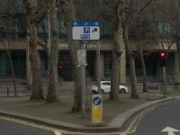
|
J1 | R105 · R802 | O164346 | Clockwise only. Preceded by current J40. Formerly J40. | |
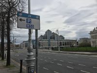
|
J2 | R801 · R802 | O164345 | Clockwise only. Formerly J1. | |
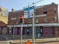
|
J3 | R802 · R813 | O164344 | Clockwise only. Formerly J2. | |
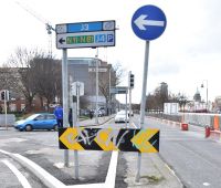
|
J4 | R813 · R814 | O167343 | Clockwise only. Formerly J3. | |
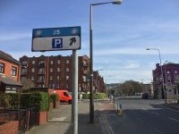
|
J5 | R802 · R814 | O166342 | Clockwise only. Formerly J4. | |
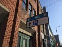
|
J6 | R138 · R802 · R814 | O166340 | Succeeded by J43. | |
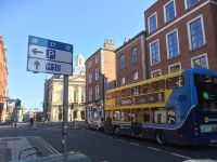
|
J7 | R138 · R815 | O165338 | Technically replaces former J9, but at the time the road signs only mentioned the exit for Fenian Street, not this exit for Westland Row. | |
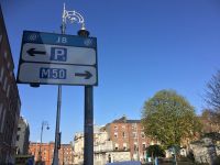
|
J8 Merrion Square | R118 | O165337 | Succeeded by current J10. Formerly J10. | |
|
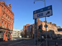
J9 | R118 · R138 | O164338 | Anti-clockwise only. Succeeded by current J7. Formerly J7. | |
|
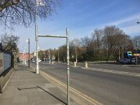
J10 Merrion Square | O164335 | Preceded by J8. Formerly J12. | ||
|
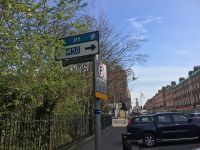
J11 Merrion Square | O167334 | Clockwise only. Formerly J43. | ||
|
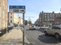
J12 | R816 | O166332 | Clockwise only. Unnumbered until 2020. | |
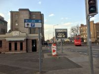
|
J13 | R138 · R811 | O163327 | Clockwise only. Formerly J45. Very close to Outer Orbital J57. | |
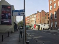
|
J14 St Stephen's Green | R110 · R138 | O161331 | Succeeded by J46. Formerly J13. | |
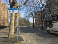
|
J15 St Stephen's Green | R110 | O157333 | Formerly J14. | |
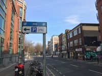
|
J16 | R110 · R114 | O155333 | Formerly J15. | |
|
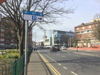
J17 | R110 | O153333 | Here the two directions cross over each other. Preceded by J19. Formerly J16. | |
|
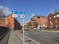
J18 | O152336 | Clockwise only. Succeeded by J20. Unnumbered until 2020. | ||
|
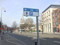
J19 | R110 · R137 | O150334 | Technically anti-clockwise only. Succeeded by current J17. Formerly J17. | |
|
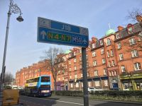
J20 | R137 | O151337 | Here the two directions cross over each other. Formerly J18. | |
|
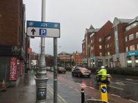
J21 Christchurch | R108 · R137 | O151338 | Formerly J19. | |
|
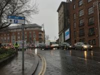
J22 | R108 · R810 | O149339 | Formerly J20. | |
|
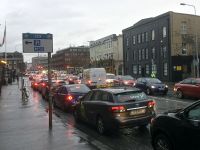
J23 | R108 · R148 | O148341 | Preceded by J45. Formerly J21. | |
|
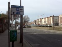
J24 | R148 · R804 | O144342 | Clockwise only. Formerly J23. | |
|
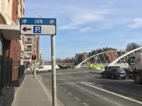
J25 | R148 · R804 | O144343 | Succeeded by J45. Formerly J24. | |
|
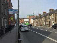
J26 | R804 · R805 | O144346 | Clockwise only. Formerly J25. | |
|
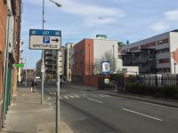
J27 | R804 · R805 | O145346 | Preceded by J31. Succeeded by J25. Formerly J26. | |
|
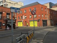
J28 | R804 | O145347 | Clockwise only. Formerly J27. | |
|
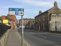
J29 | R108 · R804 | O149347 | Formerly J28. | |
|
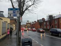
J30 | R108 · R804 | O149346 | Succeeded by J27. Alternative route to J45. Formerly J29. | |
|
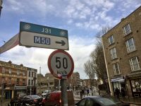
J31 | R803 · R804 | O152347 | Formerly J30. Preceded by J44. | |
|
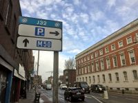
J32 | R804 | O152347 | Clockwise only. Formerly J31. Arguably the most unassuming turning of them all: a narrow right turn off a dual carriageway. | |
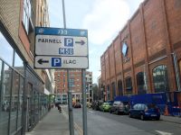
|
J33 | R803 | O154347 | Succeeded by J44. | |
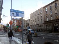
|
J34 | R132 · R803 | O156348 | Preceded by J37 or J39. | |
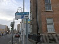
|
J35 | R132 | O155350 | ||
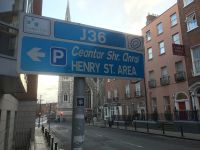
|
J36 | R132 | O156351 | ||
|
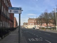
J37 Mountjoy Square | R802 | O159354 | Succeeded by J34. Very close to Outer Orbital J75. | |
|
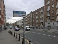
J38 | R802 · R803 | O161351 | Alternative to J34. | |
|
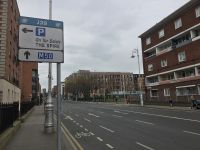
J39 | R802 | O161350 | Unnumbered until 2020. | |
|
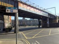
J40 | R105 · R802 | O163346 | Preceded by J40. Succeeded by J1. Formerly J39. | |
|
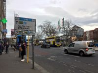
J41 | R105 · R802 | O162345 | Anti-clockwise only. | |
|
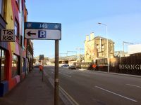
J42 | R105 · R138 · R802 | O162344 | Anti-clockwise only. | |
|
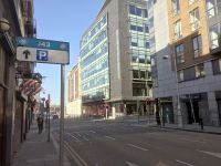
J43 | R802 | O162342 | Anti-clockwise only. Preceded by J6. | |
|
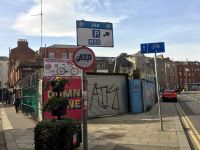
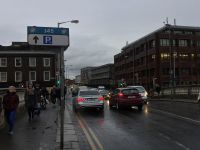
J44 | R803 | O153346 | Anti-clockwise only. Preceded by J33. Succeeded by J31. Formerly J32. | |
|
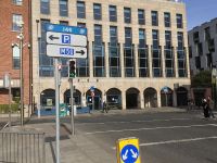
J45 | R108 · R148 | O148342 | Anti-clockwise only. Preceded by J25 or J30. Succeeded by J23. Formerly J22. | |
|
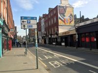
J46 St Stephen's Green | R138 | O162334 | Anti-clockwise only. Unnumbered until 2020. Preceded by J14. | |
|
J47 | R138 | O163333 | Anti-clockwise only. Added to the route in 2020. Succeeded by J10. |
Former Junctions
| Image | Name | Classified Road(s) | Grid Reference | More Info | Map |
|---|---|---|---|---|---|
|
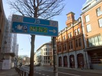
J5 | R118 · R802 | O162341 | Anti-clockwise only. Became a mandatory right turn in 2003; number removed in 2020. | |

|
J8 | R138 | O160339 | Anti-clockwise only. Right turn banned in 2013. | |

|
J9 | R138 · R815 | O165338 | Replaced by current J7, but the previous signage did not acknowledge the turn into Westland Row, and instead focused on the exit for Fenian Street. | |
|
J11 | R118 · R802 | O160335 | Anti-clockwise only. Became redundant in 2013. |
| Dublin Inner Orbital Route | ||||
| ||||
| ||||
| ||||
| ||||
|
