File:0017-10-261-2173.png
Jump to navigation
Jump to search

No higher resolution available.
0017-10-261-2173.png (800 × 518 pixels, file size: 42 KB, MIME type: image/png)
| ||||||||||||||
|
Galleries | United States of America | ||
File history
Click on a date/time to view the file as it appeared at that time.
| Date/Time | Thumbnail | Dimensions | User | Comment | |
|---|---|---|---|---|---|
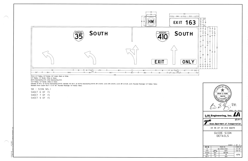
| current | 16:44, 23 June 2013 | | 800 × 518 (42 KB) | J n winkler (talk | contribs) | Proof that TxDOT is now using overhead arrow-per-lane diagrammatics |
File usage
There are no pages that use this file.