No higher resolution available.
 | |  |
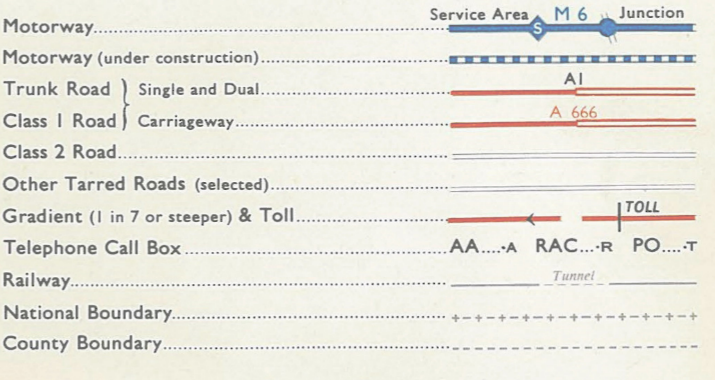
| | Description: | Key to the 1965 edition of the OS Route Planning Map | | Location: | This picture currently has no coords, edit this page to add them. | | Road: | | | Date: | | | Photographer: | | | Source: | |
| |
 | |  |
File history
Click on a date/time to view the file as it appeared at that time.
| Date/Time | Thumbnail | Dimensions | User | Comment |
|---|
| current | 13:37, 23 October 2017 |  | 715 × 380 (432 KB) | Steven (talk | contribs) | Key to the 1965 edition of the OS Route Planning Map |
File usage
The following page uses this file:
This file contains additional information, probably added from the digital camera or scanner used to create or digitise it.
If the file has been modified from its original state, some details may not fully reflect the modified file.
