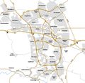
File:1970 Telford Plan.jpg
From Roader's Digest: The SABRE Wiki
Jump to navigation Jump to search

Original file(1,613 × 1,592 pixels, file size: 420 KB, MIME type: image/jpeg)

Y topleft.gifY topright.gif
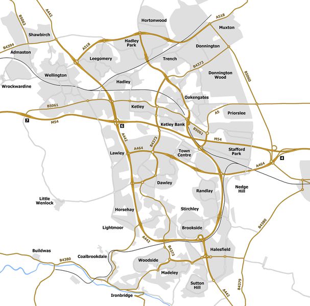
Description:This map shows what was originally planned for Telford based on a diagram from around 1970.

The GSJ layouts are all accurate although whether some junctions had underpasses vs flyovers is unclear due to the low resolution of the original diagram. Note that M54 J5 is not shown. The present J5 is the second junction to bear that number. The original J5 was located to the east of the present junction and had west facing slips only. To improved access to the town centre this junction was closed and a full access junction was built slightly to the west. The plan I've seen for the new town doesn't show either J5. Whether this is an error I don't know but as a result I haven't shown either J5 on the map. As J4 was to have an east facing freeflow and J6 was to have additional grade separated in the north-south direction I assume these junctions would have been able to handle all M54 to town centre traffic.

I've shown roads as dual carriageways if they were built with room for a second carriageway or if they contain GSJ's. Other roads are shown as single carriageway. This may not necessarily be correct.

I've taken liberties with the road numbering as the present numbers are based on the unfinished road network that current exists. I've rerouted the A442 along the western side of the primary ring. The northern side of the ring is A518. I've left the eastern side blank as I've no indication what the likely number would be. The A464 is now extended westwards to Lawley along the central corridor.
Location:52.6768504, -2.4471188
Road:
Date:
Photographer:Truvelo
Source:own work

Map

Y btmleft.gifY btmright.gif

Galleries  | Telford


File history

Click on a date/time to view the file as it appeared at that time.

Date/TimeThumbnailDimensionsUserComment
current18:06, 9 October 2011Thumbnail for version as of 18:06, 9 October 20111,613 × 1,592 (420 KB)Truvelo (talk | contribs)
20:15, 22 September 2011Thumbnail for version as of 20:15, 22 September 20111,461 × 1,593 (406 KB)Truvelo (talk | contribs)This map shows what was originally planned for Telford based on a diagram from around 1970. The junction layouts are all accurate apart from M54 J4 which would have had freeflow links to the M54 East. I've shown roads as dual carriageways if they were

There are no pages that use this file.

SABRE - The Society for All British and Irish Road Enthusiasts
Discuss - Digest - Discover - Help