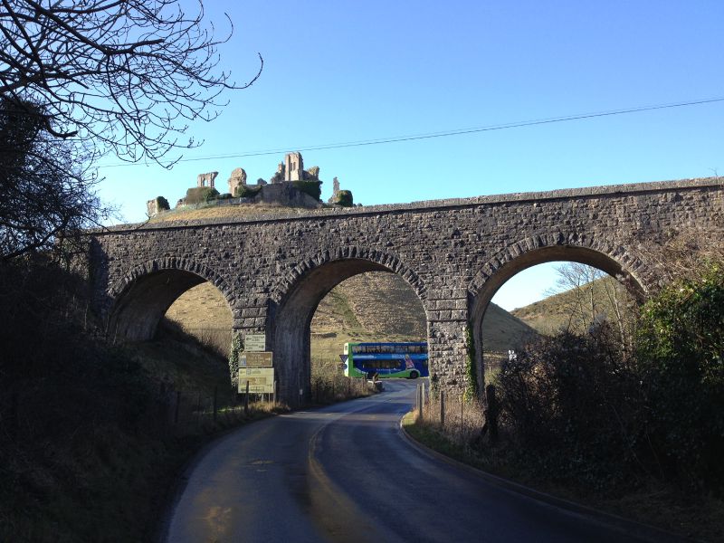
The B3351 Studland Road passing under the Swanage Railway viaduct. The bus is on the A351, and will remain on it practically to the end of the road (bar a diversion into Wareham along the old route of this road). Above the viaduct on the hill is Corfe Castle, a 1000 year old hill fort built by William the Conquerer and now owned by the National Trust.
The B3351 Studland Road passing under the Swanage Railway viaduct. The bus is on the A351, and will remain on it practically to the end of the road (bar a diversion into Wareham along the old route of this road). Above the viaduct on the hill is Corfe ...
