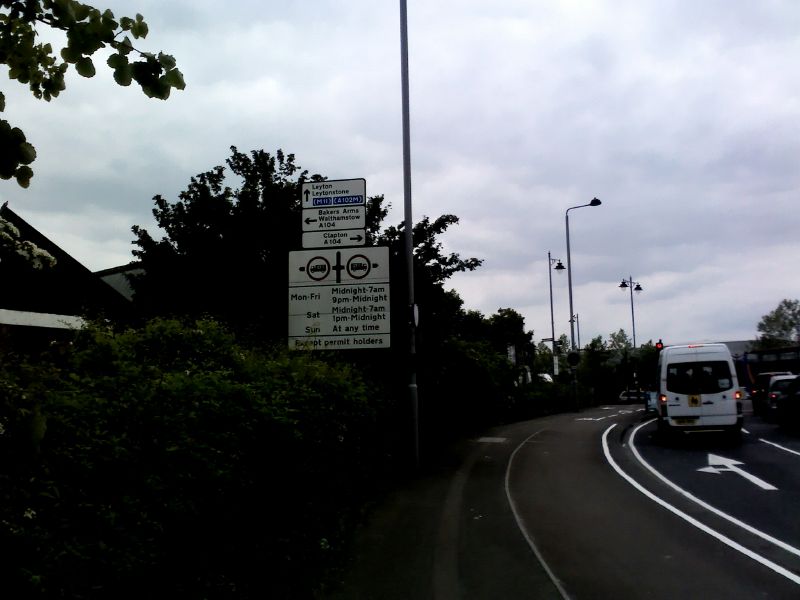
Sign on Argall Way near Lea Bridge station. This road that leads to an industrial estate post-dates the downgrading of the A102(M) by a couple of years.
Sign on Argall Way near Lea Bridge station. This road that leads to an industrial estate post-dates the downgrading of the A102(M) by a couple of years.
File usage
There are no pages that use this file.
Metadata
This file contains additional information, probably added from the digital camera or scanner used to create or digitise it.
If the file has been modified from its original state, some details may not fully reflect the modified file.
