File:20160124-1230 - B1039-B1368 crossroads Barley 52.03173N 0.0397631E.jpg
Jump to navigation
Jump to search


Size of this preview: 800 × 449 pixels. Other resolution: 2,592 × 1,456 pixels.
Original file (2,592 × 1,456 pixels, file size: 1.34 MB, MIME type: image/jpeg)
| |||||||||||||||||||||||||
|
Galleries | B1039 | B1368 | Images by C2r | Flag Sign | Hertfordshire | ||
File history
Click on a date/time to view the file as it appeared at that time.
| Date/Time | Thumbnail | Dimensions | User | Comment | |
|---|---|---|---|---|---|
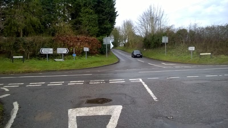
| current | 14:17, 25 January 2016 | | 2,592 × 1,456 (1.34 MB) | C2r (talk | contribs) | B1039/B1038 crossroads at Barley. All four flag signs were previously on the post with the cycle sign on it. These have now been split out in the arragement here with signs everywhere. The B1039 here gives way to the B1038. Royston is straight ... |
File usage
The following 2 pages use this file: