File:A1070 (Colchester).png
Jump to navigation
Jump to search

No higher resolution available.
A1070_(Colchester).png (316 × 166 pixels, file size: 127 KB, MIME type: image/png)
| |||||||||||||||||||||||||
|
Galleries | A1070 (Colchester) | OS Ministry of Transport Road Map | ||
File history
Click on a date/time to view the file as it appeared at that time.
| Date/Time | Thumbnail | Dimensions | User | Comment | |
|---|---|---|---|---|---|
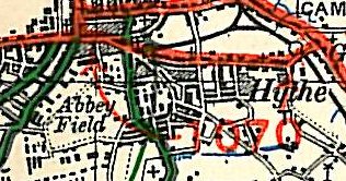
| current | 18:18, 13 January 2011 | | 316 × 166 (127 KB) | Ritchie333 (talk | contribs) | A1070 in Colchester, 1926 |
File usage
The following page uses this file:
.png&oldid=486161)