File:A1178.png
Jump to navigation
Jump to search

No higher resolution available.
A1178.png (437 × 428 pixels, file size: 13 KB, MIME type: image/png)
| ||||||||||||||
|
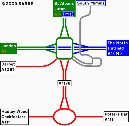
Galleries | A1178 | Bignells Corner | Potters Bar | Potters Bar Interchange | Other Mapping | Strip Maps | ||
File history
Click on a date/time to view the file as it appeared at that time.
| Date/Time | Thumbnail | Dimensions | User | Comment | |
|---|---|---|---|---|---|
| current | 19:43, 13 May 2009 | | 437 × 428 (13 KB) | Abeaton (talk | contribs) | |
| 19:42, 13 May 2009 |  | 437 × 428 (13 KB) | Abeaton (talk | contribs) | Added Copyright | |
| 11:03, 17 April 2009 |  | 437 × 428 (11 KB) | Abeaton (talk | contribs) | Here is a strip map of the A1178 on opening. |
File usage
The following page uses this file: