File:A14 - Jet route card scans - Coppermine - 1663.jpg
Jump to navigation
Jump to search
Size of this preview: 424 × 600 pixels. Other resolution: 1,240 × 1,754 pixels.
Original file (1,240 × 1,754 pixels, file size: 343 KB, MIME type: image/jpeg)
| ||||||||||||||
|
Galleries | A14 | Documents and Media | ||
File history
Click on a date/time to view the file as it appeared at that time.
| Date/Time | Thumbnail | Dimensions | User | Comment | |
|---|---|---|---|---|---|
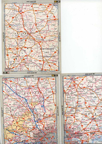
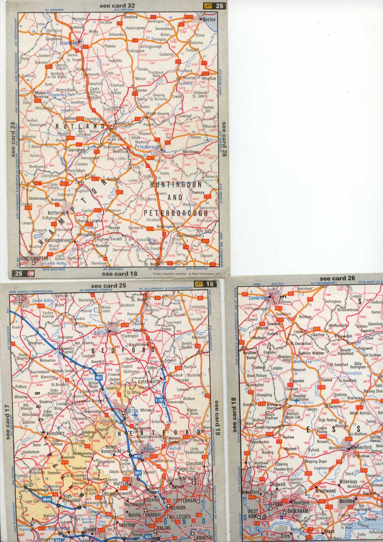
| current | 15:26, 15 May 2010 | | 1,240 × 1,754 (343 KB) | Bob@romiley1 (talk | contribs) | '''A14 - Jet route card scans''' From 1969 Jet Routemaps this show the full route of the A14 from it's present junction - as the A14{M) perhaps - to the A10 south of Cambridge. <small>''Originally uploaded to Coppermine on Apr 27, 2005 by Derek''</small |
File usage
There are no pages that use this file.