File:A24 improvements.png
Jump to navigation
Jump to search
Size of this preview: 298 × 599 pixels. Other resolution: 649 × 1,304 pixels.
Original file (649 × 1,304 pixels, file size: 1.29 MB, MIME type: image/png)
| |||||||||||||||||||||||||
|
Galleries | A24 | A272 | A24 Named Junctions | Buckbarn Crossroads | D2 | GSJ | ||
File history
Click on a date/time to view the file as it appeared at that time.
| Date/Time | Thumbnail | Dimensions | User | Comment | |
|---|---|---|---|---|---|
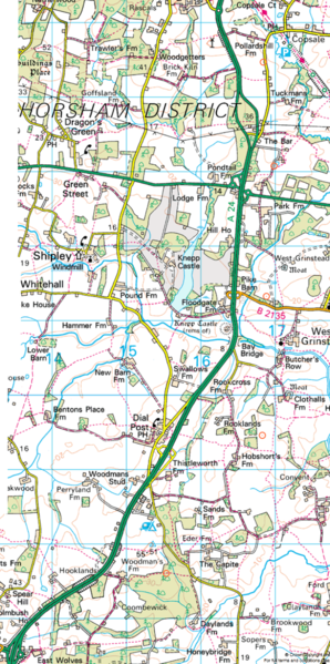
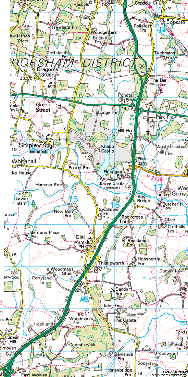
| current | 16:41, 24 September 2011 | | 649 × 1,304 (1.29 MB) | Mrvixen (talk | contribs) | An outline map of the proposed improvements to the A24 that seems to be forever being brought forward, pushed back, cancelled or delayed! |
File usage
The following 2 pages use this file: