File:A3290 flyover, Winnersh (C) Andrew Smith - Geograph - 504095.jpg

From Roader's Digest: The SABRE Wiki
Jump to navigation Jump to search

A3290_flyover,_Winnersh_(C)_Andrew_Smith_-_Geograph_-_504095.jpg(640 × 480 pixels, file size: 104 KB, MIME type: image/jpeg)

Y topleft.gifY topright.gif
Description:
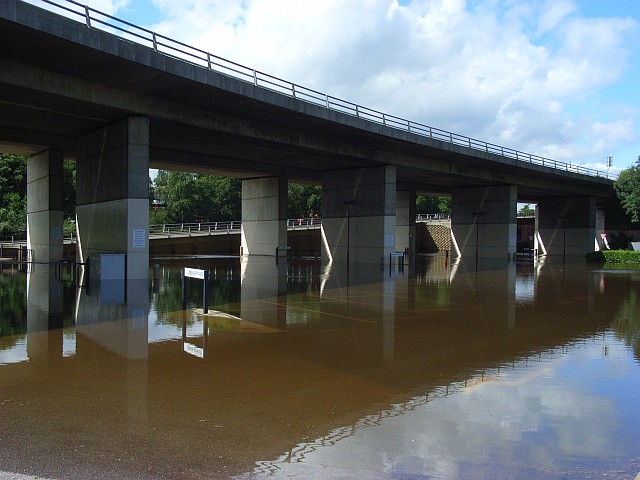
A3290 flyover, Winnersh (C) Andrew Smith
Taking the dual carriageway over the floodwaters of the River Loddon. The inundated tarmac is usually the car park for the park and ride service into the centre of Reading. The road was formerly the A329(M) but the stretch from here into Reading lost its motorway status so that they could have a bus lane.
Location:51.439113, -0.897892
Road:A3290
Date:21 07 2007
Photographer:Andrew Smith and licensed for reuse under this Creative Commons Licence
Source:Geograph

Map

Y btmleft.gifY btmright.gif

Galleries  | A3290 | A3290 Bridge | Loddon Bridge Interchange

File history

Click on a date/time to view the file as it appeared at that time.

Date/TimeThumbnailDimensionsUserComment
current16:46, 29 October 2014Thumbnail for version as of 16:46, 29 October 2014640 × 480 (104 KB)Jeni (talk | contribs)'''A3290 flyover, Winnersh (C) Andrew Smith '''<br/>Taking the dual carriageway over the floodwaters of the River Loddon. The inundated tarmac is usually the car park for the park and ride service into the centre of Reading. The road was formerly the A...

The following 3 pages use this file:

Metadata

SABRE - The Society for All British and Irish Road Enthusiasts
Discuss - Digest - Discover - Help