File:A33 and M3 - Geograph - 1770871.jpg

From Roader's Digest: The SABRE Wiki
Jump to navigation Jump to search

A33_and_M3_-_Geograph_-_1770871.jpg(640 × 428 pixels, file size: 145 KB, MIME type: image/jpeg)

Y topleft.gifY topright.gif
Description:
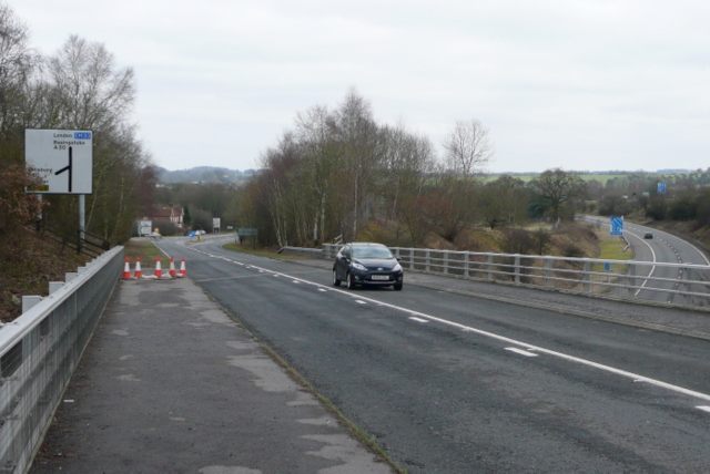
A33 and M3
On foot this area is a confusing set of junctions and bridges. I am standing on the A33 looking north-east towards Basingstoke; the car is heading south-west towards Winchester on the old road. At the bottom of the hill is the junction with the A30 to/from the west country. Underneath us is the eastbound only link road from the A30 to the M3. It is already technically motorway at this point and the signs for merging with the M3 can be seen in the distance.
Location:51.203122, -1.190524
Road:A33
Date:21 03 2010
Photographer:� Copyright Graham Horn and licensed for reuse under this Creative Commons Licence
Source:Geograph

Map

Y btmleft.gifY btmright.gif

Galleries  | A33 | Popham Interchange

File history

Click on a date/time to view the file as it appeared at that time.

Date/TimeThumbnailDimensionsUserComment
current14:40, 26 March 2010Thumbnail for version as of 14:40, 26 March 2010640 × 428 (145 KB)Jeni (talk | contribs)'''A33 and M3'''<br/>On foot this area is a confusing set of junctions and bridges. I am standing on the A33 looking north-east towards Basingstoke; the car is heading south-west towards Winchester on the old road. At the bottom of the hill is the junct

The following page uses this file:

Metadata

SABRE - The Society for All British and Irish Road Enthusiasts
Discuss - Digest - Discover - Help