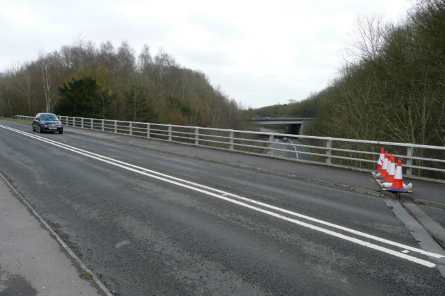
A33 and M3 On foot this area is a confusing muddle of junctions and bridges, with a severed footpath. I am standing on the A33, looking north-east towards Basingstoke. The car is heading south-west towards Winchester. Underneath is the westbound spur of the M3 that links to the A30 for the West Country. Is is still motorway at this point and has dived under the M3. The next bridge carries both carriageways of the M3 itself, right towards Winchester and Southampton, left towards Basingstoke and London.
'''A33 and M3'''<br/>On foot this area is a confusing muddle of junctions and bridges, with a severed footpath. I am standing on the A33, looking north-east towards Basingstoke. The car is heading south-west towards Winchester. Underneath is the westbo
File usage
There are no pages that use this file.
Metadata
This file contains additional information, probably added from the digital camera or scanner used to create or digitise it.
If the file has been modified from its original state, some details may not fully reflect the modified file.
