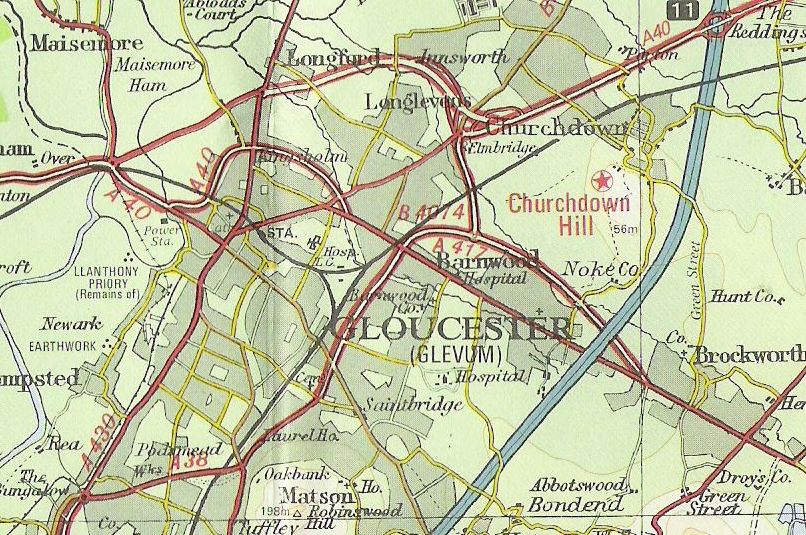
This 1970's Bartholemew map shows the A40 / A417 junction as a complete GSJ. Why was this never built, and remains to this day as a roundabout?
Originally uploaded to Coppermine on May 31, 2005 by DavidBrown
This page includes a scan of a non-free copyrighted map, and the copyright for it is most likely held by the company or person that produced the map. It is believed that the use of a limited number of web-resolution scans qualifies as fair use under United States copyright law, where this web page is hosted, as such display does not significantly impede the right of the copyright holder to sell the copyrighted material, is not being used to generate profit in this context, and presents information that cannot be exhibited otherwise. If the copyright holder considers this is an infringement of their rights, please contact the Site Management Team to discuss further steps.
'''Unbuilt Interchange - Gloucester (A40/A417)'''
This 1970's Bartholemew map shows the A40 / A417 junction as a complete GSJ. Why was this never built, and remains to this day as a roundabout?
<small>''Originally uploaded to Coppermine on May 31, 20...
_-_Coppermine_-_2365.jpg&oldid=482750)