File:A4177 Five Ways Island Near Warwick - Coppermine - 16063.jpg

From Roader's Digest: The SABRE Wiki
Jump to navigation Jump to search

A4177_Five_Ways_Island_Near_Warwick_-_Coppermine_-_16063.jpg(640 × 480 pixels, file size: 68 KB, MIME type: image/jpeg)

Y topleft.gifY topright.gif
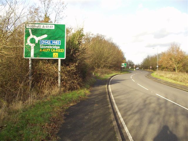
Description:A4177 Five Ways Island Near Warwick

Northbound view on the A4177 (formerly A41 which has an identity crisis!) on the approach to Five Ways Island north west of Warwick. The A4177 goes off to the right whilst the former A41 continues north as the A4141. The LDS is visible in the distance. Warwickshire have resigned recently as most of the signs noticed in the area were fairly clean and had that newish look. I think the southbound confirmation sign behind me still showed A41 - I am still around this area so will take a pic if I remember. 291107

Originally uploaded to Coppermine on Nov 29, 2007 by leekman
Location:52.327622, -1.666098
Road:A4177
Date:29 11 2007
Photographer:Leekman
Source:Coppermine

Map

Y btmleft.gifY btmright.gif

Galleries  | A4177 | Advance Direction Sign

File history

Click on a date/time to view the file as it appeared at that time.

Date/TimeThumbnailDimensionsUserComment
current01:45, 20 January 2010Thumbnail for version as of 01:45, 20 January 2010640 × 480 (68 KB)Jeni (talk | contribs){{Information |description = '''A4177 Five Ways Island Near Warwick''' Northbound view on the A4177 (formerly A41 which has an identity crisis!) on the approach to Five Ways Island north west of Warwick. The A4177 goes off to the right whilst the former

The following page uses this file:

Metadata

SABRE - The Society for All British and Irish Road Enthusiasts
Discuss - Digest - Discover - Help